

-

Multi-jurisdictional Hazard Mitigation Plan for Landslides for the Kentucky River Area Development District, Kentucky
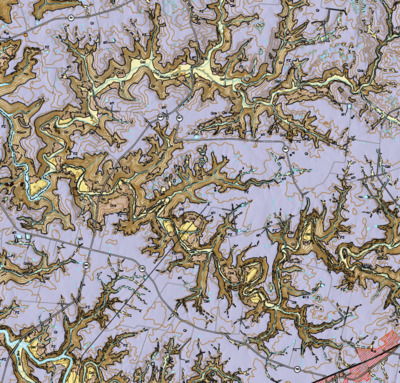
Landslides are a widespread and complex geologic hazard that affects people and infrastructure. The Kentucky River Area Development District, Kentucky, sustains relatively high landslide activity that impacts several municipalities in eastern Kentucky. This hazard mitigation planning project outlines landslide hazard and risk assessments for the Kentucky River Area Development District, with information needed for each community in the region to develop mitigation strategies that will support infrastructure and development needs, land-use planning, situational awareness, and response and recovery actions for the communities.
-

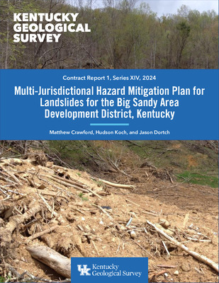
Multi-Jurisdictional Hazard Mitigation Plan for Landslides for the Big Sandy Area Development District, Kentucky
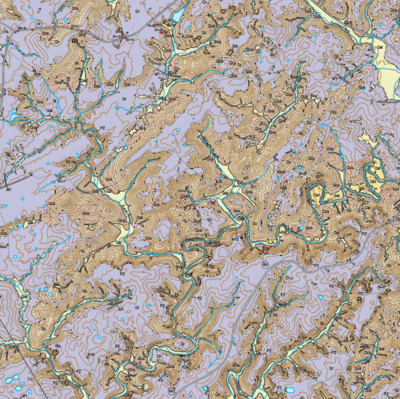
Landslides are a complex geologic hazard that occurs worldwide, impacting lives, infrastructure, and property. The Big Sandy Area Development District, Kentucky incurs high landslide activity impacting several municipalities. This hazard mitigation planning project includes landslide susceptibility and risk assessments for the Big Sandy Area Development District. We based the landslide susceptibility model on statistics of hillslope morphological features such as slope, curvature, roughness, aspect, and elevation. Using a dual machine learning approach, we modeled the probability of landslide occurrence, defined as an area that is occupied, or might be occupied in the future, by a landslide. We also developed the ...Read More
-

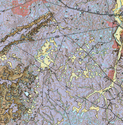
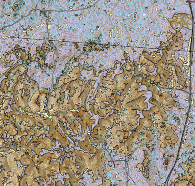
Surficial geologic map of the Bristow 7.5-minute quadrangle, Kentucky
The Kentucky Geological Survey (KGS), a state-supported independent research center within the University of Kentucky, is committed to providing accurate and unbiased geologic information on natural resources, environmental issues, and natural hazards in Kentucky. While Kentucky boasts complete coverage by 1:24,000-scale geologic bedrock maps, surficial materials have been largely overlooked, except in regions with thick deposits obscuring the bedrock. Given the increasing trends in economic development and urbanization, detailed surficial geologic mapping has become crucial for supporting geotechnical planning, environmental management, and hazard assessment. In response, KGS has prioritized new, detailed surficial geologic mapping since 2004, specifically targeting areas anticipated ...Read More
-

Surficial geologic map of the Bowling Green South 7.5-minute quadrangle, Kentucky
The Kentucky Geological Survey (KGS), a state-supported independent research center within the University of Kentucky, is committed to providing accurate and unbiased geologic information on natural resources, environmental issues, and natural hazards in Kentucky. While Kentucky boasts complete coverage by 1:24,000-scale geologic bedrock maps, surficial materials have been largely overlooked, except in regions with thick deposits obscuring the bedrock. Given the increasing trends in economic development and urbanization, detailed surficial geologic mapping has become crucial for supporting geotechnical planning, environmental management, and hazard assessment. In response, KGS has prioritized new, detailed surficial geologic mapping since 2004, specifically targeting areas anticipated ...Read More
-

Surficial geologic map of the Smiths Grove 7.5-minute quadrangle, Kentucky
The Kentucky Geological Survey (KGS), a state-supported independent research center within the University of Kentucky, is committed to providing accurate and unbiased geologic information on natural resources, environmental issues, and natural hazards in Kentucky. While Kentucky boasts complete coverage by 1:24,000-scale geologic bedrock maps, surficial materials have been largely overlooked, except in regions with thick deposits obscuring the bedrock. Given the increasing trends in economic development and urbanization, detailed surficial geologic mapping has become crucial for supporting geotechnical planning, environmental management, and hazard assessment. In response, KGS has prioritized new, detailed surficial geologic mapping since 2004, specifically targeting areas anticipated ...Read More
-

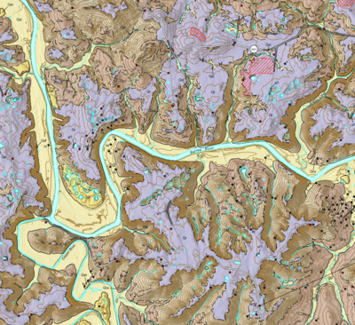
Surficial Geologic Map of the Rockfield 7.5-Minute Quadrangle, Warren, Logan, and Simpson Counties, Kentucky
The Rockfield 7.5-minute quadrangle is located west of Bowling Green, Kentucky situated mostly in Warren County, but also includes small areas of Simpson and Logan Counties in its southwestern corner. Regionally, the quadrangle includes parts of the Pennyroyal and Mammoth Cave plateau within the Mississippian Plateaus physiographic region (McDowell, 1986). The Dripping Springs escarpment, which separates the lower-elevation Pennyroyal from the higher-elevation Mammoth Cave plateau is highly dissected in the quadrangle. Topography in the Pennyroyal is characterized by pervasive sinkhole development across a low-relief plain, which is mostly underlain by the Mississippian Ste. Genevieve Limestone. Higher-relief topography is restricted to ...Read More
-

Surficial Geologic Map of the Hadley 7.5-Minute Quadrangle, Warren County, Kentucky
The Hadley 7.5-minute quadrangle is located in Warren County northwest of Bowling Green, Kentucky. Regionally, the quadrangle is entirely within the Mammoth Cave plateau, which is located in the Mississippian Plateaus physiographic region (McDowell, 1986). The Mammoth Cave plateau is a regional west-dipping cuesta, that has been extensively incised by the Green and Barren Rivers and their tributaries. The area is underlain by Upper Mississippian to Lower Pennsylvanian (Rainey, 1963): the lowest fluvial valleys are underlain by Ste. Genevieve Limestone; Girkin Formation is exposed on the steep slopes between the lower valleys and higher plateau; the plateau is underlain by ...Read More
-

Surficial Geologic Map of the Bowling Green North 7.5-Minute Quadrangle, Warren County, Kentucky
The Bowling Green North 7.5-minute quadrangle is located in Warren County immediately north of Bowling Green, Kentucky. Regionally, the quadrangle includes parts of the Pennyroyal and Mammoth Cave plateau, both within the Mississippian Plateaus physiographic region (McDowell, 1986). The Dripping Springs escarpment, which separates the lower-elevation Pennyroyal from the higher-elevation Mammoth Cave plateau is highly dissected in the quadrangle. Topography in the Pennyroyal is characterized by pervasive sinkhole development across the low-relief Pennyroyal, which is mostly underlain by the Mississippian St. Louis Limestone, Ste. Genevieve Limestone, and Girkin Formation (Shawe, 1963). Higher-relief topography is restricted to the slopes of the ...Read More
-

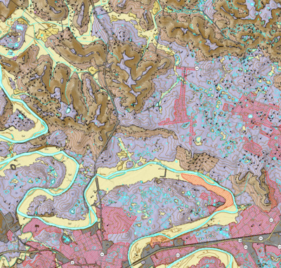
Surficial Geologic Map of the Summit 7.5-Minute Quadrangle, Kentucky
The Summit 7.5-minute quadrangle is located south of Louisville and west of Elizabethtown along the boundary between Hardin and Grayson Counties and within the Mississippian Plateau physiographic region (McDowell, 1986). Topography is characterized by the low relief Pennyroyal region that sits at elevations between 560 to 650 ft above sea level, the low relief Mammoth Cave plateau at elevations between 750 to 900 ft, and the steep Dripping Springs escarpment that separates the two plains. Moore (1964) mapped the bedrock geology of the quadrangle, which was later digitized by Conley (2002). Mississippian bedrock is exposed throughout the quadrangle and is ...Read More
-

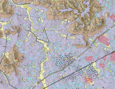
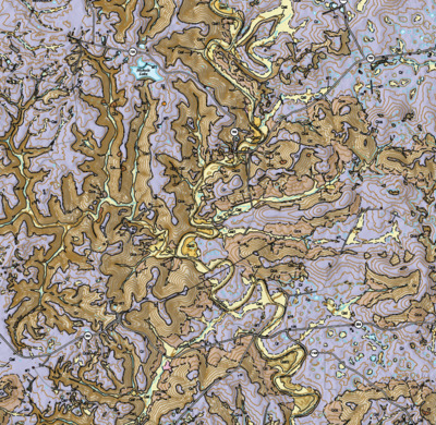
Landslide Susceptibility Map of Floyd County, Kentucky
The purpose of this map is to identify landslide-prone areas in Floyd County in order to provide the public, as well as local and state government agencies, with information about where landslides are likely to occur. This map represents geomorphic-based susceptibility modeling that focuses on physical slope characteristics and morphology, the quality of which is dependent on data accuracy and resolution of terrain models. The availability of high-resolution (5-ft digital elevation model) lidar derived datasets allows for the generation of terrain elevation derivatives such as hillshades, slope, aspect, curvature, and roughness, as well as identification of existing landslide deposits. These ...Read More
-

Landslide Susceptibility Map of Johnson County, Kentucky
The purpose of this map is to identify landslide-prone areas in Johnson County in order to provide the public, as well as local and state government agencies, with information about where landslides are likely to occur. This map represents geomorphic-based susceptibility modeling that focuses on physical slope characteristics and morphology, the quality of which is dependent on data accuracy and resolution of terrain models. The availability of high-resolution (5-ft digital elevation model) lidar derived datasets allows for the generation of terrain elevation derivatives such as hillshades, slope, aspect, curvature, and roughness, as well as identification of existing landslide deposits. These ...Read More
-

Landslide Susceptibility Map of Martin County, Kentucky
The purpose of this map is to identify landslide-prone areas in Martin County in order to provide the public, as well as local and state government agencies, with information about where landslides are likely to occur. This map represents geomorphic-based susceptibility modeling that focuses on physical slope characteristics and morphology, the quality of which is dependent on data accuracy and resolution of terrain models. The availability of high-resolution (5-ft digital elevation model) lidar derived datasets allows for the generation of terrain elevation derivatives such as hillshades, slope, aspect, curvature, and roughness, as well as identification of existing landslide deposits. These ...Read More
-

Landslide Susceptibility Map of Pike County, Kentucky
The purpose of this map is to identify landslide-prone areas in Pike County in order to provide the public, as well as local and state government agencies, with information about where landslides are likely to occur. This map represents geomorphic-based susceptibility modeling that focuses on physical slope characteristics and morphology, the quality of which is dependent on data accuracy and resolution of terrain models. The availability of high-resolution (5-ft digital elevation model) lidar derived datasets allows for the generation of terrain elevation derivatives such as hillshades, slope, aspect, curvature, and roughness, as well as identification of existing landslide deposits. These ...Read More
-

Landslide Susceptibility Map of Magoffin County, Kentucky
The purpose of this map is to identify landslide-prone areas in Magoffin County, Kentucky, in order to provide the public, as well as local and state government agencies, with information about where landslides are likely to occur. This map represents geomorphic-based susceptibility modeling that focuses on physical slope characteristics and morphology, the quality of which is dependent on data accuracy and resolution of terrain models. The availability of high-resolution (5-ft digital elevation model) lidar derived datasets allows for the generation of terrain elevation derivatives such as hillshades, slope, aspect, curvature, and roughness, as well as identification of existing landslide deposits. ...Read More
-

Surficial Geologic Map of the Big Clifty 7.5-Minute Quadrangle, Kentucky
The Big Clifty 7.5-minute quadrangle is located south of Louisville and west of Elizabethtown along the boundary between Hardin and Grayson Counties. The quadrangle lies within the Mammoth Cave plateau of the Mississippian Plateau physiographic region (McDowell, 1986). Topography is characterized by a low relief plain sitting at elevations between 650 to 850 ft above sea level, which is dissected and incised by Rough River, Meeting Creek, Clifty Creek, and their tributaries to below 500 ft. Swadley (1962) mapped the bedrock geology of the quadrangle, which was later digitized by Conley (2002). Mississippian bedrock is exposed throughout the quadrangle and ...Read More
-

Surficial Geologic Map of the Constantine 7.5-Minute Quadrangle, Kentucky
The Constantine 7.5-minute quadrangle is located west of Elizabethtown along the boundary of Hardin and Breckinridge Counties. The quadrangle lies along the northern section of the Dripping Springs Escarpment, which separates the Mammoth Cave Plateau and Pennyroyal regions of the Mississippian Sinkhole Plain physiographic province (McFarlan, 1943). Topography is mostly characterized by high-elevation plateaus, ridges, and knobs of the Mammoth Cave Plateau (up to 919 ft), which have been intensely dissected by the Rough River and its tributaries (down to 516 ft). A small area of the Pennyroyal extends into the eastern part of the quadrangle, which is marked by ...Read More
-

Surficial Geologic Map of the Flaherty 7.5-Minute Quadrangle, Kentucky
The Flaherty 7.5-minute quadrangle is located southwest of Louisville and northwest of Elizabethtown along the boundary between Hardin and Meade Counties. The quadrangle includes mostly the Pennyroyal region of the Mississippian Plateau and also smaller areas of the Mammoth Cave plateau and the highly dissected Dripping Springs escarpment in the western half of the map area (McDowell, 1986). Topography is mostly characterized by pervasive sinkhole development in a lower elevation and low-relief plain, and high-relief plateaus, ridges, and knobs of the Dripping Springs escarpment scattered along the west side of the quadrangle. Swadley (1963) mapped the bedrock geology of the ...Read More
-

Surficial Geologic Map of the Millerstown 7.5-Minute Quadrangle, Kentucky
The Millerstown 7.5-minute quadrangle is located south of Louisville and southwest of Elizabethtown along the boundaries between Hardin, Grayson, and Hart Counties and within the Mississippian Plateau physiographic region (McDowell, 1986). Topography is characterized by the low relief Pennyroyal plain that sits at altitudes below about 650 ft above sea level, the low relief Mammoth Cave plateau at altitudes above about 650 ft, and steep slopes of and isolated knobs of the incised Dripping Springs escarpment that separates the two plains. Moore (1965) mapped the bedrock geology of the quadrangle, which was later digitized by Johnson (2006). Mississippian bedrock and ...Read More
-

Surficial Geologic Map of the Upton 7.5-Minute Quadrangle, Kentucky
The Upton 7.5-minute quadrangle is located south of Elizabethtown along the boundaries between Hardin, Hart, and Larue Counties and within the Mississippian Plateau physiographic region (McDowell, 1986). Topography is characterized by the low relief Pennyroyal plain that sits at altitudes below about 750 ft above sea level, the ridges, spurs, and isolated knobs of the intensely dissected Dripping Springs escarpment; the low relief cap of the escarpment landforms is part of the Mammoth Cave plateau region. Moore (1972) mapped the bedrock geology of the quadrangle, which was later digitized by Toth (2006). Mississippian bedrock is exposed throughout most of the ...Read More
-

Surficial Geologic Map of the Patriot 7.5-Minute Quadrangle, Kentucky
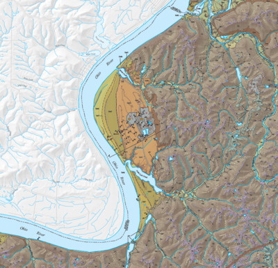
The Patriot 7.5-minute quadrangle is located in Boone, Gallatin, and Grant Counties of northern Kentucky in the Outer Bluegrass physiographic province (McFarlan, 1943). Broad to narrow ridges, steep hillsides, and the Ohio River Valley characterize the topography of the quadrangle. The Ohio River has been made navigable by a series of high-level dams, and the Markland Locks and Dam controls the river level in this area (Ray, 1974). The bedrock geology, originally mapped by Swadley (1969), consists, from oldest to youngest, of the Point Pleasant Formation, the Kope Formation, the Fairview Formation, the Bellevue Tongue of the Grant Lake Limestone, ...Read More
-

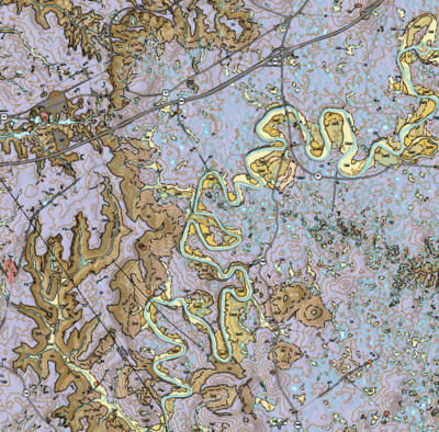
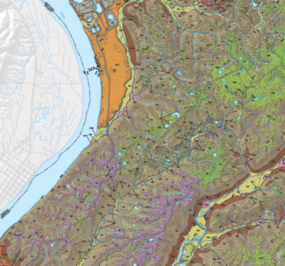
Surficial Geologic Map of the Rising Sun 7.5-Minute Quadrangle, Kentucky
The Rising Sun 7.5-minute quadrangle is located in northern Kentucky in the Outer Bluegrass physiographic province (McFarlan, 1943). The area is underlain by Upper Ordovician limestone and shale, and is characterized by low- to medium-relief topography. The oldest rock unit in the quadrangle is the Point Pleasant Formation, which consists of interbedded limestone and shale, and is exposed at the base of the bedrock uplands area south of Lower East Bend Bottom. The shale-dominated Kope Formation overlying the Point Pleasant Formation is exposed in most stream channels and underlies the valleys and hillslopes in the quadrangle. The Kope Formation is ...Read More
-

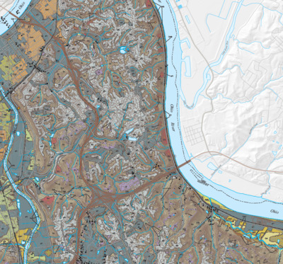
Surficial Geologic Map of the Newport 7.5-Minute Quadrangle, Kentucky
The Newport 7.5-minute quadrangle is located in the Outer Bluegrass physiographic province (McFarlan, 1943) in the Greater Cincinnati metropolitan area of northern Kentucky and includes parts of Kenton and Campbell Counties. Topography is characterized by a relatively broad expanse of upland with moderate relief that is bounded by the Ohio River Valley, Licking River Valley, and Fourmile Creek. Gibbons (1973) mapped the bedrock geology of this quadrangle, which was later digitized by Sparks (2002). The entire quadrangle is underlain by horizontal Ordovician limestone and shale, consisting of the Point Pleasant Formation, Kope Formation, Fairview Formation, Bellevue Tongue of the Grant ...Read More
Printing is not supported at the primary Gallery Thumbnail page. Please first navigate to a specific Image before printing.
