

Archived
This content is available here for research, reference, and/or recordkeeping.
Researcher ORCID Identifier
Massey, M: Matthew Massey (0000-0003-3316-9550) - ORCID
Swallom, M: Meredith Swallom (0000-0002-1400-6919) - ORCID
Hodelka, B: Bailee Hodelka (0009-0003-4241-2417) - ORCID
Morris, E: Emily Morris (0000-0002-3310-3175) - ORCID
Files
Download Full Text (115.4 MB)
Abstract
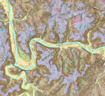
The Hadley 7.5-minute quadrangle is located in Warren County northwest of Bowling Green, Kentucky. Regionally, the quadrangle is entirely within the Mammoth Cave plateau, which is located in the Mississippian Plateaus physiographic region (McDowell, 1986). The Mammoth Cave plateau is a regional west-dipping cuesta, that has been extensively incised by the Green and Barren Rivers and their tributaries. The area is underlain by Upper Mississippian to Lower Pennsylvanian (Rainey, 1963): the lowest fluvial valleys are underlain by Ste. Genevieve Limestone; Girkin Formation is exposed on the steep slopes between the lower valleys and higher plateau; the plateau is underlain by Big Clifty Sandstone and Haney Limestone Members of the Golconda Formation, Hardinsburg Sandstone, Glen Dean Limestone, Leitchfield Formation, and, locally, the Lower Pennsylvanian Caseyville Formation.
Publication Date
2023
Series
13
Report Number
56
Digital Object Identifier (DOI)
https://doi.org/10.13023/kgs13cr562023
Spatial Coverage
Hadley 7.5-Minute Geologic Quadrangle, Warren County, Kentucky
Funding Information
This map was generated using new field mapping along with compilation of unpublished and previously published data, and was funded in part by the U.S. Geological Survey’s National Cooperative Mapping Program under the STATEMAP program authorized by the National Geologic Mapping Act of 1992, Grant No. G22AC00570, and by the Kentucky Geological Survey.
Language
English
Repository Citation
Massey, M.A., Swallom, M., Bottoms, A., Buchanan, W., Hodelka, B., Morris, E., 2023, Surficial Geologic Map of Hadley 7.5-Minute Quadrangle, Warren County, Kentucky, Kentucky Geological Survey, ser. 13, Contract Report 56

Methodology
This map was generated by compiling multiple datasets with standard geologic field mapping techniques and sediment analysis. The datasets include the KYFromAbove statewide lidar dataset (5-ft average horizontal spacing) and its accompanying aerial imagery, as well as Kentucky Geological Survey map services that compile data from water-well logs and oil and gas records. Natural hazard assessments include data from a landslide mapping inventory (Crawford, 2014), and an algorithm for identifying sinkholes (Zhu and Pierskalla, 2016). Previous publications, including Rainey’s 1963 bedrock geologic map, the Natural Resources Conservation Services soil map (2018), and Kentucky Transportation Cabinet geotechnical reports were also used as sources for spatial and lithologic data. Colluvium was mapped using raster analysis to identify slopes exceeding 12° (a threshold determined by field and geotechnical evidence). Grain-size analysis was performed on sediment fractions of less than 2 mm with a laser particle analyzer; results were interpreted using methods discussed in Folk (1966), and grain size is reported using the modified Wentworth scale. Samples representative of major map units were analyzed by X-ray fluorescence and X-ray diffraction for bulk chemistry and mineralogy, respectively. Detailed data and additional information are available in an accompanying GIS dataset publication (Massey et al., 2023).