
Archived
This content is available here for research, reference, and/or recordkeeping.
Preview
Description
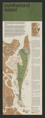
Title: Cumberland Island, 1977 (front)
Author: United States. National Park Service
Subjects: Cumberland Island (Ga.) -- Maps; Cumberland Island National Seashore (Ga.) -- Maps
Publisher: National Park Service, U.S. Department of the Interior
Creation Date: 1977
Format: col. map on sheet 50 x 18 cm. fold. to 9 x 18 cm.
Source: University of Kentucky Libraries
Library Location: Science & Engineering Library, Gwen Curtis Map Collection, G3922.C8 1977.U5
Curation Date
2020
