

Research Data--KGS
Archived
This content is available here for research, reference, and/or recordkeeping.
Files
Download (28.4 MB)
Release Date
2007
Publisher
Kentucky Geological Survey
Description
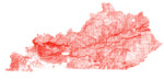
This dataset includes geologic stuctural contours of varying datums across Kentucky in shapefile format. These structural contours are compiled from structural contour layers published as a part of the individual Digitally Vectorized Geologic Quadrangles (DVGQ) datasets (by the Kentucky Geologic Survey: https://kgs.uky.edu/kygeode/services/pubs/?pubtype=DVGQ&searchtype=pubcategory). The original structural contours were mapped on the 7.5-minute (1:24,000 scale) series geologic maps published during the Kentucky geologic mapping program (Kentucky Geological Survey - U.S. Geological Survey from 1960 to 1989: https://kgs.uky.edu/kygeode/services/pubs/?pubtype=GQ&searchtype=pubcategory). The digital contours were subsequently digitized as a part of the DVGQ datasets during the geologic digital mapping program at KGS (1996 – 2007). Contoured formations were determined by the original quadrangle map author, therefore contour datum may vary across quadrangle boundaries. These structural contours are not based on subsequently obtained subsurface data and should only be used as a general guideline for the underlying geologic structure. Contours are in feet above sea level, and may vary in contour interval across quadrangle boundaries. Please note that some contours are projected above the land surface. Refer to the metadata and supporting information for detail about the data fields and data attributes.
Supporting Information
See ReadMe.txt and metadata XML for additional information about fields, spatial information, and geographic extent.
File Format
Zip file (.zip) containing the following:
- ESRI Shapefile (SHP - collection of 8 files)
- ArcPro layerfile for symbolizing in ESRI ArcPro (use Type field to symbolize)
- ReadMe.txt (more information about the dataset)
- Data Origin Citations.txt (citations of original datasets from which this compilation is derived)
- Data Authors.txt (unique list of authors in the Data Origin Citations.txt)
- thumbnail.png (browse graphic)
File Size
29 MB
Version
1.0
Spatial Coverage
Kentucky.
Spatial Reference:
Type: Projected
Geographic coordinate reference: GCS_North_American_1983
Projection: NAD_1983_StatePlane_Kentucky_FIPS_1600_Feet
WKID: 102763
WKT: PROJCS["NAD_1983_StatePlane_Kentucky_FIPS_1600_Feet",GEOGCS["GCS_North_American_1983",DATUM["D_North_American_1983",SPHEROID["GRS_1980",6378137.0,298.257222101]],PRIMEM["Greenwich",0.0],UNIT["Degree",0.0174532925199433]],PROJECTION["Lambert_Conformal_Conic"],PARAMETER["False_Easting",4921250.0],PARAMETER["False_Northing",3280833.333333333],PARAMETER["Central_Meridian",-85.75],PARAMETER["Standard_Parallel_1",37.08333333333334],PARAMETER["Standard_Parallel_2",38.66666666666666],PARAMETER["Latitude_Of_Origin",36.33333333333334],UNIT["Foot_US",0.3048006096012192],AUTHORITY["EPSG",3089]]
Recommended Citation
Kentucky Geological Survey, 2007. Kentucky Structural Contours from Digitally Vectorized Geologic Quadrangles, Kentucky Geological Survey, ser. 12, Research Data.

Notes
Data Origin Citations (data is a compilation from these datasets):
Toth, K.S., 2003, Spatial database of the Adairville quadrangle, Kentucky-Tennessee: Kentucky Geological Survey, DVGQ-569, scale 1:24,000
Plauche, S.T., 2006, Spatial database of the Adams quadrangle, Lawrence County, Kentucky: Kentucky Geological Survey, DVGQ-1489, scale 1:24,000
Mullins, J.E., 2003, Spatial database of the Adolphus quadrangle, Kentucky-Tennessee: Kentucky Geological Survey, DVGQ-299, scale 1:24,000
Johnson, T.L., 2005, Spatial database of the Albany quadrangle, Kentucky-Tennessee: Kentucky Geological Survey, DVGQ-550, scale 1:24,000
Nelson, H.L., Jr., 2000, Spatial database of the Alcorn quadrangle, east-central Kentucky: Kentucky Geological Survey, DVGQ-963, scale 1:24,000
Harper, A.S., 2002, Spatial database of the Alexandria quadrangle, Campbell and Kenton Counties, Kentucky: Kentucky Geological Survey, DVGQ-926, scale 1:24,000
Nelson, H.L., Jr., 2003, Spatial database of the Allegre quadrangle, Todd County, Kentucky: Kentucky Geological Survey, DVGQ-446, scale 1:24,000
Mullins, J.E., 2003, Spatial database of the Allen Springs quadrangle, Kentucky: Kentucky Geological Survey, DVGQ-285, scale 1:24,000
Lambert, J.R., 2003, Spatial database of the Allensville quadrangle, Kentucky-Tennessee: Kentucky Geological Survey, DVGQ-502, scale 1:24,000
Conley, T.J., 2005, Spatial database of the Alton and Derby quadrangles, Meade and Breckinridge Counties, Kentucky: Kentucky Geological Survey, DVGQ-845, scale 1:24,000
Lambert, J.R., 2005, Spatial database of the Amandaville quadrangle, Kentucky: Kentucky Geological Survey, DVGQ-186, scale 1:24,000
Nelson, H.L., Jr., 2002, Spatial database of the Anchorage quadrangle, Jefferson and Oldham Counties, Kentucky: Kentucky Geological Survey, DVGQ-906, scale 1:24,000
Yang, X.Y., and Stidham, M., 2006, Spatial database of the Ano quadrangle, Kentucky: Kentucky Geological Survey, DVGQ-171, scale 1:24,000
Nelson, H.L., Jr., and Curl, D.C., 2006, Spatial database of the Argillite quadrangle, Kentucky: Kentucky Geological Survey, DVGQ-175, scale 1:24,000
Martin, S.L., 2002, Spatial database of the Arlington and Wickliffe Southwest quadrangles, Carlise and Hickman Counties, Kentucky: Kentucky Geological Survey, DVGQ-1329, scale 1:24,000
Conley, T.J., 2003, Spatial database of the Artemus quadrangle, Bell and Knox Counties, Kentucky: Kentucky Geological Survey, DVGQ-1207, scale 1:24,000
Zhang, Q., 2007, Spatial database of the Ashbrook quadrangle, central Kentucky: Kentucky Geological Survey, DVGQ-1289, scale 1:24,000
Smith, P.C., 2006, Spatial database of the Ashland quadrangle, Kentucky-Ohio, and Catlettsburg quadrangle in Kentucky: Kentucky Geological Survey, DVGQ-196, scale 1:24,000
Johnson, T.L., 2003, Spatial database of the Auburn quadrangle, Kentucky: Kentucky Geological Survey, DVGQ-415, scale 1:24,000
Palmgreen, K.A., 2005, Spatial database of the Ault quadrangle, northeastern Kentucky: Kentucky Geological Survey, DVGQ-1066, scale 1:24,000
Yang, X.Y., 2001, Spatial database of the Austerlitz quadrangle, Clark and Bourbon Counties, Kentucky: Kentucky Geological Survey, DVGQ-1245, scale 1:24,000
Johnson, T.L., and Thompson, M.F., 2003, Spatial database of the Austin quadrangle, Kentucky: Kentucky Geological Survey, DVGQ-173, scale 1:24,000
Martin, S.L., 2003, Spatial database of the Balkan quadrangle, Bell and Harlan Counties, Kentucky: Kentucky Geological Survey, DVGQ-1127, scale 1:24,000
Zhang, Q., 2002, Spatial database of the Ballardsville quadrangle, north-central Kentucky: Kentucky Geological Survey, DVGQ-1389, scale 1:24,000
Yang, X.Y., and Martin, S.L., 2002, Spatial database of the Bandana and Olmsted quadrangles, McCracken and Ballard Counties, Kentucky: Kentucky Geological Survey, DVGQ-799, scale 1:24,000
Palmgreen, K.A., and Petersen, C., 2005, Spatial database of the Bangor quadrangle, east-central Kentucky: Kentucky Geological Survey, DVGQ-947, scale 1:24,000
Johnson, T.L., 2003, Spatial database of the Barbourville quadrangle, Knox and Whitley Counties, Kentucky: Kentucky Geological Survey, DVGQ-1254, scale 1:24,000
Sparks, T.N., Patton, J.A., and Lambert, J.R., 2005, Spatial database of the Barcreek quadrangle, Clay County, Kentucky: Kentucky Geological Survey, DVGQ-1485, scale 1:24,000
Nelson, H.L., Jr., 2007, Spatial database of the Bardstown quadrangle, Nelson County, Kentucky: Kentucky Geological Survey, DVGQ-825, scale 1:24,000
Zhang, Q., and Stidham, M., 2006, Spatial database of the Barthell quadrangle and part of the Oneida North quadrangle, Kentucky: Kentucky Geological Survey, DVGQ-314, scale 1:24,000
Sparks, T.N., and Lambert, J.R., 2005, Spatial database of the Beattyville quadrangle, Lee and Owsley Counties, Kentucky: Kentucky Geological Survey, DVGQ-1483, scale 1:24,000
Tyra, M.A., 2002, Spatial database of the Bedford quadrangle, north-central Kentucky: Kentucky Geological Survey, DVGQ-1409, scale 1:24,000
Mullins, J.E., 2006, Spatial database of the Bee Spring quadrangle, Edmonson and Grayson Counties, Kentucky: Kentucky Geological Survey, DVGQ-757, scale 1:24,000
Solis, M.P., and Terry, J.S., 2000, Spatial database of the Beech Grove quadrangle, western Kentucky: Kentucky Geological Survey, DVGQ-1230, scale 1:24,000
Murphy, M.L., 2005, Spatial database of the Belfry quadrangle, Pike County, Kentucky: Kentucky Geological Survey, DVGQ-1369, scale 1:24,000
Zhang, Q., 2006, Spatial database of the Bell Farm quadrangle and part of the Barthell Southwest quadrangle, McCreary and Wayne Counties, Kentucky: Kentucky Geological Survey, DVGQ-1496, scale 1:24,000
Sparks, T.N., 2003, Spatial database of the Benham and Appalachia quadrangles, Harlan and Letcher Counties, Kentucky: Kentucky Geological Survey, DVGQ-1059, scale 1:24,000
Nelson, H.L., Jr., 2000, Spatial database of the Berea quadrangle, east-central Kentucky: Kentucky Geological Survey, DVGQ-649, scale 1:24,000
Nelson, H.L., Jr., 2002, Spatial database of the Berlin quadrangle, Bracken and Pendleton Counties, Kentucky: Kentucky Geological Survey, DVGQ-1256, scale 1:24,000
Yang, X.Y., and Stidham, M., 2006, Spatial database of the Bernstadt quadrangle, Kentucky: Kentucky Geological Survey, DVGQ-202, scale 1:24,000
Zhang, Q., 2002, Spatial database of the Berry quadrangle, north-central Kentucky: Kentucky Geological Survey, DVGQ-1284, scale 1:24,000
Thompson, M.F., 2002, Spatial database of the Bethlehem quadrangle, Trimble and Oldham Counties, Kentucky: Kentucky Geological Survey, DVGQ-1436, scale 1:24,000
Mullins, J.E., and Murphy, M.L., 2003, Spatial database of the Beverly quadrangle, southeastern Kentucky: Kentucky Geological Survey, DVGQ-1310, scale 1:24,000
Conley, T.J., 2002, Spatial database of the Big Clifty quadrangle, Kentucky: Kentucky Geological Survey, DVGQ-192, scale 1:24,000
Sparks, T.N., Patton, J.A., and Lambert, J.R., 2005, Spatial database of the Big Creek quadrangle, southeastern Kentucky: Kentucky Geological Survey, DVGQ-1477, scale 1:24,000
Crawford, M.M., 2002, Spatial database of the Big Spring quadrangle, Kentucky: Kentucky Geological Survey, DVGQ-261, scale 1:24,000
Nelson, H.L., Jr., 2000, Spatial database of the Bighill quadrangle, east-central Kentucky: Kentucky Geological Survey, DVGQ-900, scale 1:24,000
Murphy, M.L., and Stidham, M., 2006, Spatial database of the Billows quadrangle, Kentucky: Kentucky Geological Survey, DVGQ-228, scale 1:24,000
Hettinger, C.P., 2002, Spatial database of the Birmingham Point quadrangle, western Kentucky: Kentucky Geological Survey, DVGQ-471, scale 1:24,000
Murphy, M.L., 2004, Spatial database of the Blackey quadrangle, Letcher and Knott Counties, Kentucky: Kentucky Geological Survey, DVGQ-1322, scale 1:24,000
Tyra, M.A., 2005, Spatial database of the Blackford quadrangle, western Kentucky: Kentucky Geological Survey, DVGQ-873, scale 1:24,000
Mullins, J.E., 2005, Spatial database of the Blacks Ferry quadrangle, Monroe and Cumberland Counties, Kentucky: Kentucky Geological Survey, DVGQ-803, scale 1:24,000
Nelson, H.L., Jr., Patton, J.A., Hesley, J., Lambert, J.R., and Sparks, T.N., 2006, Spatial database of the Blackwater quadrangle, Kentucky: Kentucky Geological Survey, DVGQ-304, scale 1:24,000
Ashcraft, M.C., 2006, Spatial database of the Blaine quadrangle, Lawrence County, Kentucky: Kentucky Geological Survey, DVGQ-1507, scale 1:24,000
Solis, M.P., 2002, Spatial database of the Blandville quadrangle, Ballard and Carlisle Counties, Kentucky: Kentucky Geological Survey, DVGQ-938, scale 1:24,000
Sparks, T.N., 2003, Spatial database of the Bledsoe quadrangle, southeastern Kentucky: Kentucky Geological Survey, DVGQ-889, scale 1:24,000
Zhang, Q., 2007, Spatial database of the Bloomfield quadrangle, Nelson and Spencer Counties, Kentucky: Kentucky Geological Survey, DVGQ-1101, scale 1:24,000
Murphy, M.L., 2006, Spatial database of the Bobtown quadrangle, Pulaski County, Kentucky: Kentucky Geological Survey, DVGQ-1102, scale 1:24,000
Ashcraft, M.C., 2006, Spatial database of the Boltsfork and Burnaugh quadrangles, Kentucky: Kentucky Geological Survey, DVGQ-316, scale 1:24,000
Solis, M.P., Tyra, M.A., 2002, Spatial database of the Bondurant quadrangle, Fulton County, Kentucky, and New Madrid and Mississippi Counties, Missouri: Kentucky Geological Survey, DVGQ-944, scale 1:24,000
Andrews, W.M., Jr., Patton, J.A., Clark, L., Hesley, J., and Lambert, J.R., 2006, Spatial database of the Booneville quadrangle, Owsley and Lee Counties, Kentucky: Kentucky Geological Survey, DVGQ-1479, scale 1:24,000
Solis, M.P., and Venard, E.A., 2000, Spatial database of the Bordley quadrangle, Union and Webster Counties, Kentucky: Kentucky Geological Survey, DVGQ-1275, scale 1:24,000
Davidson, S.T., 2006, Spatial database of the Bowling Green North quadrangle, Kentucky: Kentucky Geological Survey, DVGQ-234, scale 1:24,000
Thompson, M.F., 2003, Spatial database of the Bowling Green South quadrangle, Kentucky: Kentucky Geological Survey, DVGQ-235, scale 1:24,000
Murphy, M.L., 2006, Spatial database of the Bradfordsville Northeast quadrangle, central Kentucky: Kentucky Geological Survey, DVGQ-1396, scale 1:24,000
Petersen, C., 2006, Spatial database of the Bradfordsville quadrangle, central Kentucky: Kentucky Geological Survey, DVGQ-1386, scale 1:24,000
Nelson, H.L., Jr., 2001, Spatial database of the Breckinridge quadrangle, Harrison and Scott Counties, Kentucky: Kentucky Geological Survey, DVGQ-1344, scale 1:24,000
Lambert, J.R., 2005, Spatial database of the Breeding quadrangle, Kentucky: Kentucky Geological Survey, DVGQ-287, scale 1:24,000
Martin, S.L., 2002, Spatial database of the Briensburg quadrangle, Kentucky: Kentucky Geological Survey, DVGQ-327, scale 1:24,000
Toth, K.S., 2006, Spatial database of the Bristow quadrangle, Kentucky: Kentucky Geological Survey, DVGQ-216, scale 1:24,000
Murphy, M.L., 2005, Spatial database of the Broad Bottom quadrangle, eastern Kentucky: Kentucky Geological Survey, DVGQ-442, scale 1:24,000
Murphy, M.L., 2006, Spatial database of the Brodhead quadrangle, east-central Kentucky: Kentucky Geological Survey, DVGQ-662, scale 1:24,000
Nelson, H.L., Jr., and Sparks, T.N., 2002, Spatial database of the Brooks quadrangle, Bullitt and Jefferson Counties, Kentucky: Kentucky Geological Survey, DVGQ-961, scale 1:24,000
Nelson, H.L., Jr., 2002, Spatial database of the Brooksville quadrangle, Bracken County, Kentucky: Kentucky Geological Survey, DVGQ-905, scale 1:24,000
Mullins, J.E., 2006, Spatial database of the Brownsville quadrangle, Kentucky: Kentucky Geological Survey, DVGQ-411, scale 1:24,000
Plauche, S.T., 2005, Spatial database of the Bruin quadrangle, Elliott and Carter Counties, Kentucky: Kentucky Geological Survey, DVGQ-522, scale 1:24,000
Crawford, M.M., 2007, Spatial database of the Brush Grove quadrangle, Nelson and Washington Counties, Kentucky: Kentucky Geological Survey, DVGQ-1076, scale 1:24,000
Plauche, S.T., and Petersen, C., 2006, Spatial database of the Brushart quadrangle, Kentucky: Kentucky Geological Survey, DVGQ-324, scale 1:24,000
Carey, D.I., and Hettinger, C.P., 2000, Spatial database of the Bryantsville quadrangle, central Kentucky: Kentucky Geological Survey, DVGQ-945, scale 1:24,000
Carey, D.I., 2000, Spatial database of the Buckeye quadrangle, central Kentucky: Kentucky Geological Survey, DVGQ-843, scale 1:24,000
Morris, L.G., Patton, J.A., Hesley, J., and Lambert, J.R., 2005, Spatial database of the Buckhorn quadrangle, southeastern Kentucky: Kentucky Geological Survey, DVGQ-1449, scale 1:24,000
Thompson, M.F., 2005, Spatial database of the Burkesville quadrangle, Kentucky: Kentucky Geological Survey, DVGQ-220, scale 1:24,000
Sparks, T.N., 2002, Spatial database of the Burlington and Addyston quadrangles, Boone County, Kentucky: Kentucky Geological Survey, DVGQ-1025, scale 1:24,000
Martin, S.L., 2002, Spatial database of the Burna quadrangle, Livingston County, Kentucky: Kentucky Geological Survey, DVGQ-1150, scale 1:24,000
Murphy, M.L., and Stidham, M., 2006, Spatial database of the Burnside quadrangle, south-central Kentucky: Kentucky Geological Survey, DVGQ-1253, scale 1:24,000
Zhang, Q., 2005, Spatial database of the Burtonville quadrangle, Kentucky: Kentucky Geological Survey, DVGQ-396, scale 1:24,000
Nelson, H.L., Jr., 2002, Spatial database of the Butler quadrangle, Pendleton and Campbell Counties, Kentucky: Kentucky Geological Survey, DVGQ-982, scale 1:24,000
Nelson, H.L., Jr., 2003, Spatial database of the Cadiz quadrangle, Trigg County, Kentucky: Kentucky Geological Survey, DVGQ-412, scale 1:24,000
Martin, S.L., and Tyra, M.A., 2002, Spatial database of the Cairo and Barlow quadrangles, Ballard County, Kentucky: Kentucky Geological Survey, DVGQ-885, scale 1:24,000
Robinson, E.D., 2003, Spatial database of the Caledonia quadrangle, Trigg and Christian Counties, Kentucky: Kentucky Geological Survey, DVGQ-604, scale 1:24,000
Tyra, M.A., and Venard, E.A., 2000, Spatial database of the Calhoun quadrangle, western Kentucky: Kentucky Geological Survey, DVGQ-1239, scale 1:24,000
Murphy, M.L., and Martin, S.L., 2002, Spatial database of the Calvert City quadrangle, Livingston and Marshall Counties, Kentucky: Kentucky Geological Survey, DVGQ-731, scale 1:24,000
Thompson, M.F., 2002, Spatial database of the Campbellsburg quadrangle, north-central Kentucky: Kentucky Geological Survey, DVGQ-1364, scale 1:24,000
Petersen, C., 2006, Spatial database of the Campbellsville quadrangle, southern Kentucky: Kentucky Geological Survey, DVGQ-448, scale 1:24,000
Sullivan, V.M., Lambert, J.R., and Sparks, T.N., 2005, Spatial database of the Campton quadrangle, east-central Kentucky: Kentucky Geological Survey, DVGQ-1502, scale 1:24,000
Murphy, M.L., 2006, Spatial database of the Cane Valley quadrangle, Kentucky: Kentucky Geological Survey, DVGQ-369, scale 1:24,000
Mullins, J.E., 2006, Spatial database of the Caneyville quadrangle, Grayson County, Kentucky: Kentucky Geological Survey, DVGQ-1472, scale 1:24,000
Crawford, M.M., 2006, Spatial database of the Canmer quadrangle, Hart County, Kentucky: Kentucky Geological Survey, DVGQ-816, scale 1:24,000
Sparks, T.N., and Lambert, J.R., 2005, Spatial database of the Cannel City quadrangle, eastern Kentucky: Kentucky Geological Survey, DVGQ-1498, scale 1:24,000
Cordiviola, S.J., Patton, J.A., Hesley, J., and Lambert, J.R., 2005, Spatial database of the Canoe quadrangle, Breathitt and Perry Counties, Kentucky: Kentucky Geological Survey, DVGQ-1497, scale 1:24,000
Nelson, H.L., Jr., 2003, Spatial database of the Canton quadrangle, Kentucky: Kentucky Geological Survey, DVGQ-279, scale 1:24,000
Zhang, Q., 2007, Spatial database of the Cardwell quadrangle, Washington and Mercer Counties, Kentucky: Kentucky Geological Survey, DVGQ-1379, scale 1:24,000
Hettinger, C.P., 2001, Spatial database of the Carlisle quadrangle, Nicholas and Bourbon Counties, Kentucky: Kentucky Geological Survey, DVGQ-1450, scale 1:24,000
Morris, L.G., Patton, J.A., Hesley, J., and Lambert, J.R., 2005, Spatial database of the Carrie quadrangle, Kentucky: Kentucky Geological Survey, DVGQ-422, scale 1:24,000
Thompson, M.F., 2002, Spatial database of the Carrollton quadrangle, Carroll and Trimble Counties, Kentucky: Kentucky Geological Survey, DVGQ-1281, scale 1:24,000
Martin, S.L., 2002, Spatial database of the Cave in Rock quadrangle, Crittenden County, Kentucky: Kentucky Geological Survey, DVGQ-1201, scale 1:24,000
Martin, S.L., 2002, Spatial database of the Cayce quadrangle, Hickman and Fulton Counties, Kentucky: Kentucky Geological Survey, DVGQ-601, scale 1:24,000
Toth, K.S., 2007, Spatial database of the Cecilia quadrangle, Kentucky: Kentucky Geological Survey, DVGQ-263, scale 1:24,000
Thompson, M.F., 2006, Spatial database of the Center quadrangle, south-central Kentucky: Kentucky Geological Survey, DVGQ-693, scale 1:24,000
Nelson, H.L., Jr., 2001, Spatial database of the Centerville quadrangle, central Kentucky: Kentucky Geological Survey, DVGQ-653, scale 1:24,000
Nelson, H.L., Jr., 2005, Spatial database of the Central City East quadrangle, Muhlenberg and Ohio Counties, Kentucky: Kentucky Geological Survey, DVGQ-1031, scale 1:24,000
Solis, M.P., 2005, Spatial database of the Central City West quadrangle, Muhlenberg and Ohio Counties, Kentucky: Kentucky Geological Survey, DVGQ-831, scale 1:24,000
Zhang, Q., 2007, Spatial database of the Chaplin quadrangle, central Kentucky: Kentucky Geological Survey, DVGQ-1279, scale 1:24,000
Petersen, C., 2006, Spatial database of the Charters quadrangle, Kentucky: Kentucky Geological Survey, DVGQ-293, scale 1:24,000
Lambert, J.R., 2003, Spatial database of the Church Hill quadrangle, Christian County, Kentucky: Kentucky Geological Survey, DVGQ-556, scale 1:24,000
Mullins, J.E., 2006, Spatial database of the Clarkson quadrangle, Kentucky: Kentucky Geological Survey, DVGQ-278, scale 1:24,000
Morris, L.G., 2005, Spatial database of the Clay City quadrangle, Powell and Estill Counties, Kentucky: Kentucky Geological Survey, DVGQ-663, scale 1:24,000
Nelson, H.L., Jr., 2002, Spatial database of the Claysville quadrangle, northeastern Kentucky: Kentucky Geological Survey, DVGQ-1341, scale 1:24,000
Petersen, C., 2006, Spatial database of the Clementsville quadrangle, Casey and Adair Counties, Kentucky: Kentucky Geological Survey, DVGQ-1033, scale 1:24,000
Solis, M.P., 2002, Spatial database of the Clinton quadrangle, Hickman County, Kentucky: Kentucky Geological Survey, DVGQ-1030, scale 1:24,000
Murphy, M.L., 2001, Spatial database of the Clintonville quadrangle, central Kentucky: Kentucky Geological Survey, DVGQ-717, scale 1:24,000
Solis, M.P., and Venard, E.A., 2002, Spatial database of the Cloverport quadrangle, Kentucky-Indiana, and the Kentucky part of the Cannelton quadrangle: Kentucky Geological Survey, DVGQ-273, scale 1:24,000
Hosey, K.T., 2003, Spatial database of the Cobb quadrangle, Trigg and Caldwell Counties, Kentucky: Kentucky Geological Survey, DVGQ-710, scale 1:24,000
Murphy, M.L., and Lambert, J.R., 2005, Spatial database of the Cobhill quadrangle, east-central Kentucky: Kentucky Geological Survey, DVGQ-1347, scale 1:24,000
Toth, K.S., 2005, Spatial database of the Coiltown quadrangle, Hopkins County, Kentucky: Kentucky Geological Survey, DVGQ-629, scale 1:24,000
Bhattarai, K., 2007, Spatial database of the Colesburg quadrangle, Hardin and Bullitt Counties, Kentucky: Kentucky Geological Survey, DVGQ-602, scale 1:24,000
Nelson, H.L., Jr., 2000, Spatial database of the Coletown quadrangle, east-central Kentucky: Kentucky Geological Survey, DVGQ-644, scale 1:24,000
Nelson, H.L., Jr., and Petersen, C., 2005, Spatial database of the Colfax quadrangle, east-central Kentucky: Kentucky Geological Survey, DVGQ-1332, scale 1:24,000
Lambert, J.R., 2006, Spatial database of the Columbia quadrangle, Kentucky: Kentucky Geological Survey, DVGQ-249, scale 1:24,000
Plauche, S.T., 2006, Spatial database of the Concord and Buena Vista quadrangles, Lewis County, Kentucky: Kentucky Geological Survey, DVGQ-525, scale 1:24,000
Conley, T.J., 2002, Spatial database of the Constantine quadrangle, Kentucky: Kentucky Geological Survey, DVGQ-302, scale 1:24,000
Duncan, R.S., 2006, Spatial database of the Coopersville quadrangle, Wayne and McCreary Counties, Kentucky: Kentucky Geological Survey, DVGQ-1315, scale 1:24,000
Duncan, R.S., 2006, Spatial database of the Corbin quadrangle, Kentucky: Kentucky Geological Survey, DVGQ-231, scale 1:24,000
Thompson, M.F., 2000, Spatial database of the Cornishville quadrangle, Mercer County, Kentucky: Kentucky Geological Survey, DVGQ-1135, scale 1:24,000
Sparks, T.N., 2002, Spatial database of the Covington quadrangle, northern Kentucky: Kentucky Geological Survey, DVGQ-955, scale 1:24,000
Petersen, C., 2005, Spatial database of the Cowan quadrangle, northeastern Kentucky: Kentucky Geological Survey, DVGQ-1466, scale 1:24,000
Sparks, T.N., Patton, J.A., Hesley, J., and Lambert, J.R., 2005, Spatial database of the Cowcreek quadrangle, Owsley and Breathitt Counties, Kentucky: Kentucky Geological Survey, DVGQ-1448, scale 1:24,000
Murphy, M.L., and Petersen, C., 2006, Spatial database of the Crab Orchard quadrangle, Lincoln County, Kentucky: Kentucky Geological Survey, DVGQ-571, scale 1:24,000
Murphy, M.L., and Petersen, C., 2005, Spatial database of the Cranston quadrangle, northeastern Kentucky: Kentucky Geological Survey, DVGQ-1212, scale 1:24,000
Nelson, H.L., Jr., 2007, Spatial database of the Cravens quadrangle, Bullitt and Nelson Counties, Kentucky: Kentucky Geological Survey, DVGQ-737, scale 1:24,000
Morris, L.G., Patton, J.A., Hesley, J., and Lambert, J.R., 2005, Spatial database of the Creekville quadrangle, Clay and Leslie Counties, Kentucky: Kentucky Geological Survey, DVGQ-1464, scale 1:24,000
Conley, T.J., 2005, Spatial database of the Creelsboro quadrangle, Kentucky: Kentucky Geological Survey, DVGQ-204, scale 1:24,000
Zhang, Q., 2002, Spatial database of the Crestwood quadrangle, north-central Kentucky: Kentucky Geological Survey, DVGQ-1342, scale 1:24,000
Nelson, H.L., Jr., 2005, Spatial database of the Crider quadrangle, Caldwell County, Kentucky: Kentucky Geological Survey, DVGQ-1283, scale 1:24,000
Toth, K.S., 2005, Spatial database of the Crofton quadrangle, Christian and Hopkins Counties, Kentucky: Kentucky Geological Survey, DVGQ-1361, scale 1:24,000
Thompson, M.F., Toth, K.S., Mullins, J.E., and Andrews, W.M., Jr., 2006, Spatial database of the Cromwell quadrangle, Butler and Ohio Counties, Kentucky: Kentucky Geological Survey, DVGQ-1250, scale 1:24,000
Solis, M.P., 2002, Spatial database of the Crutchfield quadrangle, Kentucky: Kentucky Geological Survey, DVGQ-270, scale 1:24,000
Toth, K.S., 2006, Spatial database of the Cub Run quadrangle, Kentucky: Kentucky Geological Survey, DVGQ-386, scale 1:24,000
Hettinger, C.P., 2002, Spatial database of the Cuba quadrangle, Kentucky: Kentucky Geological Survey, DVGQ-322, scale 1:24,000
Johnson, T.L., 2005, Spatial database of the Cumberland City quadrangle, southern Kentucky: Kentucky Geological Survey, DVGQ-475, scale 1:24,000
Zhang, Q., and Stidham, M., 2006, Spatial database of the Cumberland Falls quadrangle, Kentucky: Kentucky Geological Survey, DVGQ-274, scale 1:24,000
Tyra, M.A., and Terry, J.S., 2000, Spatial database of the Curdsville quadrangle, western Kentucky: Kentucky Geological Survey, DVGQ-1039, scale 1:24,000
Conley, T.J., 2002, Spatial database of the Custer quadrangle, Breckinridge and Hardin Counties, Kentucky: Kentucky Geological Survey, DVGQ-1367, scale 1:24,000
Sparks, T.N., Patton, J.A., Hesley, J., and Lambert, J.R., 2005, Spatial database of the Cutshin quadrangle, Leslie County, Kentucky: Kentucky Geological Survey, DVGQ-1424, scale 1:24,000
Thompson, M.F., 2001, Spatial database of the Cynthiana quadrangle, Harrison County, Kentucky: Kentucky Geological Survey, DVGQ-1333, scale 1:24,000
Smith, P.C., 2005, Spatial database of the Dalton quadrangle, western Kentucky: Kentucky Geological Survey, DVGQ-490, scale 1:24,000
Zhang, Q., 2000, Spatial database of the Danville quadrangle, Mercer and Boyle Counties, Kentucky: Kentucky Geological Survey, DVGQ-985, scale 1:24,000
Murphy, M.L., 2005, Spatial database of the David quadrangle, eastern Kentucky: Kentucky Geological Survey, DVGQ-720, scale 1:24,000
Smith, P.C., 2005, Spatial database of the Dawson Springs quadrangle, western Kentucky: Kentucky Geological Survey, DVGQ-573, scale 1:24,000
Hosey, K.T., 2005, Spatial database of the Dawson Springs Southeast quadrangle, Christian and Hopkins Counties, Kentucky: Kentucky Geological Survey, DVGQ-1365, scale 1:24,000
Smith, P.C., 2005, Spatial database of the Dawson Springs Southwest quadrangle, western Kentucky: Kentucky Geological Survey, DVGQ-1061, scale 1:24,000
Crawford, M.M., 2001, Spatial database of the Dekoven and Saline Mines quadrangles, Crittenden and Union Counties, Kentucky: Kentucky Geological Survey, DVGQ-1147, scale 1:24,000
Nelson, H.L., Jr., 2001, Spatial database of the Delaplain quadrangle, Scott County, Kentucky: Kentucky Geological Survey, DVGQ-1426, scale 1:24,000
Solis, M.P., and Terry, J.S., 2000, Spatial database of the Delaware quadrangle, western Kentucky: Kentucky Geological Survey, DVGQ-1087, scale 1:24,000
Ciszak, E.A., 2006, Spatial database of the Delmer quadrangle, Pulaski County, Kentucky: Kentucky Geological Survey, DVGQ-909, scale 1:24,000
Harper, A.S., and Sparks, T.N., 2002, Spatial database of the DeMossville quadrangle, north-central Kentucky: Kentucky Geological Survey, DVGQ-862, scale 1:24,000
Johnson, T.L., 2003, Spatial database of the Dennis quadrangle, Logan County, Kentucky: Kentucky Geological Survey, DVGQ-450, scale 1:24,000
Hettinger, C.P., 2002, Spatial database of the Dexter quadrangle, Kentucky: Kentucky Geological Survey, DVGQ-244, scale 1:24,000
Zhang, Q., Lambert, J.R., and Sparks, T.N., 2005, Spatial database of the Dingus quadrangle, eastern Kentucky: Kentucky Geological Survey, DVGQ-1463, scale 1:24,000
Solis, M.P., and Venard, E.A., 2000, Spatial database of the Dixon quadrangle, Webster County, Kentucky: Kentucky Geological Survey, DVGQ-1293, scale 1:24,000
Murphy, M.L., 2004, Spatial database of the Dorton quadrangle, Pike County, Kentucky: Kentucky Geological Survey, DVGQ-713, scale 1:24,000
Toth, K.S., 2003, Spatial database of the Dot quadrangle, Kentucky-Tennessee: Kentucky Geological Survey, DVGQ-568, scale 1:24,000
Toth, K.S., 2003, Spatial database of the Drake quadrangle, Kentucky: Kentucky Geological Survey, DVGQ-277, scale 1:24,000
Toth, K.S., 2005, Spatial database of the Drakesboro quadrangle, Muhlenberg County, Kentucky: Kentucky Geological Survey, DVGQ-934, scale 1:24,000
Murphy, M.L., 2002, Spatial database of the Dublin quadrangle, Graves and Hickman Counties, Kentucky: Kentucky Geological Survey, DVGQ-972, scale 1:24,000
Mullins, J.E., and Thompson, M.F., 2005, Spatial database of the Dubre quadrangle, southern Kentucky: Kentucky Geological Survey, DVGQ-676, scale 1:24,000
Toth, K.S., 2002, Spatial database of the Dundee quadrangle, Ohio County, Kentucky: Kentucky Geological Survey, DVGQ-688, scale 1:24,000
Toth, K.S., 2006, Spatial database of the Dunmor quadrangle, Kentucky: Kentucky Geological Survey, DVGQ-290, scale 1:24,000
Petersen, C., 2006, Spatial database of the Dunnville quadrangle, Kentucky: Kentucky Geological Survey, DVGQ-367, scale 1:24,000
Martin, S.L., 2002, Spatial database of the Dycusburg quadrangle, western Kentucky: Kentucky Geological Survey, DVGQ-1149, scale 1:24,000
Yang, X.Y., and Stidham, M., 2006, Spatial database of the Dykes quadrangle, Pulaski County, Kentucky: Kentucky Geological Survey, DVGQ-1197, scale 1:24,000
Murphy, M.L., 2006, Spatial database of the East Fork quadrangle, Kentucky: Kentucky Geological Survey, DVGQ-413, scale 1:24,000
Martin, S.L., 2002, Spatial database of the Eddyville quadrangle, Kentucky: Kentucky Geological Survey, DVGQ-255, scale 1:24,000
Lambert, J.R., 2005, Spatial database of the Edmonton quadrangle, Metcalfe County, Kentucky: Kentucky Geological Survey, DVGQ-523, scale 1:24,000
Zhang, Q., 2006, Spatial database of the Eli quadrangle, Kentucky: Kentucky Geological Survey, DVGQ-393, scale 1:24,000
Crawford, M.M., 2007, Spatial database of the Elizabethtown quadrangle, Hardin and Larue Counties, Kentucky: Kentucky Geological Survey, DVGQ-559, scale 1:24,000
Zhang, Q., 2005, Spatial database of the Elizaville quadrangle, Fleming and Mason Counties, Kentucky: Kentucky Geological Survey, DVGQ-893, scale 1:24,000
Johnson, T.L., 2004, Spatial database of the Elkhorn City quadrangle, Kentucky-Virginia, and part of the Harman quadrangle, Pike County, Kentucky: Kentucky Geological Survey, DVGQ-951, scale 1:24,000
Nelson, H.L., Jr., 2003, Spatial database of the Elkton quadrangle, Todd County, Kentucky: Kentucky Geological Survey, DVGQ-650, scale 1:24,000
Yang, X.Y., Zhang, Q., and Petersen, C., 2006, Spatial database of the Ellisburg quadrangle, Casey County, Kentucky: Kentucky Geological Survey, DVGQ-1397, scale 1:24,000
Duncan, R.S., and Thompson, M.F., 2002, Spatial database of the Elliston quadrangle, Grant County, Kentucky: Kentucky Geological Survey, DVGQ-994, scale 1:24,000
Duncan, R.S., and Martin, S.L., 2002, Spatial database of the Elva quadrangle, Kentucky: Kentucky Geological Survey, DVGQ-230, scale 1:24,000
Davidson, S.T., 2002, Spatial database of the Eminence quadrangle, Shelby and Henry Counties, Kentucky: Kentucky Geological Survey, DVGQ-1385, scale 1:24,000
Tyra, M.A., and Crawford, M.M., 2005, Spatial database of the Equality quadrangle, western Kentucky: Kentucky Geological Survey, DVGQ-815, scale 1:24,000
Yang, X.Y., 2006, Spatial database of the Eubank quadrangle, south-central Kentucky: Kentucky Geological Survey, DVGQ-1096, scale 1:24,000
Solis, M.P., and Terry, J.S., 2000, Spatial database of the Evansville South quadrangle, Henderson County, Kentucky: Kentucky Geological Survey, DVGQ-1089, scale 1:24,000
Mullins, J.E., 2003, Spatial database of the Evarts quadrangle, and part of the Hubbard Springs quadrangle, southeastern Kentucky and Virginia: Kentucky Geological Survey, DVGQ-914, scale 1:24,000
Mullins, J.E., 2003, Spatial database of the Ewing quadrangle, Kentucky-Virginia: Kentucky Geological Survey, DVGQ-172, scale 1:24,000
Crawford, M.M., 2006, Spatial database of the Exie quadrangle, Green County, Kentucky: Kentucky Geological Survey, DVGQ-752, scale 1:24,000
Murphy, M.L., Lambert, J.R., and Sparks, T.N., 2005, Spatial database of the Ezel quadrangle, Morgan and Menifee Counties, Kentucky: Kentucky Geological Survey, DVGQ-721, scale 1:24,000
Martin, S.L., 2002, Spatial database of the Fairdealing quadrangle, Kentucky: Kentucky Geological Survey, DVGQ-320, scale 1:24,000
Zhang, Q., 2007, Spatial database of the Fairfield quadrangle, central Kentucky: Kentucky Geological Survey, DVGQ-1225, scale 1:24,000
Toth, K.S., 2002, Spatial database of the Falls of Rough quadrangle, western Kentucky: Kentucky Geological Survey, DVGQ-1360, scale 1:24,000
Petersen, C., 2006, Spatial database of the Fallsburg quadrangle, Kentucky-West Virginia, and the Prichard quadrangle, Kentucky: Kentucky Geological Survey, DVGQ-584, scale 1:24,000
Yang, X.Y., 2002, Spatial database of the Falmouth quadrangle, Pendleton County, Kentucky: Kentucky Geological Survey, DVGQ-1037, scale 1:24,000
Martin, S.L., 2002, Spatial database of the Fancy Farm quadrangle, western Kentucky: Kentucky Geological Survey, DVGQ-1491, scale 1:24,000
Murphy, M.L., and Petersen, C., 2005, Spatial database of the Farmers quadrangle, east-central Kentucky: Kentucky Geological Survey, DVGQ-1236, scale 1:24,000
Murphy, M.L., 2002, Spatial database of the Farmington quadrangle, Graves County, Kentucky: Kentucky Geological Survey, DVGQ-530, scale 1:24,000
Ciszak, E.A., 2006, Spatial database of the Faubush quadrangle, Pulaski and Russell Counties, Kentucky: Kentucky Geological Survey, DVGQ-802, scale 1:24,000
Zhang, Q., 2002, Spatial database of the Felicity quadrangle, Ohio-Kentucky: Kentucky Geological Survey, DVGQ-1063, scale 1:24,000
Martin, S.L., 2002, Spatial database of the Fenton quadrangle, Kentucky: Kentucky Geological Survey, DVGQ-317, scale 1:24,000
Nelson, H.L., Jr., 2002, Spatial database of the Fisherville quadrangle, north-central Kentucky: Kentucky Geological Survey, DVGQ-1321, scale 1:24,000
Crawford, M.M., 2002, Spatial database of the Flaherty quadrangle, Kentucky: Kentucky Geological Survey, DVGQ-229, scale 1:24,000
Zhang, Q., 2005, Spatial database of the Flemingsburg quadrangle, Fleming and Mason Counties, Kentucky: Kentucky Geological Survey, DVGQ-837, scale 1:24,000
Mullins, J.E., 2006, Spatial database of the Flener quadrangle, Butler and Ohio Counties, Kentucky: Kentucky Geological Survey, DVGQ-1049, scale 1:24,000
Nelson, H.L., Jr., 2000, Spatial database of the Ford quadrangle, central Kentucky: Kentucky Geological Survey, DVGQ-764, scale 1:24,000
Harbin, H., 2002, Spatial database of the Fordsville quadrangle, Kentucky: Kentucky Geological Survey, DVGQ-295, scale 1:24,000
Bhattarai, K., 2007, Spatial database of the Fort Knox quadrangle, north-central Kentucky: Kentucky Geological Survey, DVGQ-1375, scale 1:24,000
Conley, T.J., 2003, Spatial database of the Fount quadrangle, Knox County, Kentucky: Kentucky Geological Survey, DVGQ-1487, scale 1:24,000
Johnson, T.L., 2005, Spatial database of the Fountain Run quadrangle, Kentucky-Tennessee: Kentucky Geological Survey, DVGQ-254, scale 1:24,000
Johnson, T.L., 2003, Spatial database of the Frakes quadrangle, and part of the Eagan quadrangle, southeastern Kentucky: Kentucky Geological Survey, DVGQ-1249, scale 1:24,000
Nelson, H.L., Jr., 2001, Spatial database of the Frankfort East quadrangle, Franklin and Woodford Counties, Kentucky: Kentucky Geological Survey, DVGQ-707, scale 1:24,000
Nelson, H.L., Jr., 2001, Spatial database of the Frankfort West quadrangle, Franklin and Anderson Counties, Kentucky: Kentucky Geological Survey, DVGQ-1221, scale 1:24,000
Thompson, M.F., 2003, Spatial database of the Franklin quadrangle, Kentucky-Tennessee: Kentucky Geological Survey, DVGQ-281, scale 1:24,000
Nelson, H.L., Jr., 2002, Spatial database of the Franklinton quadrangle, Henry County, Kentucky: Kentucky Geological Survey, DVGQ-1330, scale 1:24,000
Zhang, Q., 2006, Spatial database of the Frazer quadrangle, Pulaski and Wayne Counties, Kentucky: Kentucky Geological Survey, DVGQ-1223, scale 1:24,000
Martin, S.L., 2002, Spatial database of the Fredonia quadrangle, western Kentucky: Kentucky Geological Survey, DVGQ-607, scale 1:24,000
Thompson, M.F., 2005, Spatial database of the Freedom quadrangle, Kentucky: Kentucky Geological Survey, DVGQ-349, scale 1:24,000
Nelson, H.L., Jr., 2005, Spatial database of the Frenchburg quadrangle, east-central Kentucky: Kentucky Geological Survey, DVGQ-1390, scale 1:24,000
Toth, K.S., and Petersen, C., 2006, Spatial database of the Friendship quadrangle, Lewis and Greenup Counties, Kentucky: Kentucky Geological Survey, DVGQ-526, scale 1:24,000
Lambert, J.R., 2005, Spatial database of the Frogue quadrangle, Kentucky-Tennessee: Kentucky Geological Survey, DVGQ-675, scale 1:24,000
Lambert, J.R., 2005, Spatial database of the Gamaliel quadrangle, Kentucky: Kentucky Geological Survey, DVGQ-253, scale 1:24,000
Crawford, M.M., 2002, Spatial database of the Garfield quadrangle, Breckinridge County, Kentucky: Kentucky Geological Survey, DVGQ-1278, scale 1:24,000
Plauche, S.T., and Petersen, C., 2006, Spatial database of the Garrison quadrangle, Kentucky-Ohio, and part of the Pond Run quadrangle, Lewis County, Kentucky: Kentucky Geological Survey, DVGQ-1490, scale 1:24,000
Nelson, H.L., Jr., 2001, Spatial database of the Georgetown quadrangle, Scott and Fayette Counties, Kentucky: Kentucky Geological Survey, DVGQ-605, scale 1:24,000
Smith, P.C., 2006, Spatial database of the Germantown quadrangle, Mason and Bracken Counties, Kentucky: Kentucky Geological Survey, DVGQ-971, scale 1:24,000
Mullins, J.E., 2006, Spatial database of the Glasgow North quadrangle, Kentucky: Kentucky Geological Survey, DVGQ-339, scale 1:24,000
Mullins, J.E., 2005, Spatial database of the Glasgow South quadrangle, Barren County, Kentucky: Kentucky Geological Survey, DVGQ-416, scale 1:24,000
Solis, M.P., 2002, Spatial database of the Glen Dean quadrangle, Breckinridge and Hancock Counties, Kentucky: Kentucky Geological Survey, DVGQ-836, scale 1:24,000
Nelson, H.L., Jr., 2002, Spatial database of the Glencoe quadrangle, north-central Kentucky: Kentucky Geological Survey, DVGQ-1154, scale 1:24,000
Hettinger, C.P., 2002, Spatial database of the Glensboro quadrangle, central Kentucky: Kentucky Geological Survey, DVGQ-1355, scale 1:24,000
Solis, M.P., and Hettinger, A., 2000, Spatial database of the Glenville quadrangle, McLean and Daviess Counties, Kentucky: Kentucky Geological Survey, DVGQ-1046, scale 1:24,000
Thompson, M.F., 2002, Spatial database of the Goforth quadrangle, Pendleton and Grant Counties, Kentucky: Kentucky Geological Survey, DVGQ-925, scale 1:24,000
Martin, S.L., 2002, Spatial database of the Golconda quadrangle, Kentucky-Illinois, and part of the Brownfield quadrangle, Kentucky: Kentucky Geological Survey, DVGQ-546, scale 1:24,000
Criss, D.J., 2003, Spatial database of the Gracey quadrangle, Trigg and Christian Counties, Kentucky: Kentucky Geological Survey, DVGQ-753, scale 1:24,000
Murphy, M.L., 2006, Spatial database of the Gradyville quadrangle, Kentucky: Kentucky Geological Survey, DVGQ-233, scale 1:24,000
Nelson, H.L., Jr., 2005, Spatial database of the Graham quadrangle, western Kentucky: Kentucky Geological Survey, DVGQ-765, scale 1:24,000
Murphy, M.L., 2005, Spatial database of the Grahn quadrangle, Carter County, Kentucky: Kentucky Geological Survey, DVGQ-1262, scale 1:24,000
Martin, S.L., 2002, Spatial database of the Grand Rivers quadrangle, Kentucky: Kentucky Geological Survey, DVGQ-328, scale 1:24,000
Thompson, M.F., 2001, Spatial database of the Gratz quadrangle, Owen and Henry Counties, Kentucky: Kentucky Geological Survey, DVGQ-1359, scale 1:24,000
Crawford, M.M., 2007, Spatial database of the Gravel Switch quadrangle, central Kentucky: Kentucky Geological Survey, DVGQ-1506, scale 1:24,000
Plauche, S.T., and Petersen, C., 2006, Spatial database of the Grayson quadrangle, Carter County, Kentucky: Kentucky Geological Survey, DVGQ-640, scale 1:24,000
Lambert, J.R., 2006, Spatial database of the Greensburg quadrangle, Green and Taylor Counties, Kentucky: Kentucky Geological Survey, DVGQ-739, scale 1:24,000
Toth, K.S., 2006, Spatial database of the Greenup and Ironton quadrangles, Greenup and Boyd Counties, Kentucky: Kentucky Geological Survey, DVGQ-532, scale 1:24,000
Conley, T.J., 2005, Spatial database of the Greenville quadrangle, Muhlenburg County, Kentucky: Kentucky Geological Survey, DVGQ-907, scale 1:24,000
Petersen, C., 2006, Spatial database of the Gresham quadrangle, Kentucky: Kentucky Geological Survey, DVGQ-421, scale 1:24,000
Crawford, M.M., 2001, Spatial database of the Grove Center quadrangle, Kentucky-Illinois, and part of the Shawneetown quadrangle, Kentucky: Kentucky Geological Survey, DVGQ-1314, scale 1:24,000
Sparks, T.N., Hesley, J., and Lambert, J.R., 2005, Spatial database of the Guage quadrangle, Breathitt and Magoffin Counties, Kentucky: Kentucky Geological Survey, DVGQ-1416, scale 1:24,000
Crawford, M.M., 2002, Spatial database of the Guston quadrangle, Meade and Breckinridge Counties, Kentucky: Kentucky Geological Survey, DVGQ-1481, scale 1:24,000
Nelson, H.L., Jr., 2003, Spatial database of the Guthrie quadrangle, Kentucky-Tennessee: Kentucky Geological Survey, DVGQ-539, scale 1:24,000
Morris, L.G., Patton, J.A., Hesley, J., and Lambert, J.R., 2005, Spatial database of the Haddix quadrangle, eastern Kentucky: Kentucky Geological Survey, DVGQ-447, scale 1:24,000
Mullins, J.E., 2006, Spatial database of the Hadley quadrangle, Kentucky: Kentucky Geological Survey, DVGQ-237, scale 1:24,000
Yang, X.Y., and Stidham, M., 2006, Spatial database of the Hail quadrangle, McCreary and Pulaski Counties, Kentucky: Kentucky Geological Survey, DVGQ-1058, scale 1:24,000
Nelson, H.L., Jr., and Petersen, C., 2005, Spatial database of the Haldeman quadrangle, Kentucky: Kentucky Geological Survey, DVGQ-169, scale 1:24,000
Mullins, J.E., 2005, Spatial database of the Haleys Mill quadrangle, western Kentucky: Kentucky Geological Survey, DVGQ-1428, scale 1:24,000
Yang, X.Y., and Petersen, C., 2006, Spatial database of the Halls Gap quadrangle, Lincoln County, Kentucky: Kentucky Geological Survey, DVGQ-1009, scale 1:24,000
Tyra, M.A., 2002, Spatial database of the Hamlin and Paris Landing quadrangles, western Kentucky: Kentucky Geological Survey, DVGQ-498, scale 1:24,000
Wilhelm, D.B., 2003, Spatial database of the Hammacksville quadrangle, Kentucky-Tennessee: Kentucky Geological Survey, DVGQ-540, scale 1:24,000
Petersen, C., 2006, Spatial database of the Hammonville quadrangle, Larue and Hart Counties, Kentucky: Kentucky Geological Survey, DVGQ-1051, scale 1:24,000
Murphy, M.L., 2004, Spatial database of the Handshoe quadrangle, eastern Kentucky: Kentucky Geological Survey, DVGQ-1372, scale 1:24,000
Ashcraft, M.C., 2005, Spatial database of the Hanson quadrangle, Kentucky: Kentucky Geological Survey, DVGQ-365, scale 1:24,000
Duncan, R.S., 2002, Spatial database of the Hardin quadrangle, Marshall County, Kentucky: Kentucky Geological Survey, DVGQ-759, scale 1:24,000
Solis, M.P., 2002, Spatial database of the Hardinsburg quadrangle, Breckinridge County, Kentucky: Kentucky Geological Survey, DVGQ-1232, scale 1:24,000
Toth, K.S., 2003, Spatial database of the Harlan quadrangle, Harlan County, Kentucky: Kentucky Geological Survey, DVGQ-1015, scale 1:24,000
Murphy, M.L., and Yang, X.Y., 2005, Spatial database of the Harold quadrangle, Floyd County, Kentucky: Kentucky Geological Survey, DVGQ-441, scale 1:24,000
Nelson, H.L., Jr., 2000, Spatial database of the Harrodsburg quadrangle, Mercer and Woodford Counties, Kentucky: Kentucky Geological Survey, DVGQ-1020, scale 1:24,000
Toth, K.S., 2006, Spatial database of the Hartford quadrangle, Ohio County, Kentucky: Kentucky Geological Survey, DVGQ-741, scale 1:24,000
Sparks, T.N., Patton, J.A., Hesley, J., and Lambert, J.R., 2005, Spatial database of the Hazard North quadrangle, Kentucky: Kentucky Geological Survey, DVGQ-344, scale 1:24,000
Andrews, W.M., Jr., Patton, J.A., Hesley, J., and Lambert, J.R., 2005, Spatial database of the Hazard South quadrangle, Kentucky: Kentucky Geological Survey, DVGQ-343, scale 1:24,000
Murphy, M.L., Lambert, J.R., and Sparks, T.N., 2005, Spatial database of the Hazel Green quadrangle, Kentucky: Kentucky Geological Survey, DVGQ-266, scale 1:24,000
Murphy, M.L., 2002, Spatial database of the Hazel quadrangle, Kentucky: Kentucky Geological Survey, DVGQ-203, scale 1:24,000
Murphy, M.L., 2005, Spatial database of the Head of Grassy quadrangle, Lewis County, Kentucky: Kentucky Geological Survey, DVGQ-484, scale 1:24,000
Murphy, M.L., and Martin, S.L., 2002, Spatial database of the Heath quadrangle, McCracken and Ballard Counties, Kentucky: Kentucky Geological Survey, DVGQ-561, scale 1:24,000
Murphy, M.L., 2000, Spatial database of the Hedges quadrangle, east-central Kentucky: Kentucky Geological Survey, DVGQ-1235, scale 1:24,000
Murphy, M.L., and Lambert, J.R., 2005, Spatial database of the Heidelberg quadrangle, east-central Kentucky: Kentucky Geological Survey, DVGQ-1340, scale 1:24,000
Johnson, T.L., 2003, Spatial database of the Heidrick quadrangle, Knox and Laurel Counties, Kentucky: Kentucky Geological Survey, DVGQ-1501, scale 1:24,000
Petersen, C., 2004, Spatial database of the Hellier and Clintwood quadrangles, Pike County, Kentucky: Kentucky Geological Survey, DVGQ-950, scale 1:24,000
Sparks, T.N., and Murphy, M.L., 2003, Spatial database of the Helton quadrangle, southeastern Kentucky: Kentucky Geological Survey, DVGQ-1227, scale 1:24,000
Terry, J.S., and Solis, M.P., 2000, Spatial database of the Henderson quadrangle, Henderson County, Kentucky: Kentucky Geological Survey, DVGQ-1074, scale 1:24,000
Hosey, K.T., 2003, Spatial database of the Herndon quadrangle, Kentucky-Tennessee: Kentucky Geological Survey, DVGQ-572, scale 1:24,000
Petersen, C., 2006, Spatial database of the Hibernia quadrangle, central Kentucky: Kentucky Geological Survey, DVGQ-1352, scale 1:24,000
Solis, M.P., 2002, Spatial database of the Hickman quadrangle, Fulton County, Kentucky, and Mississippi County, Missouri: Kentucky Geological Survey, DVGQ-874, scale 1:24,000
Mullins, J.E., 2003, Spatial database of the Hickory Flat quadrangle, Kentucky-Tennessee: Kentucky Geological Survey, DVGQ-420, scale 1:24,000
Duncan, R.S., 2002, Spatial database of the Hickory quadrangle, Graves County, Kentucky: Kentucky Geological Survey, DVGQ-457, scale 1:24,000
Duncan, R.S., 2002, Spatial database of the Hico quadrangle, Kentucky: Kentucky Geological Survey, DVGQ-332, scale 1:24,000
Plauche, S.T., 2006, Spatial database of the Higginsport quadrangle, Ohio-Kentucky, and part of the Russellville quadrangle, Mason County, Kentucky: Kentucky Geological Survey, DVGQ-1065, scale 1:24,000
Murphy, M.L., 2005, Spatial database of the Hillsboro quadrangle, Fleming and Bath Counties, Kentucky: Kentucky Geological Survey, DVGQ-876, scale 1:24,000
Nelson, H.L., Jr., Patton, J.A., Hesley, J., and Lambert, J.R., 2006, Spatial database of the Hima quadrangle, Kentucky: Kentucky Geological Survey, DVGQ-319, scale 1:24,000
Mullins, J.E., and Murphy, M.L., 2004, Spatial database of the Hindman quadrangle, Knott County, Kentucky: Kentucky Geological Survey, DVGQ-1308, scale 1:24,000
Ashcraft, M.C., 2006, Spatial database of the Hiseville quadrangle, Kentucky: Kentucky Geological Survey, DVGQ-401, scale 1:24,000
Johnson, T.L., 2007, Spatial database of the Hodgenville quadrangle, Larue and Nelson Counties, Kentucky: Kentucky Geological Survey, DVGQ-749, scale 1:24,000
Johnson, T.L., 2003, Spatial database of the Holland quadrangle, Kentucky-Tennessee: Kentucky Geological Survey, DVGQ-174, scale 1:24,000
Yang, X.Y., and Stidham, M., 2006, Spatial database of the Hollyhill quadrangle, McCreary and Whitley Counties, Kentucky: Kentucky Geological Survey, DVGQ-615, scale 1:24,000
Johnson, T.L., and Thompson, M.F., 2003, Spatial database of the Homer quadrangle, Logan County, Kentucky: Kentucky Geological Survey, DVGQ-549, scale 1:24,000
Hosey, K.T., 2003, Spatial database of the Honey Grove quadrangle, Kentucky: Kentucky Geological Survey, DVGQ-376, scale 1:24,000
Hosey, K.T., 2003, Spatial database of the Hopkinsville quadrangle, Christian County, Kentucky: Kentucky Geological Survey, DVGQ-651, scale 1:24,000
Smith, P.C., 2006, Spatial database of the Horse Cave quadrangle, Barren and Hart Counties, Kentucky: Kentucky Geological Survey, DVGQ-558, scale 1:24,000
Toth, K.S., Thompson M.F. and Andrews, W.M., Jr., 2006, Spatial database of the Horton quadrangle, Ohio County, Kentucky: Kentucky Geological Survey, DVGQ-915, scale 1:24,000
Morris, L.G., Patton, J.A., Hesley, J., and Lambert, J.R., 2005, Spatial database of the Hoskinston quadrangle, Leslie County, Kentucky: Kentucky Geological Survey, DVGQ-1456, scale 1:24,000
Johnson, T.L., 2007, Spatial database of the Howardstown quadrangle, central Kentucky: Kentucky Geological Survey, DVGQ-505, scale 1:24,000
Crawford, M.M., 2002, Spatial database of the Howe Valley quadrangle, Kentucky: Kentucky Geological Survey, DVGQ-232, scale 1:24,000
Petersen, C., 2006, Spatial database of the Hudgins quadrangle, Green and Hart Counties, Kentucky: Kentucky Geological Survey, DVGQ-834, scale 1:24,000
Murphy, M.L., 2004, Spatial database of the Hurley quadrangle, Pike County, Kentucky: Kentucky Geological Survey, DVGQ-748p, scale 1:24,000
Hettinger, C.P., and Petersen, C., 2006, Spatial database of the Hustonville quadrangle, Casey and Lincoln Counties, Kentucky: Kentucky Geological Survey, DVGQ-916, scale 1:24,000
Sparks, T.N., Patton, J.A., and Lambert, J.R., 2005, Spatial database of the Hyden East quadrangle, Kentucky: Kentucky Geological Survey, DVGQ-423, scale 1:24,000
Sparks, T.N., Patton, J.A., Hesley, J., and Lambert, J.R., 2005, Spatial database of the Hyden West quadrangle, Leslie and Perry Counties, Kentucky: Kentucky Geological Survey, DVGQ-1468, scale 1:24,000
Tyra, M.A., 2002, Spatial database of the Independence quadrangle, Kenton and Boone Counties, Kentucky: Kentucky Geological Survey, DVGQ-785, scale 1:24,000
Murphy, M.L., and Thompson, M.F., 2005, Spatial database of the Inez quadrangle, Kentucky: Kentucky Geological Survey, DVGQ-226, scale 1:24,000
Morris, L.G., 2005, Spatial database of the Irvine quadrangle, Estill County, Kentucky: Kentucky Geological Survey, DVGQ-1285, scale 1:24,000
Crawford, M.M., 2002, Spatial database of the Irvington quadrangle, Meade and Breckinridge Counties, Kentucky: Kentucky Geological Survey, DVGQ-1331, scale 1:24,000
Murphy, M.L., 2005, Spatial database of the Isonville quadrangle, eastern Kentucky: Kentucky Geological Survey, DVGQ-501, scale 1:24,000
Murphy, M.L., 2005, Spatial database of the Ivyton quadrangle, eastern Kentucky: Kentucky Geological Survey, DVGQ-801, scale 1:24,000
Zhang, Q., and Yang, X.Y., 2006, Spatial database of the Jabez quadrangle, Russell and Wayne Counties, Kentucky: Kentucky Geological Survey, DVGQ-483, scale 1:24,000
Morris, L.G., Lambert, J.R., and Sparks, T.N., 2005, Spatial database of the Jackson quadrangle, Kentucky: Kentucky Geological Survey, DVGQ-205, scale 1:24,000
Johnson, T.L., 2004, Spatial database of the Jamboree quadrangle, Pike County, Kentucky: Kentucky Geological Survey, DVGQ-775, scale 1:24,000
Johnson, T.L., 2005, Spatial database of the Jamestown quadrangle, Kentucky: Kentucky Geological Survey, DVGQ-182, scale 1:24,000
Nelson, H.L., Jr., 2002, Spatial database of the Jeffersontown quadrangle, Jefferson County, Kentucky: Kentucky Geological Survey, DVGQ-999, scale 1:24,000
Nelson, H.L., Jr., 2002, Spatial database of the Jeffersonville, New Albany, and Charlestown quadrangles, Kentucky-Indiana: Kentucky Geological Survey, DVGQ-1211, scale 1:24,000
Petersen, C., 2004, Spatial database of the Jenkins East quadrangle, Pike and Letcher Counties, Kentucky: Kentucky Geological Survey, DVGQ-1210, scale 1:24,000
Petersen, C., 2004, Spatial database of the Jenkins West quadrangle, Kentucky-Virginia: Kentucky Geological Survey, DVGQ-1126, scale 1:24,000
Zhang, Q., and Stidham, M., 2006, Spatial database of the Johnetta quadrangle, Rockcastle and Jackson Counties, Kentucky: Kentucky Geological Survey, DVGQ-685, scale 1:24,000
Nelson, H.L., Jr., 2003, Spatial database of the Johnson Hollow quadrangle, Trigg County, Kentucky: Kentucky Geological Survey, DVGQ-722, scale 1:24,000
Murphy, M.L., and Martin, S.L., 2002, Spatial database of the Joppa quadrangle, McCracken County, Kentucky: Kentucky Geological Survey, DVGQ-652, scale 1:24,000
Zhang, Q., 2000, Spatial database of the Junction City quadrangle, central Kentucky: Kentucky Geological Survey, DVGQ-981, scale 1:24,000
Conley, T.J., 2003, Spatial database of the Kayjay quadrangle and part of the Fork Ridge quadrangle, Bell and Knox Counties, Kentucky: Kentucky Geological Survey, DVGQ-1505, scale 1:24,000
Thompson, M.F., 2000, Spatial database of the Keene quadrangle, central Kentucky: Kentucky Geological Survey, DVGQ-440, scale 1:24,000
Zhang, Q., 2002, Spatial database of the Kelat quadrangle, Harrison and Pendleton Counties, Kentucky: Kentucky Geological Survey, DVGQ-1172, scale 1:24,000
Nelson, H.L., Jr., 2003, Spatial database of the Kelly quadrangle, Kentucky: Kentucky Geological Survey, DVGQ-307, scale 1:24,000
Zhang, Q., 2006, Spatial database of the Kentucky part of the Jellico West quadrangle: Kentucky Geological Survey, DVGQ-855, scale 1:24,000
Zhang, Q., 2006, Spatial database of the Kentucky part of the Ketchen quadrangle: Kentucky Geological Survey, DVGQ-500, scale 1:24,000
Sparks, T.N., 2003, Spatial database of the Keokee quadrangle, Virginia-Kentucky: Kentucky Geological Survey, DVGQ-851, scale 1:24,000
Murphy, M.L., 2005, Spatial database of the Kermit quadrangle, Kentucky: Kentucky Geological Survey, DVGQ-178, scale 1:24,000
Toth, K.S., 2002, Spatial database of the Kingswood quadrangle, Breckinridge County, Kentucky: Kentucky Geological Survey, DVGQ-1447, scale 1:24,000
Johnson, T.L., 2005, Spatial database of the Kirkmansville quadrangle, Muhlenberg and Todd Counties, Kentucky: Kentucky Geological Survey, DVGQ-1421, scale 1:24,000
Hettinger, C.P., 2002, Spatial database of the Kirksey quadrangle, Kentucky: Kentucky Geological Survey, DVGQ-246, scale 1:24,000
Nelson, H.L., Jr., 2000, Spatial database of the Kirksville quadrangle, Garrard and Madison Counties, Kentucky: Kentucky Geological Survey, DVGQ-452, scale 1:24,000
Johnson, T.L., 2004, Spatial database of the Kite quadrangle, southeastern Kentucky: Kentucky Geological Survey, DVGQ-1317, scale 1:24,000
Crawford, M.M., 2006, Spatial database of the Knifley quadrangle, Kentucky: Kentucky Geological Survey, DVGQ-294, scale 1:24,000
Morris, L.G., Murphy, M.L., Patton, J.A., Hesley, J., and Lambert, J.R., 2005, Spatial database of the Krypton quadrangle, Kentucky: Kentucky Geological Survey, DVGQ-389, scale 1:24,000
Murphy, M.L., and Martin, S.L., 2002, Spatial database of the LaCenter quadrangle, Ballard and McCracken Counties, Kentucky: Kentucky Geological Survey, DVGQ-1417, scale 1:24,000
Zhang, Q., 2002, Spatial database of the LaGrange quadrangle, Oldham County, Kentucky: Kentucky Geological Survey, DVGQ-901, scale 1:24,000
Nelson, H.L., Jr., 2003, Spatial database of the Lamasco quadrangle, western Kentucky: Kentucky Geological Survey, DVGQ-608, scale 1:24,000
Nelson, H.L., Jr., 2000, Spatial database of the Lancaster quadrangle, Lincoln and Garrard Counties, Kentucky: Kentucky Geological Survey, DVGQ-888, scale 1:24,000
Murphy, M.L., 2005, Spatial database of the Lancer quadrangle, Kentucky: Kentucky Geological Survey, DVGQ-347, scale 1:24,000
Sullivan, V.M., and Lambert, J.R., 2005, Spatial database of the Landsaw quadrangle, Kentucky: Kentucky Geological Survey, DVGQ-201, scale 1:24,000
Zhang, Q., 2002, Spatial database of the Laurel quadrangle, Ohio-Kentucky: Kentucky Geological Survey, DVGQ-1075, scale 1:24,000
Hettinger, C.P., 2001, Spatial database of the Lawrenceburg quadrangle, Anderson and Franklin Counties, Kentucky: Kentucky Geological Survey, DVGQ-1026, scale 1:24,000
Nelson, H.L., Jr., 2002, Spatial database of the Lawrenceburg, Aurora, and Hooven quadrangles, Boone County, Kentucky: Kentucky Geological Survey, DVGQ-989, scale 1:24,000
Nelson, H.L., Jr., 2002, Spatial database of the Lawrenceville quadrangle, Grant and Owen Counties, Kentucky: Kentucky Geological Survey, DVGQ-1204, scale 1:24,000
Morris, L.G., Patton, J.A., Hesley, J., and Lambert, J.R., 2005, Spatial database of the Leatherwood quadrangle, southeastern Kentucky: Kentucky Geological Survey, DVGQ-723, scale 1:24,000
Conley, T.J., 2005, Spatial database of the Leavenworth quadrangle, Meade County, Kentucky: Kentucky Geological Survey, DVGQ-941, scale 1:24,000
Nelson, H.L., Jr., 2007, Spatial database of the Lebanon East quadrangle, Marion County, Kentucky: Kentucky Geological Survey, DVGQ-1508, scale 1:24,000
Nelson, H.L., Jr., 2007, Spatial database of the Lebanon Junction quadrangle, central Kentucky: Kentucky Geological Survey, DVGQ-603, scale 1:24,000
Nelson, H.L., Jr., 2007, Spatial database of the Lebanon West quadrangle, Marion County, Kentucky: Kentucky Geological Survey, DVGQ-1509, scale 1:24,000
Sullivan, V.M., Lambert, J.R., and Sparks, T.N., 2005, Spatial database of the Lee City quadrangle, Kentucky: Kentucky Geological Survey, DVGQ-198, scale 1:24,000
Nelson, H.L., Jr., 2001, Spatial database of the Leesburg quadrangle, north-central Kentucky: Kentucky Geological Survey, DVGQ-1328, scale 1:24,000
Morris, L.G., and Lambert, J.R., 2005, Spatial database of the Leighton quadrangle, east-central Kentucky: Kentucky Geological Survey, DVGQ-1495, scale 1:24,000
Smith, P.C., 2006, Spatial database of the Leitchfield quadrangle, Grayson County, Kentucky: Kentucky Geological Survey, DVGQ-1316, scale 1:24,000
Ciszak, E.A., and Lambert, J.R., 2005, Spatial database of the Lenox quadrangle, Kentucky: Kentucky Geological Survey, DVGQ-181, scale 1:24,000
Morris, L.G., 2005, Spatial database of the Levee quadrangle, east-central Kentucky: Kentucky Geological Survey, DVGQ-1478, scale 1:24,000
Mullins, C.E., and Thompson, M.F., 2003, Spatial database of the Lewisburg quadrangle, Logan County, Kentucky: Kentucky Geological Survey, DVGQ-830, scale 1:24,000
Curl, D.C., 2001, Spatial database of the Lexington East quadrangle, Fayette and Bourbon Counties, Kentucky: Kentucky Geological Survey, DVGQ-683, scale 1:24,000
Zhang, Q., 2001, Spatial database of the Lexington West quadrangle, Fayette and Scott Counties, Kentucky: Kentucky Geological Survey, DVGQ-600, scale 1:24,000
Yang, X.Y., and Zhang, Q., 2006, Spatial database of the Liberty quadrangle, Casey County, Kentucky: Kentucky Geological Survey, DVGQ-946, scale 1:24,000
Murphy, M.L., 2004, Spatial database of the Lick Creek quadrangle, Pike County, Kentucky: Kentucky Geological Survey, DVGQ-716, scale 1:24,000
Sparks, T.N., and Stidham, M., 2006, Spatial database of the Lily quadrangle, Kentucky: Kentucky Geological Survey, DVGQ-218, scale 1:24,000
Murphy, M.L., and Martin, S.L., 2002, Spatial database of the Little Cypress quadrangle, Kentucky-Illinois: Kentucky Geological Survey, DVGQ-554, scale 1:24,000
Ciszak, E.A., 2000, Spatial database of the Little Hickman quadrangle, central Kentucky: Kentucky Geological Survey, DVGQ-792, scale 1:24,000
Smith, P.C., 2005, Spatial database of the Livermore quadrangle, western Kentucky: Kentucky Geological Survey, DVGQ-1467, scale 1:24,000
Yang, X.Y., and Stidham, M., 2006, Spatial database of the Livingston quadrangle, southeastern Kentucky: Kentucky Geological Survey, DVGQ-1179, scale 1:24,000
Plauche, S.T., 2006, Spatial database of the Load quadrangle, Greenup County, Kentucky: Kentucky Geological Survey, DVGQ-519, scale 1:24,000
Toth, K.S., and Crawford, M.M., 2002, Spatial database of the Lodiburg quadrangle, Kentucky: Kentucky Geological Survey, DVGQ-193, scale 1:24,000
Martin, S.L., 2002, Spatial database of the Lola quadrangle, Livingston and Crittenden Counties, Kentucky: Kentucky Geological Survey, DVGQ-1288, scale 1:24,000
Sparks, T.N., and Stidham, M., 2006, Spatial database of the London quadrangle, Kentucky: Kentucky Geological Survey, DVGQ-245, scale 1:24,000
Hettinger, C.P., and Stidham, M., 2006, Spatial database of the London Southwest quadrangle, Kentucky: Kentucky Geological Survey, DVGQ-195, scale 1:24,000
Nelson, H.L., Jr., 2007, Spatial database of the Loretto quadrangle, central Kentucky: Kentucky Geological Survey, DVGQ-1034, scale 1:24,000
Sparks, T.N., 2003, Spatial database of the Louellen quadrangle, southeastern Kentucky: Kentucky Geological Survey, DVGQ-1060, scale 1:24,000
Smith, P.C., 2006, Spatial database of the Louisa quadrangle, Kentucky-West Virginia: Kentucky Geological Survey, DVGQ-1462, scale 1:24,000
Nelson, H.L., Jr., 2002, Spatial database of the Louisville East quadrangle, Jefferson County, Kentucky: Kentucky Geological Survey, DVGQ-1203, scale 1:24,000
Nelson, H.L., Jr., and Sparks, T.N., 2002, Spatial database of the Louisville West and Lanesville quadrangles, Jefferson County, Kentucky: Kentucky Geological Survey, DVGQ-1202, scale 1:24,000
Solis, M.P., 2002, Spatial database of the Lovelaceville quadrangle, western Kentucky: Kentucky Geological Survey, DVGQ-763, scale 1:24,000
Mullins, J.E., 2003, Spatial database of the Lucas quadrangle, Kentucky: Kentucky Geological Survey, DVGQ-251, scale 1:24,000
Martin, S.L., 2002, Spatial database of the Lynn Grove quadrangle, Kentucky: Kentucky Geological Survey, DVGQ-268, scale 1:24,000
Solis, M.P., 2002, Spatial database of the Lynnville quadrangle, Kentucky: Kentucky Geological Survey, DVGQ-414, scale 1:24,000
Solis, M.P., and Venard, E.A., 2002, Spatial database of the Maceo quadrangle, Daviess and Hancock Counties, Kentucky: Kentucky Geological Survey, DVGQ-570, scale 1:24,000
Crawford, M.M., 2007, Spatial database of the Mackville quadrangle, central Kentucky: Kentucky Geological Survey, DVGQ-1378, scale 1:24,000
Tyra, M.A., 2002, Spatial database of the Madison East quadrangle, Trimble and Carroll Counties, Kentucky: Kentucky Geological Survey, DVGQ-1471, scale 1:24,000
Thompson, M.F., 2002, Spatial database of the Madison West quadrangle, Trimble County, Kentucky: Kentucky Geological Survey, DVGQ-1469, scale 1:24,000
Smith, P.C., 2005, Spatial database of the Madisonville East quadrangle, Kentucky: Kentucky Geological Survey, DVGQ-252, scale 1:24,000
Toth, K.S., 2005, Spatial database of the Madisonville West quadrangle, Kentucky: Kentucky Geological Survey, DVGQ-346, scale 1:24,000
Toth, K.S., 2002, Spatial database of the Madrid quadrangle, western Kentucky: Kentucky Geological Survey, DVGQ-1482, scale 1:24,000
Thompson, M.F., 2006, Spatial database of the Magnolia quadrangle, central Kentucky: Kentucky Geological Survey, DVGQ-1280, scale 1:24,000
Murphy, M.L., 2005, Spatial database of the Majestic-Hurley and Wharncliffe quadrangles, Pike County, Kentucky: Kentucky Geological Survey, DVGQ-748w, scale 1:24,000
Davidson, S.T., 2006, Spatial database of the Mammoth Cave quadrangle, Kentucky: Kentucky Geological Survey, DVGQ-351, scale 1:24,000
Ashcraft, M.C., and Petersen, C., 2006, Spatial database of the Manchester Islands quadrangle, Lewis County, Kentucky: Kentucky Geological Survey, DVGQ-581, scale 1:24,000
Nelson, H.L., Jr., Patton, J.A., and Lambert, J.R., 2006, Spatial database of the Manchester quadrangle, Kentucky: Kentucky Geological Survey, DVGQ-318, scale 1:24,000
Murphy, M.L., 2006, Spatial database of the Mannsville quadrangle, south-central Kentucky: Kentucky Geological Survey, DVGQ-562, scale 1:24,000
Yang, X.Y., and Stidham, M., 2006, Spatial database of the Maretburg quadrangle, Kentucky: Kentucky Geological Survey, DVGQ-338, scale 1:24,000
Martin, S.L., 2002, Spatial database of the Marion quadrangle, Crittenden and Caldwell Counties, Kentucky: Kentucky Geological Survey, DVGQ-547, scale 1:24,000
Tyra, M.A., and Murphy, M.L., 2005, Spatial database of the Martin quadrangle, Floyd County, Kentucky: Kentucky Geological Survey, DVGQ-563, scale 1:24,000
Nelson, H.L., Jr., 2002, Spatial database of the Mason quadrangle, Grant and Harrison Counties, Kentucky: Kentucky Geological Survey, DVGQ-1311, scale 1:24,000
Murphy, M.L., and Thompson, M.F., 2005, Spatial database of the Matewan quadrangle, Kentucky: Kentucky Geological Survey, DVGQ-373, scale 1:24,000
Harbin, H., 2002, Spatial database of the Mattingly quadrangle, Kentucky-Indiana: Kentucky Geological Survey, DVGQ-361, scale 1:24,000
Nelson, H.L., Jr., 2007, Spatial database of the Maud quadrangle, Nelson and Washington Counties, Kentucky: Kentucky Geological Survey, DVGQ-1043, scale 1:24,000
Nelson, H.L., Jr., Patton, J.A., Hesley, J., and Lambert, J.R., 2006, Spatial database of the Maulden quadrangle, southeastern Kentucky: Kentucky Geological Survey, DVGQ-1140, scale 1:24,000
Murphy, M.L., 2002, Spatial database of the Mayfield quadrangle, Graves County, Kentucky: Kentucky Geological Survey, DVGQ-372, scale 1:24,000
Conley, T.J., 2004, Spatial database of the Mayking quadrangle, Letcher and Knott Counties, Kentucky: Kentucky Geological Survey, DVGQ-1309, scale 1:24,000
Petersen, C., 2006, Spatial database of the Mays Lick quadrangle, Mason County, Kentucky: Kentucky Geological Survey, DVGQ-784, scale 1:24,000
Toth, K.S., and Petersen, C., 2006, Spatial database of the Maysville East quadrangle, Ohio-Kentucky: Kentucky Geological Survey, DVGQ-1006, scale 1:24,000
Toth, K.S., 2006, Spatial database of the Maysville West quadrangle, Kentucky-Ohio: Kentucky Geological Survey, DVGQ-1005, scale 1:24,000
Smith, P.C., and Petersen, C., 2006, Spatial database of the Mazie quadrangle, eastern Kentucky: Kentucky Geological Survey, DVGQ-1388, scale 1:24,000
Ciszak, E.A., 2000, Spatial database of the McBrayer quadrangle, Anderson and Mercer Counties, Kentucky: Kentucky Geological Survey, DVGQ-1079, scale 1:24,000
Toth, K.S., 2002, Spatial database of the McDaniels quadrangle, Grayson and Breckinridge Counties, Kentucky: Kentucky Geological Survey, DVGQ-1473, scale 1:24,000
Conley, T.J., 2004, Spatial database of the McDowell quadrangle, Floyd and Pike Counties, Kentucky: Kentucky Geological Survey, DVGQ-732, scale 1:24,000
Nelson, H.L., Jr., Patton, J.A., Hesley, J., and Lambert, J.R., 2006, Spatial database of the McKee quadrangle, Jackson and Owsley Counties, Kentucky: Kentucky Geological Survey, DVGQ-1125, scale 1:24,000
Thompson, M.F., 2003, Spatial database of the Meador quadrangle, Kentucky: Kentucky Geological Survey, DVGQ-288, scale 1:24,000
Morris, L.G., 2005, Spatial database of the Means quadrangle, east-central Kentucky: Kentucky Geological Survey, DVGQ-1324, scale 1:24,000
Solis, M.P., 2002, Spatial database of the Melber quadrangle, Graves and McCracken Counties, Kentucky: Kentucky Geological Survey, DVGQ-860, scale 1:24,000
Murphy, M.L., 2005, Spatial database of the Meta quadrangle, Pike County, Kentucky: Kentucky Geological Survey, DVGQ-497, scale 1:24,000
Sparks, T.N., and Lambert, J.R., 2003, Spatial database of the Middlesboro North quadrangle, Kentucky: Kentucky Geological Survey, DVGQ-1663, scale 1:24,000
Thompson, M.F., 2003, Spatial database of the Middlesboro South quadrangle, Tennessee-Kentucky-Virginia: Kentucky Geological Survey, DVGQ-301, scale 1:24,000
Nelson, H.L., Jr., 2001, Spatial database of the Midway quadrangle, central Kentucky: Kentucky Geological Survey, DVGQ-856, scale 1:24,000
Martin, S.L., 2002, Spatial database of the Milburn quadrangle, Carlisle and Hickman Counties, Kentucky: Kentucky Geological Survey, DVGQ-1420, scale 1:24,000
Murphy, M.L., 2006, Spatial database of the Mill Springs quadrangle, south-central Kentucky: Kentucky Geological Survey, DVGQ-1057, scale 1:24,000
Murphy, M.L., 2004, Spatial database of the Millard quadrangle, Pike County, Kentucky: Kentucky Geological Survey, DVGQ-659, scale 1:24,000
Nelson, H.L., Jr., 2001, Spatial database of the Millersburg quadrangle, east-central Kentucky: Kentucky Geological Survey, DVGQ-1219, scale 1:24,000
Johnson, T.L., 2006, Spatial database of the Millerstown quadrangle, Kentucky: Kentucky Geological Survey, DVGQ-417, scale 1:24,000
Smith, P.C., 2005, Spatial database of the Millport quadrangle, Muhlenberg and Hopkins Counties, Kentucky: Kentucky Geological Survey, DVGQ-1050, scale 1:24,000
Murphy, M.L., and Yang, X.Y., 2005, Spatial database of the Milo quadrangle, Kentucky-West Virginia, and the part of the Webb quadrangle in Kentucky: Kentucky Geological Survey, DVGQ-543, scale 1:24,000
Murphy, M.L., 2006, Spatial database of the Mintonville quadrangle, Casey and Pulaski Counties, Kentucky: Kentucky Geological Survey, DVGQ-1198, scale 1:24,000
Sparks, T.N., Patton, J.A., Hesley, J., and Lambert, J.R., 2005, Spatial database of the Mistletoe quadrangle, southeastern Kentucky: Kentucky Geological Survey, DVGQ-1474, scale 1:24,000
Miller, J.M., 2000, Spatial database of the Moberly quadrangle, Madison and Estill Counties, Kentucky: Kentucky Geological Survey, DVGQ-664, scale 1:24,000
Hosey, K.T., 2003, Spatial database of the Model quadrangle, Kentucky: Kentucky Geological Survey, DVGQ-409, scale 1:24,000
Hettinger, C.P., and Solis, M.P., 2002, Spatial database of the Mont quadrangle, Kentucky: Kentucky Geological Survey, DVGQ-305, scale 1:24,000
Thompson, M.F., 2001, Spatial database of the Monterey quadrangle, Owen County, Kentucky: Kentucky Geological Survey, DVGQ-1400, scale 1:24,000
Zhang, Q., 2006, Spatial database of the Monticello quadrangle, Wayne County, Kentucky: Kentucky Geological Survey, DVGQ-1319, scale 1:24,000
Murphy, M.L., 2006, Spatial database of the Montpelier quadrangle, Kentucky: Kentucky Geological Survey, DVGQ-337, scale 1:24,000
Palmgreen, K.A., 2005, Spatial database of the Moorefield quadrangle, northeastern Kentucky: Kentucky Geological Survey, DVGQ-1510, scale 1:24,000
Duncan, R.S., and Petersen, C., 2005, Spatial database of the Morehead quadrangle, Rowan County, Kentucky: Kentucky Geological Survey, DVGQ-1022, scale 1:24,000
Venard, E.A., and Solis, M.P., 2000, Spatial database of the Morganfield quadrangle, Union County, Kentucky: Kentucky Geological Survey, DVGQ-1269, scale 1:24,000
Mullins, J.E., 2006, Spatial database of the Morgantown quadrangle, Butler and Warren Counties, Kentucky: Kentucky Geological Survey, DVGQ-1040, scale 1:24,000
Zhang, Q., 2002, Spatial database of the Moscow quadrangle, Ohio-Kentucky: Kentucky Geological Survey, DVGQ-1069, scale 1:24,000
Mullins, J.E., 2002, Spatial database of the Mount Eden quadrangle, central Kentucky: Kentucky Geological Survey, DVGQ-1313, scale 1:24,000
Harper, A.S., 2002, Spatial database of the Mount Olivet quadrangle, Robertson and Bracken Counties, Kentucky: Kentucky Geological Survey, DVGQ-1404, scale 1:24,000
Curl, D.C., Wente, K.J., and Petersen, C., 2005, Spatial database of the Mount Sterling quadrangle, Montgomery County, Kentucky: Kentucky Geological Survey, DVGQ-1335, scale 1:24,000
Yang, X.Y., and Stidham, M., 2006, Spatial database of the Mount Vernon quadrangle, Rockcastle County, Kentucky: Kentucky Geological Survey, DVGQ-902, scale 1:24,000
Zhang, Q., 2002, Spatial database of the Mount Washington quadrangle, north-central Kentucky: Kentucky Geological Survey, DVGQ-1282, scale 1:24,000
Mullins, J.E., 2006, Spatial database of the Munfordville quadrangle, Hart County, Kentucky: Kentucky Geological Survey, DVGQ-1055, scale 1:24,000
Murphy, M.L., 2005, Spatial database of the Naugatuck and Delbarton quadrangles, eastern Kentucky: Kentucky Geological Survey, DVGQ-879, scale 1:24,000
Smith, P.C., 2005, Spatial database of the Nebo quadrangle, Webster and Hopkins Counties, Kentucky: Kentucky Geological Survey, DVGQ-777, scale 1:24,000
Johnson, T.L., 2007, Spatial database of the Nelsonville quadrangle, central Kentucky: Kentucky Geological Survey, DVGQ-564, scale 1:24,000
Zhang, Q., and Stidham, M., 2006, Spatial database of the Nevelsville quadrangle, south-central Kentucky: Kentucky Geological Survey, DVGQ-1326, scale 1:24,000
Conley, T.J., 2005, Spatial database of the New Amsterdam quadrangle, Kentucky-Indiana, and part of the Mauckport quadrangle, Kentucky: Kentucky Geological Survey, DVGQ-990, scale 1:24,000
Mullins, J.E., 2002, Spatial database of the New Castle quadrangle, Henry County, Kentucky: Kentucky Geological Survey, DVGQ-1431, scale 1:24,000
Patton, J.A., 2001, Spatial database of the New Columbus quadrangle, north-central Kentucky: Kentucky Geological Survey, DVGQ-1492, scale 1:24,000
Hettinger, C.P., 2002, Spatial database of the New Concord quadrangle and part of the Buchanan quadrangle, Kentucky: Kentucky Geological Survey, DVGQ-313, scale 1:24,000
Nelson, H.L., Jr., 2007, Spatial database of the New Haven quadrangle, Nelson and Larue Counties, Kentucky: Kentucky Geological Survey, DVGQ-506, scale 1:24,000
Nelson, H.L., Jr., 2002, Spatial database of the New Liberty quadrangle, Owen and Henry Counties, Kentucky: Kentucky Geological Survey, DVGQ-1348, scale 1:24,000
Martin, S.L., 2002, Spatial database of the New Madrid Southeast and Hubbard Lake quadrangles, Kentucky: Kentucky Geological Survey, DVGQ-292, scale 1:24,000
Tyra, M.A., 2002, Spatial database of the New Richmond quadrangle, Kentucky-Ohio: Kentucky Geological Survey, DVGQ-1228, scale 1:24,000
Solis, M.P., and Terry, J.S., 2000, Spatial database of the Newburgh and Yankeetown quadrangles, Henderson and Daviess Counties, Kentucky: Kentucky Geological Survey, DVGQ-1045, scale 1:24,000
Sparks, T.N., 2002, Spatial database of the Newport and Withamsville quadrangles, Campbell and Kenton Counties, Kentucky: Kentucky Geological Survey, DVGQ-1072, scale 1:24,000
Nelson, H.L., Jr., 2000, Spatial database of the Nicholasville quadrangle, Jessamine and Fayette Counties, Kentucky: Kentucky Geological Survey, DVGQ-767, scale 1:24,000
Andrews, W.M., Jr., Patton, J.A., Hesley, J., and Lambert, J.R., 2005, Spatial database of the Noble quadrangle, eastern Kentucky: Kentucky Geological Survey, DVGQ-1476, scale 1:24,000
Sparks, T.N., 2003, Spatial database of the Nolansburg quadrangle, southeastern Kentucky: Kentucky Geological Survey, DVGQ-868, scale 1:24,000
Toth, K.S., 2006, Spatial database of the Nolin Reservoir quadrangle, western Kentucky: Kentucky Geological Survey, DVGQ-895, scale 1:24,000
Murphy, M.L., 2001, Spatial database of the North Middletown quadrangle, east-central Kentucky: Kentucky Geological Survey, DVGQ-1444, scale 1:24,000
Nelson, H.L., Jr., 2002, Spatial database of the North Pleasureville quadrangle, Shelby and Henry Counties, Kentucky: Kentucky Geological Survey, DVGQ-1346, scale 1:24,000
Toth, K.S., 2005, Spatial database of the Nortonville quadrangle, Hopkins and Christian Counties, Kentucky: Kentucky Geological Survey, DVGQ-762, scale 1:24,000
Nelson, H.L., Jr., 2003, Spatial database of the Oak Grove quadrangle, Kentucky-Tennessee: Kentucky Geological Survey, DVGQ-565, scale 1:24,000
Martin, S.L., 2002, Spatial database of the Oak Level quadrangle, western Kentucky: Kentucky Geological Survey, DVGQ-744, scale 1:24,000
Solis, M.P., 2002, Spatial database of the Oakton quadrangle and part of the Wolfe Island quadrangle, Hickman and Fulton Counties, Kentucky: Kentucky Geological Survey, DVGQ-1187, scale 1:24,000
Murphy, M.L., 2005, Spatial database of the Offutt quadrangle, Kentucky: Kentucky Geological Survey, DVGQ-348, scale 1:24,000
Morris, L.G., Patton, J.A., Hesley, J., and Lambert, J.R., 2005, Spatial database of the Ogle quadrangle, Clay and Knox Counties, Kentucky: Kentucky Geological Survey, DVGQ-1484, scale 1:24,000
Murphy, M.L., 2005, Spatial database of the Oil Springs quadrangle, eastern Kentucky: Kentucky Geological Survey, DVGQ-586, scale 1:24,000
Hawkins, S.J., 2002, Spatial database of the Olaton quadrangle, western Kentucky: Kentucky Geological Survey, DVGQ-687, scale 1:24,000
Petersen, C., 2006, Spatial database of the Oldtown quadrangle, Kentucky: Kentucky Geological Survey, DVGQ-353, scale 1:24,000
Nelson, H.L., Jr., and Petersen, C., 2005, Spatial database of the Olive Hill quadrangle, northeastern Kentucky: Kentucky Geological Survey, DVGQ-1270, scale 1:24,000
Nelson, H.L., Jr., 2003, Spatial database of the Olmstead quadrangle, Todd and Logan Counties, Kentucky: Kentucky Geological Survey, DVGQ-553, scale 1:24,000
Toth, K.S., 2005, Spatial database of the Olney quadrangle, Caldwell and Hopkins Counties, Kentucky: Kentucky Geological Survey, DVGQ-742, scale 1:24,000
Curl, D.C., and Petersen, C., 2005, Spatial database of the Olympia quadrangle, Bath and Menifee Counties, Kentucky: Kentucky Geological Survey, DVGQ-1406, scale 1:24,000
Morris, L.G., Patton, J.A., Hesley, J., and Lambert, J.R., 2005, Spatial database of the Oneida quadrangle, Clay and Owsley Counties, Kentucky: Kentucky Geological Survey, DVGQ-1470, scale 1:24,000
Toth, K.S., 2006, Spatial database of the Orangeburg quadrangle, northeastern Kentucky: Kentucky Geological Survey, DVGQ-588, scale 1:24,000
Zhang, Q., 2002, Spatial database of the Owen quadrangle, Oldham County, Kentucky: Kentucky Geological Survey, DVGQ-904, scale 1:24,000
Venard, E.A., and Solis, M.P., 2000, Spatial database of the Owensboro East quadrangle, Daviess County, Kentucky: Kentucky Geological Survey, DVGQ-751, scale 1:24,000
Solis, M.P., and Terry, J.S., 2000, Spatial database of the Owensboro West quadrangle, Daviess County, Kentucky: Kentucky Geological Survey, DVGQ-890, scale 1:24,000
Nelson, H.L., Jr., 2002, Spatial database of the Owenton quadrangle, Owen and Grant Counties, Kentucky: Kentucky Geological Survey, DVGQ-1237, scale 1:24,000
Nelson, H.L., Jr., and Petersen, C., 2005, Spatial database of the Owingsville quadrangle, Bath and Montgomery Counties, Kentucky: Kentucky Geological Survey, DVGQ-1242, scale 1:24,000
Murphy, M.L., and Martin, S.L., 2002, Spatial database of the Paducah East quadrangle, western Kentucky: Kentucky Geological Survey, DVGQ-531, scale 1:24,000
Murphy, M.L., and Martin, S.L., 2002, Spatial database of the Paducah West and part of the Metropolis quadrangles, Kentucky-Illinois: Kentucky Geological Survey, DVGQ-557, scale 1:24,000
Nelson, H.L., Jr., 2000, Spatial database of the Paint Lick quadrangle, east-central Kentucky: Kentucky Geological Survey, DVGQ-800, scale 1:24,000
Murphy, M.L., 2005, Spatial database of the Paintsville quadrangle, Johnson and Floyd Counties, Kentucky: Kentucky Geological Survey, DVGQ-495, scale 1:24,000
Sullivan, V.M., 2000, Spatial database of the Palmer quadrangle, east-central Kentucky: Kentucky Geological Survey, DVGQ-613, scale 1:24,000
Miller, J.M., 2000, Spatial database of the Panola quadrangle, Estill and Madison Counties, Kentucky: Kentucky Geological Survey, DVGQ-686, scale 1:24,000
Solis, M.P., and Terry, J.S., 2000, Spatial database of the Panther quadrangle, Daviess County, Kentucky: Kentucky Geological Survey, DVGQ-866, scale 1:24,000
Mullins, J.E., and Thompson, M.F., 2006, Spatial database of the Paradise quadrangle, Muhlenberg and Ohio Counties, Kentucky: Kentucky Geological Survey, DVGQ-1173, scale 1:24,000
Yang, X.Y., 2001, Spatial database of the Paris East quadrangle, Bourbon County, Kentucky: Kentucky Geological Survey, DVGQ-1167, scale 1:24,000
Yang, X.Y., 2001, Spatial database of the Paris West quadrangle, Bourbon and Fayette Counties, Kentucky: Kentucky Geological Survey, DVGQ-1162, scale 1:24,000
Thompson, M.F., 2006, Spatial database of the Park City quadrangle, Kentucky: Kentucky Geological Survey, DVGQ-183, scale 1:24,000
Thompson, M.F., 2006, Spatial database of the Park quadrangle, south-central Kentucky: Kentucky Geological Survey, DVGQ-634, scale 1:24,000
Patton, J.A., 2000, Spatial database of the Parksville quadrangle, Boyle and Casey Counties, Kentucky: Kentucky Geological Survey, DVGQ-1494, scale 1:24,000
Zhang, Q., 2006, Spatial database of the Parmleysville quadrangle, and part of the Sharp Place quadrangle, Wayne and McCreary Counties, Kentucky: Kentucky Geological Survey, DVGQ-1405, scale 1:24,000
Zhang, Q., and Yang, X.Y., 2006, Spatial database of the Parnell quadrangle, Wayne County, Kentucky: Kentucky Geological Survey, DVGQ-861, scale 1:24,000
Yang, X.Y., and Stidham, M., 2006, Spatial database of the Parrot quadrangle, Kentucky: Kentucky Geological Survey, DVGQ-236, scale 1:24,000
Tyra, M.A., 2002, Spatial database of the Patriot and Florence quadrangles, north-central Kentucky: Kentucky Geological Survey, DVGQ-846, scale 1:24,000
Solis, M.P., and Venard, E.A., 2002, Spatial database of the Pellville quadrangle, Kentucky: Kentucky Geological Survey, DVGQ-284, scale 1:24,000
Nelson, H.L., Jr., 2003, Spatial database of the Pembroke quadrangle, Christian and Todd Counties, Kentucky: Kentucky Geological Survey, DVGQ-709, scale 1:24,000
Sparks, T.N., 2003, Spatial database of the Pennington Gap quadrangle, Lee County, Virginia, and Harlan County, Kentucky: Kentucky Geological Survey, DVGQ-1098, scale 1:24,000
Sparks, T.N., and Nuttall B.C., 2000, Spatial database of the Perryville quadrangle, Mercer and Boyle Counties, Kentucky: Kentucky Geological Survey, DVGQ-1185, scale 1:24,000
Johnson, T.L., 2003, Spatial database of the Petroleum quadrangle, Kentucky-Tennessee: Kentucky Geological Survey, DVGQ-352, scale 1:24,000
Zhang, Q., and Melton, C.E., 2006, Spatial database of the Phil quadrangle, Kentucky: Kentucky Geological Survey, DVGQ-395, scale 1:24,000
Solis, M.P., and Venard, E.A., 2002, Spatial database of the Philpot quadrangle, Kentucky: Kentucky Geological Survey, DVGQ-297, scale 1:24,000
Murphy, M.L., 2004, Spatial database of the Pikeville quadrangle, Pike and Floyd Counties, Kentucky: Kentucky Geological Survey, DVGQ-480, scale 1:24,000
Johnson, T.L., and Sparks, T.N., 2003, Spatial database of the Pineville quadrangle, Bell and Knox Counties, Kentucky: Kentucky Geological Survey, DVGQ-1129, scale 1:24,000
Sparks, T.N., 2001, Spatial database of the Piqua quadrangle, northeastern Kentucky: Kentucky Geological Survey, DVGQ-1425, scale 1:24,000
Bhattarai, K., 2007, Spatial database of the Pitts Point quadrangle, Bullitt and Hardin Counties, Kentucky: Kentucky Geological Survey, DVGQ-1376, scale 1:24,000
Nelson, H.L., Jr., 2003, Spatial database of the Pleasant Green Hill quadrangle, Kentucky: Kentucky Geological Survey, DVGQ-321, scale 1:24,000
Solis, M.P., 2002, Spatial database of the Pleasant Ridge quadrangle, Ohio and Daviess Counties, Kentucky: Kentucky Geological Survey, DVGQ-766, scale 1:24,000
Murphy, M.L., 2005, Spatial database of the Plummers Landing quadrangle, Fleming and Rowan Counties, Kentucky: Kentucky Geological Survey, DVGQ-964, scale 1:24,000
Thompson, M.F., 2003, Spatial database of the Polkville quadrangle, Kentucky: Kentucky Geological Survey, DVGQ-194, scale 1:24,000
Thompson, M.F., 2001, Spatial database of the Polsgrove quadrangle, north-central Kentucky: Kentucky Geological Survey, DVGQ-1349, scale 1:24,000
Nelson, H.L., Jr., and Lambert, J.R., 2005, Spatial database of the Pomeroyton quadrangle, east-central Kentucky: Kentucky Geological Survey, DVGQ-1184, scale 1:24,000
Solis, M.P., and Venard, E.A., 2000, Spatial database of the Poole quadrangle, western Kentucky: Kentucky Geological Survey, DVGQ-1088, scale 1:24,000
Nelson, H.L., Jr., Patton, J.A., and Lambert, J.R., 2006, Spatial database of the Portersburg quadrangle, Kentucky: Kentucky Geological Survey, DVGQ-359, scale 1:24,000
Smith, P.C., 2006, Spatial database of the Portsmouth quadrangle, Kentucky-Ohio, and parts of the Wheelersburg and New Boston quadrangles, Kentucky: Kentucky Geological Survey, DVGQ-312, scale 1:24,000
Zhang, Q., 2006, Spatial database of the Powersburg quadrangle, and part of the Pall Mall quadrangle, Wayne and Clinton Counties, Kentucky: Kentucky Geological Survey, DVGQ-1377, scale 1:24,000
Murphy, M.L., 2005, Spatial database of the Preston quadrangle, Bath and Montgomery Counties, Kentucky: Kentucky Geological Survey, DVGQ-1334, scale 1:24,000
Murphy, M.L., 2005, Spatial database of the Prestonsburg quadrangle, Floyd and Johnson Counties, Kentucky: Kentucky Geological Survey, DVGQ-641, scale 1:24,000
Thompson, M.F., 2003, Spatial database of the Prices Mill quadrangle, Kentucky-Tennessee: Kentucky Geological Survey, DVGQ-449, scale 1:24,000
Mullins, J.E., 2005, Spatial database of the Princeton East quadrangle, Caldwell County, Kentucky: Kentucky Geological Survey, DVGQ-1032, scale 1:24,000
Nelson, H.L., Jr., 2005, Spatial database of the Princeton West quadrangle, Kentucky: Kentucky Geological Survey, DVGQ-385, scale 1:24,000
Mullins, J.E., 2005, Spatial database of the Providence quadrangle, western Kentucky: Kentucky Geological Survey, DVGQ-491, scale 1:24,000
Toth, K.S., 2006, Spatial database of the Quality quadrangle, Butler and Logan Counties, Kentucky: Kentucky Geological Survey, DVGQ-673, scale 1:24,000
Sullivan, V.M., Lambert, J.R., and Sparks, T.N., 2005, Spatial database of the Quicksand quadrangle, Kentucky: Kentucky Geological Survey, DVGQ-240, scale 1:24,000
Crawford, M.M., 2007, Spatial database of the Raywick quadrangle, central Kentucky: Kentucky Geological Survey, DVGQ-1048, scale 1:24,000
Mullins, J.E., 2006, Spatial database of the Ready quadrangle, western Kentucky: Kentucky Geological Survey, DVGQ-1263, scale 1:24,000
Murphy, M.L., 2005, Spatial database of the Redbush quadrangle, eastern Kentucky: Kentucky Geological Survey, DVGQ-708, scale 1:24,000
Solis, M.P., and Terry, J.S., 2000, Spatial database of the Reed quadrangle, Kentucky-Indiana: Kentucky Geological Survey, DVGQ-1038, scale 1:24,000
Thompson, M.F., 2006, Spatial database of the Reedyville quadrangle, western Kentucky: Kentucky Geological Survey, DVGQ-520, scale 1:24,000
Martin, S.L., 2002, Spatial database of the Repton quadrangle, Crittenden County, Kentucky: Kentucky Geological Survey, DVGQ-754, scale 1:24,000
Toth, K.S., 2006, Spatial database of the Rhoda quadrangle, Kentucky: Kentucky Geological Survey, DVGQ-219, scale 1:24,000
Murphy, M.L., 2005, Spatial database of the Richardson quadrangle, Lawrence and Johnson Counties, Kentucky: Kentucky Geological Survey, DVGQ-1460, scale 1:24,000
Nelson, H.L., Jr., 2000, Spatial database of the Richmond North quadrangle, Madison and Fayette Counties, Kentucky: Kentucky Geological Survey, DVGQ-583, scale 1:24,000
Ciszak, E.A., 2000, Spatial database of the Richmond South quadrangle, Madison County, Kentucky: Kentucky Geological Survey, DVGQ-479, scale 1:24,000
Thompson, M.F., 2002, Spatial database of the Rising Sun quadrangle, Boone County, Kentucky: Kentucky Geological Survey, DVGQ-929, scale 1:24,000
Toth, K.S., 2006, Spatial database of the Riverside quadrangle, Butler and Warren Counties, Kentucky: Kentucky Geological Survey, DVGQ-736, scale 1:24,000
Nelson, H.L., Jr., 2003, Spatial database of the Roaring Spring quadrangle, Kentucky-Tennessee: Kentucky Geological Survey, DVGQ-658, scale 1:24,000
Solis, M.P., and Venard, E.A., 2000, Spatial database of the Robards quadrangle, Henderson and Webster Counties, Kentucky: Kentucky Geological Survey, DVGQ-1084, scale 1:24,000
Toth, K.S., 2006, Spatial database of the Rochester quadrangle, western Kentucky: Kentucky Geological Survey, DVGQ-1171, scale 1:24,000
Crawford, M.M., 2002, Spatial database of the Rock Haven quadrangle, Kentucky-Indiana, and part of the Laconia quadrangle, Kentucky: Kentucky Geological Survey, DVGQ-780, scale 1:24,000
Thompson, M.F., 2003, Spatial database of the Rockfield quadrangle, Kentucky: Kentucky Geological Survey, DVGQ-309, scale 1:24,000
Zhang, Q., and Stidham, M., 2006, Spatial database of the Rockholds quadrangle, Whitley and Knox Counties, Kentucky: Kentucky Geological Survey, DVGQ-677, scale 1:24,000
Solis, M.P., and Venard, E.A., 2002, Spatial database of the Rockport and Lewisport quadrangles, Kentucky: Kentucky Geological Survey, DVGQ-315, scale 1:24,000
Hawkins, S.J., 2002, Spatial database of the Rome quadrangle, Kentucky: Kentucky Geological Survey, DVGQ-362, scale 1:24,000
Crawford, M.M., 2003, Spatial database of the Rose Hill quadrangle, Harlan County, Kentucky: Kentucky Geological Survey, DVGQ-1121, scale 1:24,000
Crawford, M.M., 2005, Spatial database of the Rosewood quadrangle, western Kentucky: Kentucky Geological Survey, DVGQ-1445, scale 1:24,000
Plauche, S.T., 2006, Spatial database of the Rosine quadrangle, western Kentucky: Kentucky Geological Survey, DVGQ-928, scale 1:24,000
Petersen, C., 2004, Spatial database of the Roxana quadrangle, Letcher and Harlan Counties, Kentucky: Kentucky Geological Survey, DVGQ-1299, scale 1:24,000
Nelson, H.L., Jr., and Curl, D.C., 2006, Spatial database of the Rush quadrangle, Kentucky: Kentucky Geological Survey, DVGQ-408, scale 1:24,000
Harper, A.S., and Martin, S.L.., 2002, Spatial database of the Rushing Creek quadrangle, southwestern Kentucky: Kentucky Geological Survey, DVGQ-445, scale 1:24,000
Mullins, J.E., and Thompson, M.F., 2006, Spatial database of the Russell Springs quadrangle, Kentucky: Kentucky Geological Survey, DVGQ-383, scale 1:24,000
Johnson, T.L., 2003, Spatial database of the Russellville quadrangle, Logan County, Kentucky: Kentucky Geological Survey, DVGQ-714, scale 1:24,000
Ashcraft, M.C., and Hosey, K.T., 2005, Spatial database of the Sacramento quadrangle, western Kentucky: Kentucky Geological Survey, DVGQ-1306, scale 1:24,000
Nelson, H.L., Jr., 2001, Spatial database of the Sadieville quadrangle, north-central Kentucky: Kentucky Geological Survey, DVGQ-1486, scale 1:24,000
Nelson, H.L., Jr., 2007, Spatial database of the Saint Catharine quadrangle, central Kentucky: Kentucky Geological Survey, DVGQ-1252, scale 1:24,000
Crawford, M.M., 2005, Spatial database of the Saint Charles quadrangle, Hopkins and Christian Counties, Kentucky: Kentucky Geological Survey, DVGQ-674, scale 1:24,000
Martin, S.L., 2002, Spatial database of the Salem quadrangle, Kentucky: Kentucky Geological Survey, DVGQ-206, scale 1:24,000
Petersen, C., 2006, Spatial database of the Saloma quadrangle, central Kentucky: Kentucky Geological Survey, DVGQ-1351, scale 1:24,000
Nelson, H.L., Jr., and Petersen, C., 2005, Spatial database of the Salt Lick quadrangle, east-central Kentucky: Kentucky Geological Survey, DVGQ-1499, scale 1:24,000
Nelson, H.L., Jr., 2000, Spatial database of the Salvisa quadrangle, central Kentucky: Kentucky Geological Survey, DVGQ-760, scale 1:24,000
Ciszak, E.A., Hesley, J., and Lambert, J.R., 2005, Spatial database of the Salyersville North quadrangle, Kentucky: Kentucky Geological Survey, DVGQ-276, scale 1:24,000
Ciszak, E.A., Hesley, J., and Lambert, J.R., 2005, Spatial database of the Salyersville South quadrangle, Magoffin and Breathitt Counties, Kentucky: Kentucky Geological Survey, DVGQ-1373, scale 1:24,000
Nelson, H.L., Jr., 2007, Spatial database of the Samuels quadrangle, north-central Kentucky: Kentucky Geological Survey, DVGQ-824, scale 1:24,000
Nelson, H.L., Jr., 2002, Spatial database of the Sanders quadrangle, north-central Kentucky: Kentucky Geological Survey, DVGQ-1095, scale 1:24,000
Solis, M.P., and Stidham, M., 2006, Spatial database of the Sandgap quadrangle, Jackson County, Kentucky: Kentucky Geological Survey, DVGQ-1100, scale 1:24,000
Murphy, M.L., 2005, Spatial database of the Sandy Hook quadrangle, Elliott and Morgan Counties, Kentucky: Kentucky Geological Survey, DVGQ-521, scale 1:24,000
Plauche, S.T., 2006, Spatial database of the Sardis quadrangle, northeastern Kentucky: Kentucky Geological Survey, DVGQ-1091, scale 1:24,000
Johnson, T.L., 2005, Spatial database of the Savage quadrangle and part of the Moodyville quadrangle, Clinton and Wayne Counties, Kentucky: Kentucky Geological Survey, DVGQ-1318, scale 1:24,000
Curl, D.C., and Stidham, M., 2006, Spatial database of the Sawyer quadrangle, Kentucky: Kentucky Geological Survey, DVGQ-179, scale 1:24,000
Curl, D.C., and Sparks, T.N., 2006, Spatial database of the Saxton quadrangle, and part of the Jellico East quadrangle, Whitley County, Kentucky: Kentucky Geological Survey, DVGQ-1264, scale 1:24,000
Mullins, J.E., 2003, Spatial database of the Scalf quadrangle, southeastern Kentucky: Kentucky Geological Survey, DVGQ-1267, scale 1:24,000
Yang, X.Y., 2006, Spatial database of the Science Hill quadrangle, south-central Kentucky: Kentucky Geological Survey, DVGQ-1105, scale 1:24,000
Johnson, T.L., 2003, Spatial database of the Scottsville quadrangle, Kentucky: Kentucky Geological Survey, DVGQ-184, scale 1:24,000
Nelson, H.L., Jr., and Lambert, J.R., 2005, Spatial database of the Scranton quadrangle, Menifee County, Kentucky: Kentucky Geological Survey, DVGQ-1488, scale 1:24,000
Solis, M.P., and Venard, E.A., 2000, Spatial database of the Sebree quadrangle, Webster County, Kentucky: Kentucky Geological Survey, DVGQ-1238, scale 1:24,000
Sparks, T.N., Hesley, J., and Lambert, J.R., 2005, Spatial database of the Seitz quadrangle, eastern Kentucky: Kentucky Geological Survey, DVGQ-1435, scale 1:24,000
Mullins, J.E., 2005, Spatial database of the Shady Grove quadrangle, Crittenden and Caldwell Counties, Kentucky: Kentucky Geological Survey, DVGQ-880, scale 1:24,000
Nelson, H.L., Jr., 2001, Spatial database of the Shady Nook quadrangle, northeastern Kentucky: Kentucky Geological Survey, DVGQ-1261, scale 1:24,000
Nelson, H.L., Jr., 2003, Spatial database of the Sharon Grove quadrangle, Todd and Logan Counties, Kentucky: Kentucky Geological Survey, DVGQ-482, scale 1:24,000
Nelson, H.L., Jr., 2005, Spatial database of the Sharpsburg quadrangle, east-central Kentucky: Kentucky Geological Survey, DVGQ-1419, scale 1:24,000
Nelson, H.L., Jr., 2001, Spatial database of the Shawhan quadrangle, Bourbon and Harrison Counties, Kentucky: Kentucky Geological Survey, DVGQ-1122, scale 1:24,000
Thompson, M.F., 2002, Spatial database of the Shelbyville quadrangle, Shelby County, Kentucky: Kentucky Geological Survey, DVGQ-1258, scale 1:24,000
Nelson, H.L., Jr., 2007, Spatial database of the Shepherdsville quadrangle, Bullitt County, Kentucky: Kentucky Geological Survey, DVGQ-740, scale 1:24,000
Palmgreen, K.A., and Murphy, M.L., 2005, Spatial database of the Sherburne quadrangle, northeastern Kentucky: Kentucky Geological Survey, DVGQ-854, scale 1:24,000
Martin, S.L., 2002, Spatial database of the Shetlerville and Rosiclare quadrangles, Kentucky: Kentucky Geological Survey, DVGQ-400, scale 1:24,000
Hettinger, C.P., and Stidham, M., 2006, Spatial database of the Shopville quadrangle, Kentucky: Kentucky Geological Survey, DVGQ-282, scale 1:24,000
Duncan, R.S., 2001, Spatial database of the Sideview quadrangle, east-central Kentucky: Kentucky Geological Survey, DVGQ-1356, scale 1:24,000
Sparks, T.N., and Galvin, R.S., 2002, Spatial database of the Simpsonville quadrangle, Shelby and Spencer Counties, Kentucky: Kentucky Geological Survey, DVGQ-1461, scale 1:24,000
Murphy, M.L., and Tyra, M.A., 2005, Spatial database of the Sitka quadrangle, Johnson and Lawrence Counties, Kentucky: Kentucky Geological Survey, DVGQ-1398, scale 1:24,000
Nelson, H.L., Jr., 2005, Spatial database of the Slade quadrangle, east-central Kentucky: Kentucky Geological Survey, DVGQ-1183, scale 1:24,000
Mullins, J.E., 2005, Spatial database of the Slaughters quadrangle, Kentucky: Kentucky Geological Survey, DVGQ-360, scale 1:24,000
Solis, M.P., and Terry, J.S., 2000, Spatial database of the Smith Mills quadrangle, Henderson and Union Counties, Kentucky: Kentucky Geological Survey, DVGQ-1215, scale 1:24,000
Zhang, Q., 2002, Spatial database of the Smithfield quadrangle, north-central Kentucky: Kentucky Geological Survey, DVGQ-1371, scale 1:24,000
Martin, S.L., 2002, Spatial database of the Smithland quadrangle, Livingston County, Kentucky: Kentucky Geological Survey, DVGQ-657, scale 1:24,000
Thompson, M.F., 2006, Spatial database of the Smiths Grove quadrangle, Kentucky: Kentucky Geological Survey, DVGQ-357, scale 1:24,000
Murphy, M.L., 2005, Spatial database of the Soldier quadrangle, northeastern Kentucky: Kentucky Geological Survey, DVGQ-1233, scale 1:24,000
Yang, X.Y., and Stidham, M., 2006, Spatial database of the Somerset quadrangle, Pulaski County, Kentucky: Kentucky Geological Survey, DVGQ-1196, scale 1:24,000
Johnson, T.L., 2007, Spatial database of the Sonora quadrangle, Hardin and Larue Counties, Kentucky: Kentucky Geological Survey, DVGQ-492, scale 1:24,000
Mullins, J.E., 2006, Spatial database of the South Hill quadrangle, Butler and Ohio Counties, Kentucky: Kentucky Geological Survey, DVGQ-1180, scale 1:24,000
Mullins, J.E., 2003, Spatial database of the South Union quadrangle, Kentucky: Kentucky Geological Survey, DVGQ-275, scale 1:24,000
Solis, M.P., and Terry, J.S., 2000, Spatial database of the Spottsville quadrangle, Henderson County, Kentucky: Kentucky Geological Survey, DVGQ-1090, scale 1:24,000
Smith, P.C., 2006, Spatial database of the Spring Lick quadrangle, western Kentucky: Kentucky Geological Survey, DVGQ-1475, scale 1:24,000
Nelson, H.L., Jr., 2007, Spatial database of the Springfield quadrangle, Washington and Marion Counties, Kentucky: Kentucky Geological Survey, DVGQ-1380, scale 1:24,000
Murphy, M.L., 2006, Spatial database of the Spurlington quadrangle, Marion and Taylor Counties, Kentucky: Kentucky Geological Survey, DVGQ-1181, scale 1:24,000
Nelson, H.L., Jr., 2001, Spatial database of the Stamping Ground quadrangle, north-central Kentucky: Kentucky Geological Survey, DVGQ-1430, scale 1:24,000
Hettinger, C.P., 2000, Spatial database of the Stanford quadrangle, Boyle and Lincoln Counties, Kentucky: Kentucky Geological Survey, DVGQ-1137, scale 1:24,000
Sparks, T.N., 2005, Spatial database of the Stanton quadrangle, Powell and Estill Counties, Kentucky: Kentucky Geological Survey, DVGQ-1182, scale 1:24,000
Murphy, M.L., 2005, Spatial database of the Stricklett quadrangle, northeastern Kentucky: Kentucky Geological Survey, DVGQ-394, scale 1:24,000
Nelson, H.L., Jr., Patton, J.A., Hesley, J., and Lambert, J.R., 2006, Spatial database of the Sturgeon quadrangle, east-central Kentucky: Kentucky Geological Survey, DVGQ-1455, scale 1:24,000
Solis, M.P., and Hettinger, A., 2000, Spatial database of the Sturgis quadrangle, western Kentucky: Kentucky Geological Survey, DVGQ-1273, scale 1:24,000
Mullins, J.E., 2006, Spatial database of the Sugar Grove quadrangle, Kentucky: Kentucky Geological Survey, DVGQ-225, scale 1:24,000
Mullins, J.E., 2005, Spatial database of the Sulphur Lick quadrangle, Kentucky: Kentucky Geological Survey, DVGQ-323, scale 1:24,000
Petersen, C., 2006, Spatial database of the Sulphur Well quadrangle, Metcalfe and Green Counties, Kentucky: Kentucky Geological Survey, DVGQ-555, scale 1:24,000
Conley, T.J., 2005, Spatial database of the Summer Shade quadrangle, Kentucky: Kentucky Geological Survey, DVGQ-308, scale 1:24,000
Petersen, C., 2006, Spatial database of the Summersville quadrangle, Green County, Kentucky: Kentucky Geological Survey, DVGQ-870, scale 1:24,000
Conley, T.J., 2002, Spatial database of the Summit quadrangle, Kentucky: Kentucky Geological Survey, DVGQ-298, scale 1:24,000
Solis, M.P., and Terry, J.S., 2000, Spatial database of the Sutherland quadrangle, Daviess County, Kentucky: Kentucky Geological Survey, DVGQ-839, scale 1:24,000
Nelson, H.L., Jr., 2001, Spatial database of the Switzer quadrangle, north-central Kentucky: Kentucky Geological Survey, DVGQ-1266, scale 1:24,000
Martin, S.L., 2002, Spatial database of the Symsonia quadrangle, Kentucky: Kentucky Geological Survey, DVGQ-326, scale 1:24,000
Sullivan, V.M., and Lambert, J.R., 2005, Spatial database of the Tallega quadrangle, east-central Kentucky: Kentucky Geological Survey, DVGQ-1500, scale 1:24,000
Mullins, J.E., 2002, Spatial database of the Taylorsville quadrangle, Spencer and Shelby Counties, Kentucky: Kentucky Geological Survey, DVGQ-1433, scale 1:24,000
Hawkins, S.J., and Venard, E.A., 2002, Spatial database of the Tell City quadrangle, Kentucky-Indiana: Kentucky Geological Survey, DVGQ-356, scale 1:24,000
Lambert, J.R., 2005, Spatial database of the Temple Hill quadrangle, Barren County, Kentucky: Kentucky Geological Survey, DVGQ-402, scale 1:24,000
Murphy, M.L., and Duncan, R.S., 2005, Spatial database of the Thomas quadrangle, Kentucky: Kentucky Geological Survey, DVGQ-227, scale 1:24,000
Morris, L.G., Patton, J.A., Clark, L., Hesley, J., and Lambert, J.R., 2005, Spatial database of the Tilford quadrangle, southeastern Kentucky: Kentucky Geological Survey, DVGQ-451, scale 1:24,000
Sparks, T.N., Hesley, J., and Lambert, J.R., 2005, Spatial database of the Tiptop quadrangle, eastern Kentucky: Kentucky Geological Survey, DVGQ-1410, scale 1:24,000
Petersen, C., 2006, Spatial database of the Tollesboro quadrangle, Lewis and Fleming Counties, Kentucky: Kentucky Geological Survey, DVGQ-661, scale 1:24,000
Thompson, M.F., 2005, Spatial database of the Tompkinsville quadrangle, and part of the Union Hill quadrangle, Monroe County, Kentucky: Kentucky Geological Survey, DVGQ-937, scale 1:24,000
Johnson, T.L., 2007, Spatial database of the Tonieville quadrangle, Larue and Hardin Counties, Kentucky: Kentucky Geological Survey, DVGQ-560, scale 1:24,000
Smith, P.C., 2005, Spatial database of the Tracy quadrangle, Kentucky: Kentucky Geological Survey, DVGQ-217, scale 1:24,000
Murphy, M.L., and Petersen, C., 2005, Spatial database of the Tygarts Valley quadrangle, Kentucky: Kentucky Geological Survey, DVGQ-289, scale 1:24,000
Miller, J.M., Patton, J.A., Hesley, J., and Lambert, J.R., 2006, Spatial database of the Tyner quadrangle, Kentucky: Kentucky Geological Survey, DVGQ-247, scale 1:24,000
Nelson, H.L., Jr., 2001, Spatial database of the Tyrone quadrangle, Kentucky: Kentucky Geological Survey, DVGQ-303, scale 1:24,000
Nelson, H.L., Jr., 2000, Spatial database of the Union City quadrangle, Madison and Clark Counties, Kentucky: Kentucky Geological Survey, DVGQ-585, scale 1:24,000
Thompson, M.F., 2002, Spatial database of the Union quadrangle, Boone County, Kentucky: Kentucky Geological Survey, DVGQ-779, scale 1:24,000
Solis, M.P., and Venard, E.A., 2000, Spatial database of the Uniontown and Wabash Island quadrangles, Union and Henderson Counties, Kentucky: Kentucky Geological Survey, DVGQ-1291, scale 1:24,000
Toth, K.S., 2006, Spatial database of the Upton quadrangle, central Kentucky: Kentucky Geological Survey, DVGQ-1000, scale 1:24,000
Tyra, M.A., and Venard, E.A., 2000, Spatial database of the Utica quadrangle, western Kentucky: Kentucky Geological Survey, DVGQ-995, scale 1:24,000
Nelson, H.L., Jr., and Sparks, T.N., 2002, Spatial database of the Valley Station quadrangle, and part of the Kosmosdale quadrangles, north-central Kentucky: Kentucky Geological Survey, DVGQ-962, scale 1:24,000
Ciszak, E.A., 2000, Spatial database of the Valley View quadrangle, central Kentucky: Kentucky Geological Survey, DVGQ-470, scale 1:24,000
Plauche, S.T., and Petersen, C., 2006, Spatial database of the Vanceburg quadrangle, Kentucky-Ohio: Kentucky Geological Survey, DVGQ-598, scale 1:24,000
Johnson, T.L., 2003, Spatial database of the Varilla quadrangle, Kentucky-Virginia: Kentucky Geological Survey, DVGQ-190, scale 1:24,000
Murphy, M.L., and Tyra, M.A., 2005, Spatial database of the Varney quadrangle, Kentucky: Kentucky Geological Survey, DVGQ-180, scale 1:24,000
Johnson, T.L., 2005, Spatial database of the Vernon quadrangle and part of the Celina quadrangle, Monroe and Cumberland Counties, Kentucky: Kentucky Geological Survey, DVGQ-966, scale 1:24,000
Nelson, H.L., Jr., 2002, Spatial database of the Verona quadrangle, north-central Kentucky: Kentucky Geological Survey, DVGQ-819, scale 1:24,000
Nelson, H.L., Jr., 2001, Spatial database of the Versailles quadrangle, Kentucky: Kentucky Geological Survey, DVGQ-325, scale 1:24,000
Morris, L.G., Patton, J.A., Hesley, J., and Lambert, J.R., 2005, Spatial database of the Vest quadrangle, eastern Kentucky: Kentucky Geological Survey, DVGQ-1441, scale 1:24,000
Tyra, M.A., 2002, Spatial database of the Vevay South and Vevay North quadrangles, north-central Kentucky: Kentucky Geological Survey, DVGQ-1123, scale 1:24,000
Morris, L.G., Patton, J.A., Hesley, J., and Lambert, J.R., 2005, Spatial database of the Vicco quadrangle, Kentucky: Kentucky Geological Survey, DVGQ-418, scale 1:24,000
Bhattarai, K., 2007, Spatial database of the Vine Grove quadrangle, Hardin and Meade Counties, Kentucky: Kentucky Geological Survey, DVGQ-645, scale 1:24,000
Patton, J.A., and Stidham, M., 2006, Spatial database of the Vox quadrangle, Kentucky: Kentucky Geological Survey, DVGQ-224, scale 1:24,000
Thompson, M.F., 2002, Spatial database of the Waddy quadrangle, central Kentucky: Kentucky Geological Survey, DVGQ-1255, scale 1:24,000
Toth, K.S., and Sparks, T.N, 2003, Spatial database of the Wallins Creek quadrangle, Harlan and Bell Counties, Kentucky: Kentucky Geological Survey, DVGQ-1016, scale 1:24,000
Nelson, H.L., Jr., 2002, Spatial database of the Walton quadrangle, north-central Kentucky: Kentucky Geological Survey, DVGQ-1080, scale 1:24,000
Melton, C.E., and Martin, S.L., 2002, Spatial database of the Water Valley quadrangle, Kentucky: Kentucky Geological Survey, DVGQ-269, scale 1:24,000
Zhang, Q., 2002, Spatial database of the Waterford quadrangle, north-central Kentucky: Kentucky Geological Survey, DVGQ-1432, scale 1:24,000
Lambert, J.R., 2005, Spatial database of the Waterview quadrangle, Kentucky: Kentucky Geological Survey, DVGQ-286, scale 1:24,000
Solis, M.P., and Venard, E.A., 2000, Spatial database of the Waverly quadrangle, Union and Henderson Counties, Kentucky: Kentucky Geological Survey, DVGQ-1220, scale 1:24,000
Murphy, M.L., 2004, Spatial database of the Wayland quadrangle, Knott and Floyd Counties, Kentucky: Kentucky Geological Survey, DVGQ-1451, scale 1:24,000
Plauche, S.T., 2006, Spatial database of the Webbville quadrangle, eastern Kentucky: Kentucky Geological Survey, DVGQ-927, scale 1:24,000
Thompson, M.F., and Toth, K.S., 2006, Spatial database of the Welchs Creek quadrangle, Butler and Grayson Counties, Kentucky: Kentucky Geological Survey, DVGQ-1339, scale 1:24,000
Lambert, J.R., and Sparks, T.N., 2005, Spatial database of the Wesleyville quadrangle, northeastern Kentucky: Kentucky Geological Survey, DVGQ-1305, scale 1:24,000
Solis, M.P., and Terry, J.S., 2000, Spatial database of the West Franklin, Caborn, and Mount Vernon quadrangles, Henderson and Union Counties, Kentucky: Kentucky Geological Survey, DVGQ-1152, scale 1:24,000
Ciszak, E.A., Lambert, J.R., and Sparks, T.N., 2005, Spatial database of the West Liberty quadrangle, Morgan County, Kentucky: Kentucky Geological Survey, DVGQ-589, scale 1:24,000
Murphy, M.L., and Martin, S.L., 2002, Spatial database of the Westplains quadrangle, Graves County, Kentucky: Kentucky Geological Survey, DVGQ-587, scale 1:24,000
Mullins, J.E., 2004, Spatial database of the Wheelwright quadrangle, southeastern Kentucky: Kentucky Geological Survey, DVGQ-1251, scale 1:24,000
Ciszak, E.A., Hesley, J., and Lambert, J.R., 2005, Spatial database of the White Oak quadrangle, Magoffin and Morgan Counties, Kentucky: Kentucky Geological Survey, DVGQ-1480, scale 1:24,000
Petersen, C., 2004, Spatial database of the Whitesburg quadrangle, Kentucky-Virginia, and part of the Flat Gap quadrangle, Letcher County, Kentucky: Kentucky Geological Survey, DVGQ-1119, scale 1:24,000
Solis, M.P., and Venard, E.A., 2002, Spatial database of the Whitesville quadrangle, Kentucky: Kentucky Geological Survey, DVGQ-419, scale 1:24,000
Zhang, Q., Stidham, M., and Sparks, T.N., 2006, Spatial database of the Whitley City quadrangle, Kentucky, and the Kentucky part of the Winfield quadrangle: Kentucky Geological Survey, DVGQ-260, scale 1:24,000
Zhang, Q., and Stidham, M., 2006, Spatial database of the Wiborg quadrangle, McCreary County, Kentucky: Kentucky Geological Survey, DVGQ-867, scale 1:24,000
Melton, C.E., and Martin, S.L., 2002, Spatial database of the Wickliffe quadrangle, Kentucky-Missouri, and part of the Wyatt quadrangle, Kentucky: Kentucky Geological Survey, DVGQ-1161, scale 1:24,000
Yang, X.Y., and Stidham, M., 2006, Spatial database of the Wildie quadrangle, Garrard and Rockcastle Counties, Kentucky: Kentucky Geological Survey, DVGQ-684, scale 1:24,000
Smith, P.C., and Petersen, C., 2006, Spatial database of the Willard quadrangle, eastern Kentucky: Kentucky Geological Survey, DVGQ-1387, scale 1:24,000
Zhang, Q., Stidham, M., and Sparks, T.N., 2006, Spatial database of the Williamsburg quadrangle, Whitley County, Kentucky: Kentucky Geological Survey, DVGQ-616, scale 1:24,000
Murphy, M.L., 2005, Spatial database of the Williamson quadrangle, Kentucky: Kentucky Geological Survey, DVGQ-187, scale 1:24,000
Duncan, R.S., 2002, Spatial database of the Williamstown quadrangle, Grant and Pendleton Counties, Kentucky: Kentucky Geological Survey, DVGQ-1104, scale 1:24,000
Ciszak, E.A., 2000, Spatial database of the Wilmore quadrangle, central Kentucky: Kentucky Geological Survey, DVGQ-847, scale 1:24,000
Solis, M.P., and Terry, J.S., 2000, Spatial database of the Wilson quadrangle, Henderson County, Kentucky: Kentucky Geological Survey, DVGQ-1136, scale 1:24,000
Murphy, M.L., 2000, Spatial database of the Winchester quadrangle, Clark and Madison Counties, Kentucky: Kentucky Geological Survey, DVGQ-1159, scale 1:24,000
Zhang, Q., Yang, X.Y., and Stidham, M., 2006, Spatial database of the Wofford quadrangle, Whitley County, Kentucky: Kentucky Geological Survey, DVGQ-617, scale 1:24,000
Lambert, J.R., 2005, Spatial database of the Wolf Creek Dam quadrangle, Kentucky: Kentucky Geological Survey, DVGQ-177, scale 1:24,000
Thompson, M.F., 2003, Spatial database of the Woodburn quadrangle, Kentucky: Kentucky Geological Survey, DVGQ-280, scale 1:24,000
Murphy, M.L., 2006, Spatial database of the Woodstock quadrangle, south-central Kentucky: Kentucky Geological Survey, DVGQ-776, scale 1:24,000
Tyra, M.A., 2002, Spatial database of the Worthville quadrangle, north-central Kentucky: Kentucky Geological Survey, DVGQ-1265, scale 1:24,000
Murphy, M.L., 2005, Spatial database of the Wrigley quadrangle, Kentucky: Kentucky Geological Survey, DVGQ-170, scale 1:24,000
Hettinger, C.P., Zhang, Q., and Petersen, C., 2006, Spatial database of the Yosemite quadrangle, Casey and Lincoln Counties, Kentucky: Kentucky Geological Survey, DVGQ-910, scale 1:24,000
Sullivan, V.M., and Lambert, J.R., 2005, Spatial database of the Zachariah quadrangle, east-central Kentucky: Kentucky Geological Survey, DVGQ-1452, scale 1:24,000
Data Origin Citations (data is a compilation from these datasets):
Toth, K.S., 2003, Spatial database of the Adairville quadrangle, Kentucky-Tennessee: Kentucky Geological Survey, DVGQ-569, scale 1:24,000
Plauche,S.T., 2006, Spatial database of the Adams quadrangle, Lawrence County, Kentucky: Kentucky Geological Survey, DVGQ-1489, scale 1:24,000
Mullins, J.E., 2003, Spatial database of the Adolphus quadrangle, Kentucky-Tennessee: Kentucky Geological Survey, DVGQ-299, scale 1:24,000
Johnson, T.L., 2005, Spatial database of the Albany quadrangle, Kentucky-Tennessee: Kentucky Geological Survey, DVGQ-550, scale 1:24,000
Nelson, H.L., Jr., 2000, Spatial database of the Alcorn quadrangle, east-central Kentucky: Kentucky Geological Survey, DVGQ-963, scale 1:24,000
Harper, A.S., 2002, Spatial database of the Alexandria quadrangle, Campbell and Kenton Counties, Kentucky: Kentucky Geological Survey, DVGQ-926, scale 1:24,000
Nelson, H.L., Jr., 2003, Spatial database of the Allegre quadrangle, Todd County, Kentucky: Kentucky Geological Survey, DVGQ-446, scale 1:24,000
Mullins, J.E., 2003, Spatial database of the Allen Springs quadrangle, Kentucky: Kentucky Geological Survey, DVGQ-285, scale 1:24,000
Lambert, J.R., 2003, Spatial database of the Allensville quadrangle, Kentucky-Tennessee: Kentucky Geological Survey, DVGQ-502, scale 1:24,000
Conley, T.J., 2005, Spatial database of the Alton and Derby quadrangles, Meade and Breckinridge Counties, Kentucky: Kentucky Geological Survey, DVGQ-845, scale 1:24,000
Lambert, J.R., 2005, Spatial database of the Amandaville quadrangle, Kentucky: Kentucky Geological Survey, DVGQ-186, scale 1:24,000
Nelson, H.L., Jr., 2002, Spatial database of the Anchorage quadrangle, Jefferson and Oldham Counties, Kentucky: Kentucky Geological Survey, DVGQ-906, scale 1:24,000
Yang, X.Y., and Stidham, M., 2006, Spatial database of the Ano quadrangle, Kentucky: Kentucky Geological Survey, DVGQ-171, scale 1:24,000
Nelson, H.L., Jr., and Curl, D.C., 2006, Spatial database of the Argillite quadrangle, Kentucky: Kentucky Geological Survey, DVGQ-175, scale 1:24,000
Martin, S.L., 2002, Spatial database of the Arlington and Wickliffe Southwest quadrangles, Carlise and Hickman Counties, Kentucky: Kentucky Geological Survey, DVGQ-1329, scale 1:24,000
Conley, T.J., 2003, Spatial database of the Artemus quadrangle, Bell and Knox Counties, Kentucky: Kentucky Geological Survey, DVGQ-1207, scale 1:24,000
Zhang, Q., 2007, Spatial database of the Ashbrook quadrangle, central Kentucky: Kentucky Geological Survey, DVGQ-1289, scale 1:24,000
Smith, P.C., 2006, Spatial database of the Ashland quadrangle, Kentucky-Ohio, and Catlettsburg quadrangle in Kentucky: Kentucky Geological Survey, DVGQ-196, scale 1:24,000
Johnson, T.L., 2003, Spatial database of the Auburn quadrangle, Kentucky: Kentucky Geological Survey, DVGQ-415, scale 1:24,000
Palmgreen, K.A., 2005, Spatial database of the Ault quadrangle, northeastern Kentucky: Kentucky Geological Survey, DVGQ-1066, scale 1:24,000
Yang, X.Y., 2001, Spatial database of the Austerlitz quadrangle, Clark and Bourbon Counties, Kentucky: Kentucky Geological Survey, DVGQ-1245, scale 1:24,000
Johnson, T.L., and Thompson, M.F., 2003, Spatial database of the Austin quadrangle, Kentucky: Kentucky Geological Survey, DVGQ-173, scale 1:24,000
Martin, S.L., 2003, Spatial database of the Balkan quadrangle, Bell and Harlan Counties, Kentucky: Kentucky Geological Survey, DVGQ-1127, scale 1:24,000
Zhang, Q., 2002, Spatial database of the Ballardsville quadrangle, north-central Kentucky: Kentucky Geological Survey, DVGQ-1389, scale 1:24,000
Yang, X.Y., and Martin, S.L., 2002, Spatial database of the Bandana and Olmsted quadrangles, McCracken and Ballard Counties, Kentucky: Kentucky Geological Survey, DVGQ-799, scale 1:24,000
Palmgreen, K.A., and Petersen, C., 2005, Spatial database of the Bangor quadrangle, east-central Kentucky: Kentucky Geological Survey, DVGQ-947, scale 1:24,000
Johnson, T.L., 2003, Spatial database of the Barbourville quadrangle, Knox and Whitley Counties, Kentucky: Kentucky Geological Survey, DVGQ-1254, scale 1:24,000
Sparks, T.N., Patton, J.A., and Lambert, J.R., 2005, Spatial database of the Barcreek quadrangle, Clay County, Kentucky: Kentucky Geological Survey, DVGQ-1485, scale 1:24,000
Nelson, H.L., Jr., 2007, Spatial database of the Bardstown quadrangle, Nelson County, Kentucky: Kentucky Geological Survey, DVGQ-825, scale 1:24,000
Zhang, Q., and Stidham, M., 2006, Spatial database of the Barthell quadrangle and part of the Oneida North quadrangle, Kentucky: Kentucky Geological Survey, DVGQ-314, scale 1:24,000
Sparks, T.N., and Lambert, J.R., 2005, Spatial database of the Beattyville quadrangle, Lee and Owsley Counties, Kentucky: Kentucky Geological Survey, DVGQ-1483, scale 1:24,000
Tyra, M.A., 2002, Spatial database of the Bedford quadrangle, north-central Kentucky: Kentucky Geological Survey, DVGQ-1409, scale 1:24,000
Mullins, J.E., 2006, Spatial database of the Bee Spring quadrangle, Edmonson and Grayson Counties, Kentucky: Kentucky Geological Survey, DVGQ-757, scale 1:24,000
Solis, M.P., and Terry, J.S., 2000, Spatial database of the Beech Grove quadrangle, western Kentucky: Kentucky Geological Survey, DVGQ-1230, scale 1:24,000
Murphy, M.L., 2005, Spatial database of the Belfry quadrangle, Pike County, Kentucky: Kentucky Geological Survey, DVGQ-1369, scale 1:24,000
Zhang, Q., 2006, Spatial database of the Bell Farm quadrangle and part of the Barthell Southwest quadrangle, McCreary and Wayne Counties, Kentucky: Kentucky Geological Survey, DVGQ-1496, scale 1:24,000
Sparks, T.N., 2003, Spatial database of the Benham and Appalachia quadrangles, Harlan and Letcher Counties, Kentucky: Kentucky Geological Survey, DVGQ-1059, scale 1:24,000
Nelson, H.L., Jr., 2000, Spatial database of the Berea quadrangle, east-central Kentucky: Kentucky Geological Survey, DVGQ-649, scale 1:24,000
Nelson, H.L., Jr., 2002, Spatial database of the Berlin quadrangle, Bracken and Pendleton Counties, Kentucky: Kentucky Geological Survey, DVGQ-1256, scale 1:24,000
Yang, X.Y., and Stidham, M., 2006, Spatial database of the Bernstadt quadrangle, Kentucky: Kentucky Geological Survey, DVGQ-202, scale 1:24,000
Zhang, Q., 2002, Spatial database of the Berry quadrangle, north-central Kentucky: Kentucky Geological Survey, DVGQ-1284, scale 1:24,000
Thompson, M.F., 2002, Spatial database of the Bethlehem quadrangle, Trimble and Oldham Counties, Kentucky: Kentucky Geological Survey, DVGQ-1436, scale 1:24,000
Mullins, J.E., and Murphy, M.L., 2003, Spatial database of the Beverly quadrangle, southeastern Kentucky: Kentucky Geological Survey, DVGQ-1310, scale 1:24,000
Conley, T.J., 2002, Spatial database of the Big Clifty quadrangle, Kentucky: Kentucky Geological Survey, DVGQ-192, scale 1:24,000
Sparks, T.N., Patton, J.A., and Lambert, J.R., 2005, Spatial database of the Big Creek quadrangle, southeastern Kentucky: Kentucky Geological Survey, DVGQ-1477, scale 1:24,000
Crawford, M.M., 2002, Spatial database of the Big Spring quadrangle, Kentucky: Kentucky Geological Survey, DVGQ-261, scale 1:24,000
Nelson, H.L., Jr., 2000, Spatial database of the Bighill quadrangle, east-central Kentucky: Kentucky Geological Survey, DVGQ-900, scale 1:24,000
Murphy, M.L., and Stidham, M., 2006, Spatial database of the Billows quadrangle, Kentucky: Kentucky Geological Survey, DVGQ-228, scale 1:24,000
Hettinger, C.P., 2002, Spatial database of the Birmingham Point quadrangle, western Kentucky: Kentucky Geological Survey, DVGQ-471, scale 1:24,000
Murphy, M.L., 2004, Spatial database of the Blackey quadrangle, Letcher and Knott Counties, Kentucky: Kentucky Geological Survey, DVGQ-1322, scale 1:24,000
Tyra, M.A., 2005, Spatial database of the Blackford quadrangle, western Kentucky: Kentucky Geological Survey, DVGQ-873, scale 1:24,000
Mullins, J.E., 2005, Spatial database of the Blacks Ferry quadrangle, Monroe and Cumberland Counties, Kentucky: Kentucky Geological Survey, DVGQ-803, scale 1:24,000
Nelson, H.L., Jr., Patton, J.A., Hesley, J., Lambert, J.R., and Sparks, T.N., 2006, Spatial database of the Blackwater quadrangle, Kentucky: Kentucky Geological Survey, DVGQ-304, scale 1:24,000
Ashcraft, M.C., 2006, Spatial database of the Blaine quadrangle, Lawrence County, Kentucky: Kentucky Geological Survey, DVGQ-1507, scale 1:24,000
Solis, M.P., 2002, Spatial database of the Blandville quadrangle, Ballard and Carlisle Counties, Kentucky: Kentucky Geological Survey, DVGQ-938, scale 1:24,000
Sparks, T.N., 2003, Spatial database of the Bledsoe quadrangle, southeastern Kentucky: Kentucky Geological Survey, DVGQ-889, scale 1:24,000
Zhang, Q., 2007, Spatial database of the Bloomfield quadrangle, Nelson and Spencer Counties, Kentucky: Kentucky Geological Survey, DVGQ-1101, scale 1:24,000
Murphy, M.L., 2006, Spatial database of the Bobtown quadrangle, Pulaski County, Kentucky: Kentucky Geological Survey, DVGQ-1102, scale 1:24,000
Ashcraft, M.C., 2006, Spatial database of the Boltsfork and Burnaugh quadrangles, Kentucky: Kentucky Geological Survey, DVGQ-316, scale 1:24,000
Solis, M.P., Tyra, M.A., 2002, Spatial database of the Bondurant quadrangle, Fulton County, Kentucky, and New Madrid and Mississippi Counties, Missouri: Kentucky Geological Survey, DVGQ-944, scale 1:24,000
Andrews, W.M., Jr., Patton, J.A., Clark, L., Hesley, J., and Lambert, J.R., 2006, Spatial database of the Booneville quadrangle, Owsley and Lee Counties, Kentucky: Kentucky Geological Survey, DVGQ-1479, scale 1:24,000
Solis, M.P., and Venard, E.A., 2000, Spatial database of the Bordley quadrangle, Union and Webster Counties, Kentucky: Kentucky Geological Survey, DVGQ-1275, scale 1:24,000
Davidson, S.T., 2006, Spatial database of the Bowling Green North quadrangle, Kentucky: Kentucky Geological Survey, DVGQ-234, scale 1:24,000
Thompson, M.F., 2003, Spatial database of the Bowling Green South quadrangle, Kentucky: Kentucky Geological Survey, DVGQ-235, scale 1:24,000
Murphy, M.L., 2006, Spatial database of the Bradfordsville Northeast quadrangle, central Kentucky: Kentucky Geological Survey, DVGQ-1396, scale 1:24,000
Petersen, C., 2006, Spatial database of the Bradfordsville quadrangle, central Kentucky: Kentucky Geological Survey, DVGQ-1386, scale 1:24,000
Nelson, H.L., Jr., 2001, Spatial database of the Breckinridge quadrangle, Harrison and Scott Counties, Kentucky: Kentucky Geological Survey, DVGQ-1344, scale 1:24,000
Lambert, J.R., 2005, Spatial database of the Breeding quadrangle, Kentucky: Kentucky Geological Survey, DVGQ-287, scale 1:24,000
Martin, S.L., 2002, Spatial database of the Briensburg quadrangle, Kentucky: Kentucky Geological Survey, DVGQ-327, scale 1:24,000
Toth, K.S., 2006, Spatial database of the Bristow quadrangle, Kentucky: Kentucky Geological Survey, DVGQ-216, scale 1:24,000
Murphy, M.L., 2005, Spatial database of the Broad Bottom quadrangle, eastern Kentucky: Kentucky Geological Survey, DVGQ-442, scale 1:24,000
Murphy, M.L., 2006, Spatial database of the Brodhead quadrangle, east-central Kentucky: Kentucky Geological Survey, DVGQ-662, scale 1:24,000
Nelson, H.L., Jr., and Sparks, T.N., 2002, Spatial database of the Brooks quadrangle, Bullitt and Jefferson Counties, Kentucky: Kentucky Geological Survey, DVGQ-961, scale 1:24,000
Nelson, H.L., Jr., 2002, Spatial database of the Brooksville quadrangle, Bracken County, Kentucky: Kentucky Geological Survey, DVGQ-905, scale 1:24,000
Mullins, J.E., 2006, Spatial database of the Brownsville quadrangle, Kentucky: Kentucky Geological Survey, DVGQ-411, scale 1:24,000
Plauche, S.T., 2005, Spatial database of the Bruin quadrangle, Elliott and Carter Counties, Kentucky: Kentucky Geological Survey, DVGQ-522, scale 1:24,000
Crawford, M.M., 2007, Spatial database of the Brush Grove quadrangle, Nelson and Washington Counties, Kentucky: Kentucky Geological Survey, DVGQ-1076, scale 1:24,000
Plauche, S.T., and Petersen, C., 2006, Spatial database of the Brushart quadrangle, Kentucky: Kentucky Geological Survey, DVGQ-324, scale 1:24,000
Carey, D.I., and Hettinger, C.P., 2000, Spatial database of the Bryantsville quadrangle, central Kentucky: Kentucky Geological Survey, DVGQ-945, scale 1:24,000
Carey, D.I., 2000, Spatial database of the Buckeye quadrangle, central Kentucky: Kentucky Geological Survey, DVGQ-843, scale 1:24,000
Morris, L.G., Patton, J.A., Hesley, J., and Lambert, J.R., 2005, Spatial database of the Buckhorn quadrangle, southeastern Kentucky: Kentucky Geological Survey, DVGQ-1449, scale 1:24,000
Thompson, M.F., 2005, Spatial database of the Burkesville quadrangle, Kentucky: Kentucky Geological Survey, DVGQ-220, scale 1:24,000
Sparks, T.N., 2002, Spatial database of the Burlington and Addyston quadrangles, Boone County, Kentucky: Kentucky Geological Survey, DVGQ-1025, scale 1:24,000
Martin, S.L., 2002, Spatial database of the Burna quadrangle, Livingston County, Kentucky: Kentucky Geological Survey, DVGQ-1150, scale 1:24,000
Murphy, M.L., and Stidham, M., 2006, Spatial database of the Burnside quadrangle, south-central Kentucky: Kentucky Geological Survey, DVGQ-1253, scale 1:24,000
Zhang, Q., 2005, Spatial database of the Burtonville quadrangle, Kentucky: Kentucky Geological Survey, DVGQ-396, scale 1:24,000
Nelson, H.L., Jr., 2002, Spatial database of the Butler quadrangle, Pendleton and Campbell Counties, Kentucky: Kentucky Geological Survey, DVGQ-982, scale 1:24,000
Nelson, H.L., Jr., 2003, Spatial database of the Cadiz quadrangle, Trigg County, Kentucky: Kentucky Geological Survey, DVGQ-412, scale 1:24,000
Martin, S.L., and Tyra, M.A., 2002, Spatial database of the Cairo and Barlow quadrangles, Ballard County, Kentucky: Kentucky Geological Survey, DVGQ-885, scale 1:24,000
Robinson, E.D., 2003, Spatial database of the Caledonia quadrangle, Trigg and Christian Counties, Kentucky: Kentucky Geological Survey, DVGQ-604, scale 1:24,000
Tyra, M.A., and Venard, E.A., 2000, Spatial database of the Calhoun quadrangle, western Kentucky: Kentucky Geological Survey, DVGQ-1239, scale 1:24,000
Murphy, M.L., and Martin, S.L., 2002, Spatial database of the Calvert City quadrangle, Livingston and Marshall Counties, Kentucky: Kentucky Geological Survey, DVGQ-731, scale 1:24,000
Thompson, M.F., 2002, Spatial database of the Campbellsburg quadrangle, north-central Kentucky: Kentucky Geological Survey, DVGQ-1364, scale 1:24,000
Petersen, C., 2006, Spatial database of the Campbellsville quadrangle, southern Kentucky: Kentucky Geological Survey, DVGQ-448, scale 1:24,000
Sullivan, V.M., Lambert, J.R., and Sparks, T.N., 2005, Spatial database of the Campton quadrangle, east-central Kentucky: Kentucky Geological Survey, DVGQ-1502, scale 1:24,000
Murphy, M.L., 2006, Spatial database of the Cane Valley quadrangle, Kentucky: Kentucky Geological Survey, DVGQ-369, scale 1:24,000
Mullins, J.E., 2006, Spatial database of the Caneyville quadrangle, Grayson County, Kentucky: Kentucky Geological Survey, DVGQ-1472, scale 1:24,000
Crawford, M.M., 2006, Spatial database of the Canmer quadrangle, Hart County, Kentucky: Kentucky Geological Survey, DVGQ-816, scale 1:24,000
Sparks, T.N., and Lambert, J.R., 2005, Spatial database of the Cannel City quadrangle, eastern Kentucky: Kentucky Geological Survey, DVGQ-1498, scale 1:24,000
Cordiviola, S.J., Patton, J.A., Hesley, J., and Lambert, J.R., 2005, Spatial database of the Canoe quadrangle, Breathitt and Perry Counties, Kentucky: Kentucky Geological Survey, DVGQ-1497, scale 1:24,000
Nelson, H.L., Jr., 2003, Spatial database of the Canton quadrangle, Kentucky: Kentucky Geological Survey, DVGQ-279, scale 1:24,000
Zhang, Q., 2007, Spatial database of the Cardwell quadrangle, Washington and Mercer Counties, Kentucky: Kentucky Geological Survey, DVGQ-1379, scale 1:24,000
Hettinger, C.P., 2001, Spatial database of the Carlisle quadrangle, Nicholas and Bourbon Counties, Kentucky: Kentucky Geological Survey, DVGQ-1450, scale 1:24,000
Morris, L.G., Patton, J.A., Hesley, J., and Lambert, J.R., 2005, Spatial database of the Carrie quadrangle, Kentucky: Kentucky Geological Survey, DVGQ-422, scale 1:24,000
Thompson, M.F., 2002, Spatial database of the Carrollton quadrangle, Carroll and Trimble Counties, Kentucky: Kentucky Geological Survey, DVGQ-1281, scale 1:24,000
Martin, S.L., 2002, Spatial database of the Cave in Rock quadrangle, Crittenden County, Kentucky: Kentucky Geological Survey, DVGQ-1201, scale 1:24,000
Martin, S.L., 2002, Spatial database of the Cayce quadrangle, Hickman and Fulton Counties, Kentucky: Kentucky Geological Survey, DVGQ-601, scale 1:24,000
Toth, K.S., 2007, Spatial database of the Cecilia quadrangle, Kentucky: Kentucky Geological Survey, DVGQ-263, scale 1:24,000
Thompson, M.F., 2006, Spatial database of the Center quadrangle, south-central Kentucky: Kentucky Geological Survey, DVGQ-693, scale 1:24,000
Nelson, H.L., Jr., 2001, Spatial database of the Centerville quadrangle, central Kentucky: Kentucky Geological Survey, DVGQ-653, scale 1:24,000
Nelson, H.L., Jr., 2005, Spatial database of the Central City East quadrangle, Muhlenberg and Ohio Counties, Kentucky: Kentucky Geological Survey, DVGQ-1031, scale 1:24,000
Solis, M.P., 2005, Spatial database of the Central City West quadrangle, Muhlenberg and Ohio Counties, Kentucky: Kentucky Geological Survey, DVGQ-831, scale 1:24,000
Zhang, Q., 2007, Spatial database of the Chaplin quadrangle, central Kentucky: Kentucky Geological Survey, DVGQ-1279, scale 1:24,000
Petersen, C., 2006, Spatial database of the Charters quadrangle, Kentucky: Kentucky Geological Survey, DVGQ-293, scale 1:24,000
Lambert, J.R., 2003, Spatial database of the Church Hill quadrangle, Christian County, Kentucky: Kentucky Geological Survey, DVGQ-556, scale 1:24,000
Mullins, J.E., 2006, Spatial database of the Clarkson quadrangle, Kentucky: Kentucky Geological Survey, DVGQ-278, scale 1:24,000
Morris, L.G., 2005, Spatial database of the Clay City quadrangle, Powell and Estill Counties, Kentucky: Kentucky Geological Survey, DVGQ-663, scale 1:24,000
Nelson, H.L., Jr., 2002, Spatial database of the Claysville quadrangle, northeastern Kentucky: Kentucky Geological Survey, DVGQ-1341, scale 1:24,000
Petersen, C., 2006, Spatial database of the Clementsville quadrangle, Casey and Adair Counties, Kentucky: Kentucky Geological Survey, DVGQ-1033, scale 1:24,000
Solis, M.P., 2002, Spatial database of the Clinton quadrangle, Hickman County, Kentucky: Kentucky Geological Survey, DVGQ-1030, scale 1:24,000
Murphy, M.L., 2001, Spatial database of the Clintonville quadrangle, central Kentucky: Kentucky Geological Survey, DVGQ-717, scale 1:24,000
Solis, M.P., and Venard, E.A., 2002, Spatial database of the Cloverport quadrangle, Kentucky-Indiana, and the Kentucky part of the Cannelton quadrangle: Kentucky Geological Survey, DVGQ-273, scale 1:24,000
Hosey, K.T., 2003, Spatial database of the Cobb quadrangle, Trigg and Caldwell Counties, Kentucky: Kentucky Geological Survey, DVGQ-710, scale 1:24,000
Murphy, M.L., and Lambert, J.R., 2005, Spatial database of the Cobhill quadrangle, east-central Kentucky: Kentucky Geological Survey, DVGQ-1347, scale 1:24,000
Toth, K.S., 2005, Spatial database of the Coiltown quadrangle, Hopkins County, Kentucky: Kentucky Geological Survey, DVGQ-629, scale 1:24,000
Bhattarai, K., 2007, Spatial database of the Colesburg quadrangle, Hardin and Bullitt Counties, Kentucky: Kentucky Geological Survey, DVGQ-602, scale 1:24,000
Nelson, H.L., Jr., 2000, Spatial database of the Coletown quadrangle, east-central Kentucky: Kentucky Geological Survey, DVGQ-644, scale 1:24,000
Nelson, H.L., Jr., and Petersen, C., 2005, Spatial database of the Colfax quadrangle, east-central Kentucky: Kentucky Geological Survey, DVGQ-1332, scale 1:24,000
Lambert, J.R., 2006, Spatial database of the Columbia quadrangle, Kentucky: Kentucky Geological Survey, DVGQ-249, scale 1:24,000
Plauche, S.T., 2006, Spatial database of the Concord and Buena Vista quadrangles, Lewis County, Kentucky: Kentucky Geological Survey, DVGQ-525, scale 1:24,000
Conley, T.J., 2002, Spatial database of the Constantine quadrangle, Kentucky: Kentucky Geological Survey, DVGQ-302, scale 1:24,000
Duncan, R.S., 2006, Spatial database of the Coopersville quadrangle, Wayne and McCreary Counties, Kentucky: Kentucky Geological Survey, DVGQ-1315, scale 1:24,000
Duncan, R.S., 2006, Spatial database of the Corbin quadrangle, Kentucky: Kentucky Geological Survey, DVGQ-231, scale 1:24,000
Thompson, M.F., 2000, Spatial database of the Cornishville quadrangle, Mercer County, Kentucky: Kentucky Geological Survey, DVGQ-1135, scale 1:24,000
Sparks, T.N., 2002, Spatial database of the Covington quadrangle, northern Kentucky: Kentucky Geological Survey, DVGQ-955, scale 1:24,000
Petersen, C., 2005, Spatial database of the Cowan quadrangle, northeastern Kentucky: Kentucky Geological Survey, DVGQ-1466, scale 1:24,000
Sparks, T.N., Patton, J.A., Hesley, J., and Lambert, J.R., 2005, Spatial database of the Cowcreek quadrangle, Owsley and Breathitt Counties, Kentucky: Kentucky Geological Survey, DVGQ-1448, scale 1:24,000
Murphy, M.L., and Petersen, C., 2006, Spatial database of the Crab Orchard quadrangle, Lincoln County, Kentucky: Kentucky Geological Survey, DVGQ-571, scale 1:24,000
Murphy, M.L., and Petersen, C., 2005, Spatial database of the Cranston quadrangle, northeastern Kentucky: Kentucky Geological Survey, DVGQ-1212, scale 1:24,000
Nelson, H.L., Jr., 2007, Spatial database of the Cravens quadrangle, Bullitt and Nelson Counties, Kentucky: Kentucky Geological Survey, DVGQ-737, scale 1:24,000
Morris, L.G., Patton, J.A., Hesley, J., and Lambert, J.R., 2005, Spatial database of the Creekville quadrangle, Clay and Leslie Counties, Kentucky: Kentucky Geological Survey, DVGQ-1464, scale 1:24,000
Conley, T.J., 2005, Spatial database of the Creelsboro quadrangle, Kentucky: Kentucky Geological Survey, DVGQ-204, scale 1:24,000
Zhang, Q., 2002, Spatial database of the Crestwood quadrangle, north-central Kentucky: Kentucky Geological Survey, DVGQ-1342, scale 1:24,000
Nelson, H.L., Jr., 2005, Spatial database of the Crider quadrangle, Caldwell County, Kentucky: Kentucky Geological Survey, DVGQ-1283, scale 1:24,000
Toth, K.S., 2005, Spatial database of the Crofton quadrangle, Christian and Hopkins Counties, Kentucky: Kentucky Geological Survey, DVGQ-1361, scale 1:24,000
Thompson, M.F., Toth, K.S., Mullins, J.E., and Andrews, W.M., Jr., 2006, Spatial database of the Cromwell quadrangle, Butler and Ohio Counties, Kentucky: Kentucky Geological Survey, DVGQ-1250, scale 1:24,000
Solis, M.P., 2002, Spatial database of the Crutchfield quadrangle, Kentucky: Kentucky Geological Survey, DVGQ-270, scale 1:24,000
Toth, K.S., 2006, Spatial database of the Cub Run quadrangle, Kentucky: Kentucky Geological Survey, DVGQ-386, scale 1:24,000
Hettinger, C.P., 2002, Spatial database of the Cuba quadrangle, Kentucky: Kentucky Geological Survey, DVGQ-322, scale 1:24,000
Johnson, T.L., 2005, Spatial database of the Cumberland City quadrangle, southern Kentucky: Kentucky Geological Survey, DVGQ-475, scale 1:24,000
Zhang, Q., and Stidham, M., 2006, Spatial database of the Cumberland Falls quadrangle, Kentucky: Kentucky Geological Survey, DVGQ-274, scale 1:24,000
Tyra, M.A., and Terry, J.S., 2000, Spatial database of the Curdsville quadrangle, western Kentucky: Kentucky Geological Survey, DVGQ-1039, scale 1:24,000
Conley, T.J., 2002, Spatial database of the Custer quadrangle, Breckinridge and Hardin Counties, Kentucky: Kentucky Geological Survey, DVGQ-1367, scale 1:24,000
Sparks, T.N., Patton, J.A., Hesley, J., and Lambert, J.R., 2005, Spatial database of the Cutshin quadrangle, Leslie County, Kentucky: Kentucky Geological Survey, DVGQ-1424, scale 1:24,000
Thompson, M.F., 2001, Spatial database of the Cynthiana quadrangle, Harrison County, Kentucky: Kentucky Geological Survey, DVGQ-1333, scale 1:24,000
Smith, P.C., 2005, Spatial database of the Dalton quadrangle, western Kentucky: Kentucky Geological Survey, DVGQ-490, scale 1:24,000
Zhang, Q., 2000, Spatial database of the Danville quadrangle, Mercer and Boyle Counties, Kentucky: Kentucky Geological Survey, DVGQ-985, scale 1:24,000
Murphy, M.L., 2005, Spatial database of the David quadrangle, eastern Kentucky: Kentucky Geological Survey, DVGQ-720, scale 1:24,000
Smith, P.C., 2005, Spatial database of the Dawson Springs quadrangle, western Kentucky: Kentucky Geological Survey, DVGQ-573, scale 1:24,000
Hosey, K.T., 2005, Spatial database of the Dawson Springs Southeast quadrangle, Christian and Hopkins Counties, Kentucky: Kentucky Geological Survey, DVGQ-1365, scale 1:24,000
Smith, P.C., 2005, Spatial database of the Dawson Springs Southwest quadrangle, western Kentucky: Kentucky Geological Survey, DVGQ-1061, scale 1:24,000
Crawford, M.M., 2001, Spatial database of the Dekoven and Saline Mines quadrangles, Crittenden and Union Counties, Kentucky: Kentucky Geological Survey, DVGQ-1147, scale 1:24,000
Nelson, H.L., Jr., 2001, Spatial database of the Delaplain quadrangle, Scott County, Kentucky: Kentucky Geological Survey, DVGQ-1426, scale 1:24,000
Solis, M.P., and Terry, J.S., 2000, Spatial database of the Delaware quadrangle, western Kentucky: Kentucky Geological Survey, DVGQ-1087, scale 1:24,000
Ciszak, E.A., 2006, Spatial database of the Delmer quadrangle, Pulaski County, Kentucky: Kentucky Geological Survey, DVGQ-909, scale 1:24,000
Harper, A.S., and Sparks, T.N., 2002, Spatial database of the DeMossville quadrangle, north-central Kentucky: Kentucky Geological Survey, DVGQ-862, scale 1:24,000
Johnson, T.L., 2003, Spatial database of the Dennis quadrangle, Logan County, Kentucky: Kentucky Geological Survey, DVGQ-450, scale 1:24,000
Hettinger, C.P., 2002, Spatial database of the Dexter quadrangle, Kentucky: Kentucky Geological Survey, DVGQ-244, scale 1:24,000
Zhang, Q., Lambert, J.R., and Sparks, T.N., 2005, Spatial database of the Dingus quadrangle, eastern Kentucky: Kentucky Geological Survey, DVGQ-1463, scale 1:24,000
Solis, M.P., and Venard, E.A., 2000, Spatial database of the Dixon quadrangle, Webster County, Kentucky: Kentucky Geological Survey, DVGQ-1293, scale 1:24,000
Murphy, M.L., 2004, Spatial database of the Dorton quadrangle, Pike County, Kentucky: Kentucky Geological Survey, DVGQ-713, scale 1:24,000
Toth, K.S., 2003, Spatial database of the Dot quadrangle, Kentucky-Tennessee: Kentucky Geological Survey, DVGQ-568, scale 1:24,000
Toth, K.S., 2003, Spatial database of the Drake quadrangle, Kentucky: Kentucky Geological Survey, DVGQ-277, scale 1:24,000
Toth, K.S., 2005, Spatial database of the Drakesboro quadrangle, Muhlenberg County, Kentucky: Kentucky Geological Survey, DVGQ-934, scale 1:24,000
Murphy, M.L., 2002, Spatial database of the Dublin quadrangle, Graves and Hickman Counties, Kentucky: Kentucky Geological Survey, DVGQ-972, scale 1:24,000
Mullins, J.E., and Thompson, M.F., 2005, Spatial database of the Dubre quadrangle, southern Kentucky: Kentucky Geological Survey, DVGQ-676, scale 1:24,000
Toth, K.S., 2002, Spatial database of the Dundee quadrangle, Ohio County, Kentucky: Kentucky Geological Survey, DVGQ-688, scale 1:24,000
Toth, K.S., 2006, Spatial database of the Dunmor quadrangle, Kentucky: Kentucky Geological Survey, DVGQ-290, scale 1:24,000
Petersen, C., 2006, Spatial database of the Dunnville quadrangle, Kentucky: Kentucky Geological Survey, DVGQ-367, scale 1:24,000
Martin, S.L., 2002, Spatial database of the Dycusburg quadrangle, western Kentucky: Kentucky Geological Survey, DVGQ-1149, scale 1:24,000
Yang, X.Y., and Stidham, M., 2006, Spatial database of the Dykes quadrangle, Pulaski County, Kentucky: Kentucky Geological Survey, DVGQ-1197, scale 1:24,000
Murphy, M.L., 2006, Spatial database of the East Fork quadrangle, Kentucky: Kentucky Geological Survey, DVGQ-413, scale 1:24,000
Martin, S.L., 2002, Spatial database of the Eddyville quadrangle, Kentucky: Kentucky Geological Survey, DVGQ-255, scale 1:24,000
Lambert, J.R., 2005, Spatial database of the Edmonton quadrangle, Metcalfe County, Kentucky: Kentucky Geological Survey, DVGQ-523, scale 1:24,000
Zhang, Q., 2006, Spatial database of the Eli quadrangle, Kentucky: Kentucky Geological Survey, DVGQ-393, scale 1:24,000
Crawford, M.M., 2007, Spatial database of the Elizabethtown quadrangle, Hardin and Larue Counties, Kentucky: Kentucky Geological Survey, DVGQ-559, scale 1:24,000
Zhang, Q., 2005, Spatial database of the Elizaville quadrangle, Fleming and Mason Counties, Kentucky: Kentucky Geological Survey, DVGQ-893, scale 1:24,000
Johnson, T.L., 2004, Spatial database of the Elkhorn City quadrangle, Kentucky-Virginia, and part of the Harman quadrangle, Pike County, Kentucky: Kentucky Geological Survey, DVGQ-951, scale 1:24,000
Nelson, H.L., Jr., 2003, Spatial database of the Elkton quadrangle, Todd County, Kentucky: Kentucky Geological Survey, DVGQ-650, scale 1:24,000
Yang, X.Y., Zhang, Q., and Petersen, C., 2006, Spatial database of the Ellisburg quadrangle, Casey County, Kentucky: Kentucky Geological Survey, DVGQ-1397, scale 1:24,000
Duncan, R.S., and Thompson, M.F., 2002, Spatial database of the Elliston quadrangle, Grant County, Kentucky: Kentucky Geological Survey, DVGQ-994, scale 1:24,000
Duncan, R.S., and Martin, S.L., 2002, Spatial database of the Elva quadrangle, Kentucky: Kentucky Geological Survey, DVGQ-230, scale 1:24,000
Davidson, S.T., 2002, Spatial database of the Eminence quadrangle, Shelby and Henry Counties, Kentucky: Kentucky Geological Survey, DVGQ-1385, scale 1:24,000
Tyra, M.A., and Crawford, M.M., 2005, Spatial database of the Equality quadrangle, western Kentucky: Kentucky Geological Survey, DVGQ-815, scale 1:24,000
Yang, X.Y., 2006, Spatial database of the Eubank quadrangle, south-central Kentucky: Kentucky Geological Survey, DVGQ-1096, scale 1:24,000
Solis, M.P., and Terry, J.S., 2000, Spatial database of the Evansville South quadrangle, Henderson County, Kentucky: Kentucky Geological Survey, DVGQ-1089, scale 1:24,000
Mullins, J.E., 2003, Spatial database of the Evarts quadrangle, and part of the Hubbard Springs quadrangle, southeastern Kentucky and Virginia: Kentucky Geological Survey, DVGQ-914, scale 1:24,000
Mullins, J.E., 2003, Spatial database of the Ewing quadrangle, Kentucky-Virginia: Kentucky Geological Survey, DVGQ-172, scale 1:24,000
Crawford, M.M., 2006, Spatial database of the Exie quadrangle, Green County, Kentucky: Kentucky Geological Survey, DVGQ-752, scale 1:24,000
Murphy, M.L., Lambert, J.R., and Sparks, T.N., 2005, Spatial database of the Ezel quadrangle, Morgan and Menifee Counties, Kentucky: Kentucky Geological Survey, DVGQ-721, scale 1:24,000
Martin, S.L., 2002, Spatial database of the Fairdealing quadrangle, Kentucky: Kentucky Geological Survey, DVGQ-320, scale 1:24,000
Zhang, Q., 2007, Spatial database of the Fairfield quadrangle, central Kentucky: Kentucky Geological Survey, DVGQ-1225, scale 1:24,000
Toth, K.S., 2002, Spatial database of the Falls of Rough quadrangle, western Kentucky: Kentucky Geological Survey, DVGQ-1360, scale 1:24,000
Petersen, C., 2006, Spatial database of the Fallsburg quadrangle, Kentucky-West Virginia, and the Prichard quadrangle, Kentucky: Kentucky Geological Survey, DVGQ-584, scale 1:24,000
Yang, X.Y., 2002, Spatial database of the Falmouth quadrangle, Pendleton County, Kentucky: Kentucky Geological Survey, DVGQ-1037, scale 1:24,000
Martin, S.L., 2002, Spatial database of the Fancy Farm quadrangle, western Kentucky: Kentucky Geological Survey, DVGQ-1491, scale 1:24,000
Murphy, M.L., and Petersen, C., 2005, Spatial database of the Farmers quadrangle, east-central Kentucky: Kentucky Geological Survey, DVGQ-1236, scale 1:24,000
Murphy, M.L., 2002, Spatial database of the Farmington quadrangle, Graves County, Kentucky: Kentucky Geological Survey, DVGQ-530, scale 1:24,000
Ciszak, E.A., 2006, Spatial database of the Faubush quadrangle, Pulaski and Russell Counties, Kentucky: Kentucky Geological Survey, DVGQ-802, scale 1:24,000
Zhang, Q., 2002, Spatial database of the Felicity quadrangle, Ohio-Kentucky: Kentucky Geological Survey, DVGQ-1063, scale 1:24,000
Martin, S.L., 2002, Spatial database of the Fenton quadrangle, Kentucky: Kentucky Geological Survey, DVGQ-317, scale 1:24,000
Nelson, H.L., Jr., 2002, Spatial database of the Fisherville quadrangle, north-central Kentucky: Kentucky Geological Survey, DVGQ-1321, scale 1:24,000
Crawford, M.M., 2002, Spatial database of the Flaherty quadrangle, Kentucky: Kentucky Geological Survey, DVGQ-229, scale 1:24,000
Zhang, Q., 2005, Spatial database of the Flemingsburg quadrangle, Fleming and Mason Counties, Kentucky: Kentucky Geological Survey, DVGQ-837, scale 1:24,000
Mullins, J.E., 2006, Spatial database of the Flener quadrangle, Butler and Ohio Counties, Kentucky: Kentucky Geological Survey, DVGQ-1049, scale 1:24,000
Nelson, H.L., Jr., 2000, Spatial database of the Ford quadrangle, central Kentucky: Kentucky Geological Survey, DVGQ-764, scale 1:24,000
Harbin, H., 2002, Spatial database of the Fordsville quadrangle, Kentucky: Kentucky Geological Survey, DVGQ-295, scale 1:24,000
Bhattarai, K., 2007, Spatial database of the Fort Knox quadrangle, north-central Kentucky: Kentucky Geological Survey, DVGQ-1375, scale 1:24,000
Conley, T.J., 2003, Spatial database of the Fount quadrangle, Knox County, Kentucky: Kentucky Geological Survey, DVGQ-1487, scale 1:24,000
Johnson, T.L., 2005, Spatial database of the Fountain Run quadrangle, Kentucky-Tennessee: Kentucky Geological Survey, DVGQ-254, scale 1:24,000
Johnson, T.L., 2003, Spatial database of the Frakes quadrangle, and part of the Eagan quadrangle, southeastern Kentucky: Kentucky Geological Survey, DVGQ-1249, scale 1:24,000
Nelson, H.L., Jr., 2001, Spatial database of the Frankfort East quadrangle, Franklin and Woodford Counties, Kentucky: Kentucky Geological Survey, DVGQ-707, scale 1:24,000
Nelson, H.L., Jr., 2001, Spatial database of the Frankfort West quadrangle, Franklin and Anderson Counties, Kentucky: Kentucky Geological Survey, DVGQ-1221, scale 1:24,000
Thompson, M.F., 2003, Spatial database of the Franklin quadrangle, Kentucky-Tennessee: Kentucky Geological Survey, DVGQ-281, scale 1:24,000
Nelson, H.L., Jr., 2002, Spatial database of the Franklinton quadrangle, Henry County, Kentucky: Kentucky Geological Survey, DVGQ-1330, scale 1:24,000
Zhang, Q., 2006, Spatial database of the Frazer quadrangle, Pulaski and Wayne Counties, Kentucky: Kentucky Geological Survey, DVGQ-1223, scale 1:24,000
Martin, S.L., 2002, Spatial database of the Fredonia quadrangle, western Kentucky: Kentucky Geological Survey, DVGQ-607, scale 1:24,000
Thompson, M.F., 2005, Spatial database of the Freedom quadrangle, Kentucky: Kentucky Geological Survey, DVGQ-349, scale 1:24,000
Nelson, H.L., Jr., 2005, Spatial database of the Frenchburg quadrangle, east-central Kentucky: Kentucky Geological Survey, DVGQ-1390, scale 1:24,000
Toth, K.S., and Petersen, C., 2006, Spatial database of the Friendship quadrangle, Lewis and Greenup Counties, Kentucky: Kentucky Geological Survey, DVGQ-526, scale 1:24,000
Lambert, J.R., 2005, Spatial database of the Frogue quadrangle, Kentucky-Tennessee: Kentucky Geological Survey, DVGQ-675, scale 1:24,000
Lambert, J.R., 2005, Spatial database of the Gamaliel quadrangle, Kentucky: Kentucky Geological Survey, DVGQ-253, scale 1:24,000
Crawford, M.M., 2002, Spatial database of the Garfield quadrangle, Breckinridge County, Kentucky: Kentucky Geological Survey, DVGQ-1278, scale 1:24,000
Plauche, S.T., and Petersen, C., 2006, Spatial database of the Garrison quadrangle, Kentucky-Ohio, and part of the Pond Run quadrangle, Lewis County, Kentucky: Kentucky Geological Survey, DVGQ-1490, scale 1:24,000
Nelson, H.L., Jr., 2001, Spatial database of the Georgetown quadrangle, Scott and Fayette Counties, Kentucky: Kentucky Geological Survey, DVGQ-605, scale 1:24,000
Smith, P.C., 2006, Spatial database of the Germantown quadrangle, Mason and Bracken Counties, Kentucky: Kentucky Geological Survey, DVGQ-971, scale 1:24,000
Mullins, J.E., 2006, Spatial database of the Glasgow North quadrangle, Kentucky: Kentucky Geological Survey, DVGQ-339, scale 1:24,000
Mullins, J.E., 2005, Spatial database of the Glasgow South quadrangle, Barren County, Kentucky: Kentucky Geological Survey, DVGQ-416, scale 1:24,000
Solis, M.P., 2002, Spatial database of the Glen Dean quadrangle, Breckinridge and Hancock Counties, Kentucky: Kentucky Geological Survey, DVGQ-836, scale 1:24,000
Nelson, H.L., Jr., 2002, Spatial database of the Glencoe quadrangle, north-central Kentucky: Kentucky Geological Survey, DVGQ-1154, scale 1:24,000
Hettinger, C.P., 2002, Spatial database of the Glensboro quadrangle, central Kentucky: Kentucky Geological Survey, DVGQ-1355, scale 1:24,000
Solis, M.P., and Hettinger, A., 2000, Spatial database of the Glenville quadrangle, McLean and Daviess Counties, Kentucky: Kentucky Geological Survey, DVGQ-1046, scale 1:24,000
Thompson, M.F., 2002, Spatial database of the Goforth quadrangle, Pendleton and Grant Counties, Kentucky: Kentucky Geological Survey, DVGQ-925, scale 1:24,000
Martin, S.L., 2002, Spatial database of the Golconda quadrangle, Kentucky-Illinois, and part of the Brownfield quadrangle, Kentucky: Kentucky Geological Survey, DVGQ-546, scale 1:24,000
Criss, D.J., 2003, Spatial database of the Gracey quadrangle, Trigg and Christian Counties, Kentucky: Kentucky Geological Survey, DVGQ-753, scale 1:24,000
Murphy, M.L., 2006, Spatial database of the Gradyville quadrangle, Kentucky: Kentucky Geological Survey, DVGQ-233, scale 1:24,000
Nelson, H.L., Jr., 2005, Spatial database of the Graham quadrangle, western Kentucky: Kentucky Geological Survey, DVGQ-765, scale 1:24,000
Murphy, M.L., 2005, Spatial database of the Grahn quadrangle, Carter County, Kentucky: Kentucky Geological Survey, DVGQ-1262, scale 1:24,000
Martin, S.L., 2002, Spatial database of the Grand Rivers quadrangle, Kentucky: Kentucky Geological Survey, DVGQ-328, scale 1:24,000
Thompson, M.F., 2001, Spatial database of the Gratz quadrangle, Owen and Henry Counties, Kentucky: Kentucky Geological Survey, DVGQ-1359, scale 1:24,000
Crawford, M.M., 2007, Spatial database of the Gravel Switch quadrangle, central Kentucky: Kentucky Geological Survey, DVGQ-1506, scale 1:24,000
Plauche, S.T., and Petersen, C., 2006, Spatial database of the Grayson quadrangle, Carter County, Kentucky: Kentucky Geological Survey, DVGQ-640, scale 1:24,000
Lambert, J.R., 2006, Spatial database of the Greensburg quadrangle, Green and Taylor Counties, Kentucky: Kentucky Geological Survey, DVGQ-739, scale 1:24,000
Toth, K.S., 2006, Spatial database of the Greenup and Ironton quadrangles, Greenup and Boyd Counties, Kentucky: Kentucky Geological Survey, DVGQ-532, scale 1:24,000
Conley, T.J., 2005, Spatial database of the Greenville quadrangle, Muhlenburg County, Kentucky: Kentucky Geological Survey, DVGQ-907, scale 1:24,000
Petersen, C., 2006, Spatial database of the Gresham quadrangle, Kentucky: Kentucky Geological Survey, DVGQ-421, scale 1:24,000
Crawford, M.M., 2001, Spatial database of the Grove Center quadrangle, Kentucky-Illinois, and part of the Shawneetown quadrangle, Kentucky: Kentucky Geological Survey, DVGQ-1314, scale 1:24,000
Sparks, T.N., Hesley, J., and Lambert, J.R., 2005, Spatial database of the Guage quadrangle, Breathitt and Magoffin Counties, Kentucky: Kentucky Geological Survey, DVGQ-1416, scale 1:24,000
Crawford, M.M., 2002, Spatial database of the Guston quadrangle, Meade and Breckinridge Counties, Kentucky: Kentucky Geological Survey, DVGQ-1481, scale 1:24,000
Nelson, H.L., Jr., 2003, Spatial database of the Guthrie quadrangle, Kentucky-Tennessee: Kentucky Geological Survey, DVGQ-539, scale 1:24,000
Morris, L.G., Patton, J.A., Hesley, J., and Lambert, J.R., 2005, Spatial database of the Haddix quadrangle, eastern Kentucky: Kentucky Geological Survey, DVGQ-447, scale 1:24,000
Mullins, J.E., 2006, Spatial database of the Hadley quadrangle, Kentucky: Kentucky Geological Survey, DVGQ-237, scale 1:24,000
Yang, X.Y., and Stidham, M., 2006, Spatial database of the Hail quadrangle, McCreary and Pulaski Counties, Kentucky: Kentucky Geological Survey, DVGQ-1058, scale 1:24,000
Nelson, H.L., Jr., and Petersen, C., 2005, Spatial database of the Haldeman quadrangle, Kentucky: Kentucky Geological Survey, DVGQ-169, scale 1:24,000
Mullins, J.E., 2005, Spatial database of the Haleys Mill quadrangle, western Kentucky: Kentucky Geological Survey, DVGQ-1428, scale 1:24,000
Yang, X.Y., and Petersen, C., 2006, Spatial database of the Halls Gap quadrangle, Lincoln County, Kentucky: Kentucky Geological Survey, DVGQ-1009, scale 1:24,000
Tyra, M.A., 2002, Spatial database of the Hamlin and Paris Landing quadrangles, western Kentucky: Kentucky Geological Survey, DVGQ-498, scale 1:24,000
Wilhelm, D.B., 2003, Spatial database of the Hammacksville quadrangle, Kentucky-Tennessee: Kentucky Geological Survey, DVGQ-540, scale 1:24,000
Petersen, C., 2006, Spatial database of the Hammonville quadrangle, Larue and Hart Counties, Kentucky: Kentucky Geological Survey, DVGQ-1051, scale 1:24,000
Murphy, M.L., 2004, Spatial database of the Handshoe quadrangle, eastern Kentucky: Kentucky Geological Survey, DVGQ-1372, scale 1:24,000
Ashcraft, M.C., 2005, Spatial database of the Hanson quadrangle, Kentucky: Kentucky Geological Survey, DVGQ-365, scale 1:24,000
Duncan, R.S., 2002, Spatial database of the Hardin quadrangle, Marshall County, Kentucky: Kentucky Geological Survey, DVGQ-759, scale 1:24,000
Solis, M.P., 2002, Spatial database of the Hardinsburg quadrangle, Breckinridge County, Kentucky: Kentucky Geological Survey, DVGQ-1232, scale 1:24,000
Toth, K.S., 2003, Spatial database of the Harlan quadrangle, Harlan County, Kentucky: Kentucky Geological Survey, DVGQ-1015, scale 1:24,000
Murphy, M.L., and Yang, X.Y., 2005, Spatial database of the Harold quadrangle, Floyd County, Kentucky: Kentucky Geological Survey, DVGQ-441, scale 1:24,000
Nelson, H.L., Jr., 2000, Spatial database of the Harrodsburg quadrangle, Mercer and Woodford Counties, Kentucky: Kentucky Geological Survey, DVGQ-1020, scale 1:24,000
Toth, K.S., 2006, Spatial database of the Hartford quadrangle, Ohio County, Kentucky: Kentucky Geological Survey, DVGQ-741, scale 1:24,000
Sparks, T.N., Patton, J.A., Hesley, J., and Lambert, J.R., 2005, Spatial database of the Hazard North quadrangle, Kentucky: Kentucky Geological Survey, DVGQ-344, scale 1:24,000
Andrews, W.M., Jr., Patton, J.A., Hesley, J., and Lambert, J.R., 2005, Spatial database of the Hazard South quadrangle, Kentucky: Kentucky Geological Survey, DVGQ-343, scale 1:24,000
Murphy, M.L., Lambert, J.R., and Sparks, T.N., 2005, Spatial database of the Hazel Green quadrangle, Kentucky: Kentucky Geological Survey, DVGQ-266, scale 1:24,000
Murphy, M.L., 2002, Spatial database of the Hazel quadrangle, Kentucky: Kentucky Geological Survey, DVGQ-203, scale 1:24,000
Murphy, M.L., 2005, Spatial database of the Head of Grassy quadrangle, Lewis County, Kentucky: Kentucky Geological Survey, DVGQ-484, scale 1:24,000
Murphy, M.L., and Martin, S.L., 2002, Spatial database of the Heath quadrangle, McCracken and Ballard Counties, Kentucky: Kentucky Geological Survey, DVGQ-561, scale 1:24,000
Murphy, M.L., 2000, Spatial database of the Hedges quadrangle, east-central Kentucky: Kentucky Geological Survey, DVGQ-1235, scale 1:24,000
Murphy, M.L., and Lambert, J.R., 2005, Spatial database of the Heidelberg quadrangle, east-central Kentucky: Kentucky Geological Survey, DVGQ-1340, scale 1:24,000
Johnson, T.L., 2003, Spatial database of the Heidrick quadrangle, Knox and Laurel Counties, Kentucky: Kentucky Geological Survey, DVGQ-1501, scale 1:24,000
Petersen, C., 2004, Spatial database of the Hellier and Clintwood quadrangles, Pike County, Kentucky: Kentucky Geological Survey, DVGQ-950, scale 1:24,000
Sparks, T.N., and Murphy, M.L., 2003, Spatial database of the Helton quadrangle, southeastern Kentucky: Kentucky Geological Survey, DVGQ-1227, scale 1:24,000
Terry, J.S., and Solis, M.P., 2000, Spatial database of the Henderson quadrangle, Henderson County, Kentucky: Kentucky Geological Survey, DVGQ-1074, scale 1:24,000
Hosey, K.T., 2003, Spatial database of the Herndon quadrangle, Kentucky-Tennessee: Kentucky Geological Survey, DVGQ-572, scale 1:24,000
Petersen, C., 2006, Spatial database of the Hibernia quadrangle, central Kentucky: Kentucky Geological Survey, DVGQ-1352, scale 1:24,000
Solis, M.P., 2002, Spatial database of the Hickman quadrangle, Fulton County, Kentucky, and Mississippi County, Missouri: Kentucky Geological Survey, DVGQ-874, scale 1:24,000
Mullins, J.E., 2003, Spatial database of the Hickory Flat quadrangle, Kentucky-Tennessee: Kentucky Geological Survey, DVGQ-420, scale 1:24,000
Duncan, R.S., 2002, Spatial database of the Hickory quadrangle, Graves County, Kentucky: Kentucky Geological Survey, DVGQ-457, scale 1:24,000
Duncan, R.S., 2002, Spatial database of the Hico quadrangle, Kentucky: Kentucky Geological Survey, DVGQ-332, scale 1:24,000
Plauche, S.T., 2006, Spatial database of the Higginsport quadrangle, Ohio-Kentucky, and part of the Russellville quadrangle, Mason County, Kentucky: Kentucky Geological Survey, DVGQ-1065, scale 1:24,000
Murphy, M.L., 2005, Spatial database of the Hillsboro quadrangle, Fleming and Bath Counties, Kentucky: Kentucky Geological Survey, DVGQ-876, scale 1:24,000
Nelson, H.L., Jr., Patton, J.A., Hesley, J., and Lambert, J.R., 2006, Spatial database of the Hima quadrangle, Kentucky: Kentucky Geological Survey, DVGQ-319, scale 1:24,000
Mullins, J.E., and Murphy, M.L., 2004, Spatial database of the Hindman quadrangle, Knott County, Kentucky: Kentucky Geological Survey, DVGQ-1308, scale 1:24,000
Ashcraft, M.C., 2006, Spatial database of the Hiseville quadrangle, Kentucky: Kentucky Geological Survey, DVGQ-401, scale 1:24,000
Johnson, T.L., 2007, Spatial database of the Hodgenville quadrangle, Larue and Nelson Counties, Kentucky: Kentucky Geological Survey, DVGQ-749, scale 1:24,000
Johnson, T.L., 2003, Spatial database of the Holland quadrangle, Kentucky-Tennessee: Kentucky Geological Survey, DVGQ-174, scale 1:24,000
Yang, X.Y., and Stidham, M., 2006, Spatial database of the Hollyhill quadrangle, McCreary and Whitley Counties, Kentucky: Kentucky Geological Survey, DVGQ-615, scale 1:24,000
Johnson, T.L., and Thompson, M.F., 2003, Spatial database of the Homer quadrangle, Logan County, Kentucky: Kentucky Geological Survey, DVGQ-549, scale 1:24,000
Hosey, K.T., 2003, Spatial database of the Honey Grove quadrangle, Kentucky: Kentucky Geological Survey, DVGQ-376, scale 1:24,000
Hosey, K.T., 2003, Spatial database of the Hopkinsville quadrangle, Christian County, Kentucky: Kentucky Geological Survey, DVGQ-651, scale 1:24,000
Smith, P.C., 2006, Spatial database of the Horse Cave quadrangle, Barren and Hart Counties, Kentucky: Kentucky Geological Survey, DVGQ-558, scale 1:24,000
Toth, K.S., Thompson M.F. and Andrews, W.M., Jr., 2006, Spatial database of the Horton quadrangle, Ohio County, Kentucky: Kentucky Geological Survey, DVGQ-915, scale 1:24,000
Morris, L.G., Patton, J.A., Hesley, J., and Lambert, J.R., 2005, Spatial database of the Hoskinston quadrangle, Leslie County, Kentucky: Kentucky Geological Survey, DVGQ-1456, scale 1:24,000
Johnson, T.L., 2007, Spatial database of the Howardstown quadrangle, central Kentucky: Kentucky Geological Survey, DVGQ-505, scale 1:24,000
Crawford, M.M., 2002, Spatial database of the Howe Valley quadrangle, Kentucky: Kentucky Geological Survey, DVGQ-232, scale 1:24,000
Petersen, C., 2006, Spatial database of the Hudgins quadrangle, Green and Hart Counties, Kentucky: Kentucky Geological Survey, DVGQ-834, scale 1:24,000
Murphy, M.L., 2004, Spatial database of the Hurley quadrangle, Pike County, Kentucky: Kentucky Geological Survey, DVGQ-748p, scale 1:24,000
Hettinger, C.P., and Petersen, C., 2006, Spatial database of the Hustonville quadrangle, Casey and Lincoln Counties, Kentucky: Kentucky Geological Survey, DVGQ-916, scale 1:24,000
Sparks, T.N., Patton, J.A., and Lambert, J.R., 2005, Spatial database of the Hyden East quadrangle, Kentucky: Kentucky Geological Survey, DVGQ-423, scale 1:24,000
Sparks, T.N., Patton, J.A., Hesley, J., and Lambert, J.R., 2005, Spatial database of the Hyden West quadrangle, Leslie and Perry Counties, Kentucky: Kentucky Geological Survey, DVGQ-1468, scale 1:24,000
Tyra, M.A., 2002, Spatial database of the Independence quadrangle, Kenton and Boone Counties, Kentucky: Kentucky Geological Survey, DVGQ-785, scale 1:24,000
Murphy, M.L., and Thompson, M.F., 2005, Spatial database of the Inez quadrangle, Kentucky: Kentucky Geological Survey, DVGQ-226, scale 1:24,000
Morris, L.G., 2005, Spatial database of the Irvine quadrangle, Estill County, Kentucky: Kentucky Geological Survey, DVGQ-1285, scale 1:24,000
Crawford, M.M., 2002, Spatial database of the Irvington quadrangle, Meade and Breckinridge Counties, Kentucky: Kentucky Geological Survey, DVGQ-1331, scale 1:24,000
Murphy, M.L., 2005, Spatial database of the Isonville quadrangle, eastern Kentucky: Kentucky Geological Survey, DVGQ-501, scale 1:24,000
Murphy, M.L., 2005, Spatial database of the Ivyton quadrangle, eastern Kentucky: Kentucky Geological Survey, DVGQ-801, scale 1:24,000
Zhang, Q., and Yang, X.Y., 2006, Spatial database of the Jabez quadrangle, Russell and Wayne Counties, Kentucky: Kentucky Geological Survey, DVGQ-483, scale 1:24,000
Morris, L.G., Lambert, J.R., and Sparks, T.N., 2005, Spatial database of the Jackson quadrangle, Kentucky: Kentucky Geological Survey, DVGQ-205, scale 1:24,000
Johnson, T.L., 2004, Spatial database of the Jamboree quadrangle, Pike County, Kentucky: Kentucky Geological Survey, DVGQ-775, scale 1:24,000
Johnson, T.L., 2005, Spatial database of the Jamestown quadrangle, Kentucky: Kentucky Geological Survey, DVGQ-182, scale 1:24,000
Nelson, H.L., Jr., 2002, Spatial database of the Jeffersontown quadrangle, Jefferson County, Kentucky: Kentucky Geological Survey, DVGQ-999, scale 1:24,000
Nelson, H.L., Jr., 2002, Spatial database of the Jeffersonville, New Albany, and Charlestown quadrangles, Kentucky-Indiana: Kentucky Geological Survey, DVGQ-1211, scale 1:24,000
Petersen, C., 2004, Spatial database of the Jenkins East quadrangle, Pike and Letcher Counties, Kentucky: Kentucky Geological Survey, DVGQ-1210, scale 1:24,000
Petersen, C., 2004, Spatial database of the Jenkins West quadrangle, Kentucky-Virginia: Kentucky Geological Survey, DVGQ-1126, scale 1:24,000
Zhang, Q., and Stidham, M., 2006, Spatial database of the Johnetta quadrangle, Rockcastle and Jackson Counties, Kentucky: Kentucky Geological Survey, DVGQ-685, scale 1:24,000
Nelson, H.L., Jr., 2003, Spatial database of the Johnson Hollow quadrangle, Trigg County, Kentucky: Kentucky Geological Survey, DVGQ-722, scale 1:24,000
Murphy, M.L., and Martin, S.L., 2002, Spatial database of the Joppa quadrangle, McCracken County, Kentucky: Kentucky Geological Survey, DVGQ-652, scale 1:24,000
Zhang, Q., 2000, Spatial database of the Junction City quadrangle, central Kentucky: Kentucky Geological Survey, DVGQ-981, scale 1:24,000
Conley, T.J., 2003, Spatial database of the Kayjay quadrangle and part of the Fork Ridge quadrangle, Bell and Knox Counties, Kentucky: Kentucky Geological Survey, DVGQ-1505, scale 1:24,000
Thompson, M.F., 2000, Spatial database of the Keene quadrangle, central Kentucky: Kentucky Geological Survey, DVGQ-440, scale 1:24,000
Zhang, Q., 2002, Spatial database of the Kelat quadrangle, Harrison and Pendleton Counties, Kentucky: Kentucky Geological Survey, DVGQ-1172, scale 1:24,000
Nelson, H.L., Jr., 2003, Spatial database of the Kelly quadrangle, Kentucky: Kentucky Geological Survey, DVGQ-307, scale 1:24,000
Zhang, Q., 2006, Spatial database of the Kentucky part of the Jellico West quadrangle: Kentucky Geological Survey, DVGQ-855, scale 1:24,000
Zhang, Q., 2006, Spatial database of the Kentucky part of the Ketchen quadrangle: Kentucky Geological Survey, DVGQ-500, scale 1:24,000
Sparks, T.N., 2003, Spatial database of the Keokee quadrangle, Virginia-Kentucky: Kentucky Geological Survey, DVGQ-851, scale 1:24,000
Murphy, M.L., 2005, Spatial database of the Kermit quadrangle, Kentucky: Kentucky Geological Survey, DVGQ-178, scale 1:24,000
Toth, K.S., 2002, Spatial database of the Kingswood quadrangle, Breckinridge County, Kentucky: Kentucky Geological Survey, DVGQ-1447, scale 1:24,000
Johnson, T.L., 2005, Spatial database of the Kirkmansville quadrangle, Muhlenberg and Todd Counties, Kentucky: Kentucky Geological Survey, DVGQ-1421, scale 1:24,000
Hettinger, C.P., 2002, Spatial database of the Kirksey quadrangle, Kentucky: Kentucky Geological Survey, DVGQ-246, scale 1:24,000
Nelson, H.L., Jr., 2000, Spatial database of the Kirksville quadrangle, Garrard and Madison Counties, Kentucky: Kentucky Geological Survey, DVGQ-452, scale 1:24,000
Johnson, T.L., 2004, Spatial database of the Kite quadrangle, southeastern Kentucky: Kentucky Geological Survey, DVGQ-1317, scale 1:24,000
Crawford, M.M., 2006, Spatial database of the Knifley quadrangle, Kentucky: Kentucky Geological Survey, DVGQ-294, scale 1:24,000
Morris, L.G., Murphy, M.L., Patton, J.A., Hesley, J., and Lambert, J.R., 2005, Spatial database of the Krypton quadrangle, Kentucky: Kentucky Geological Survey, DVGQ-389, scale 1:24,000
Murphy, M.L., and Martin, S.L., 2002, Spatial database of the LaCenter quadrangle, Ballard and McCracken Counties, Kentucky: Kentucky Geological Survey, DVGQ-1417, scale 1:24,000
Zhang, Q., 2002, Spatial database of the LaGrange quadrangle, Oldham County, Kentucky: Kentucky Geological Survey, DVGQ-901, scale 1:24,000
Nelson, H.L., Jr., 2003, Spatial database of the Lamasco quadrangle, western Kentucky: Kentucky Geological Survey, DVGQ-608, scale 1:24,000
Nelson, H.L., Jr., 2000, Spatial database of the Lancaster quadrangle, Lincoln and Garrard Counties, Kentucky: Kentucky Geological Survey, DVGQ-888, scale 1:24,000
Murphy, M.L., 2005, Spatial database of the Lancer quadrangle, Kentucky: Kentucky Geological Survey, DVGQ-347, scale 1:24,000
Sullivan, V.M., and Lambert, J.R., 2005, Spatial database of the Landsaw quadrangle, Kentucky: Kentucky Geological Survey, DVGQ-201, scale 1:24,000
Zhang, Q., 2002, Spatial database of the Laurel quadrangle, Ohio-Kentucky: Kentucky Geological Survey, DVGQ-1075, scale 1:24,000
Hettinger, C.P., 2001, Spatial database of the Lawrenceburg quadrangle, Anderson and Franklin Counties, Kentucky: Kentucky Geological Survey, DVGQ-1026, scale 1:24,000
Nelson, H.L., Jr., 2002, Spatial database of the Lawrenceburg, Aurora, and Hooven quadrangles, Boone County, Kentucky: Kentucky Geological Survey, DVGQ-989, scale 1:24,000
Nelson, H.L., Jr., 2002, Spatial database of the Lawrenceville quadrangle, Grant and Owen Counties, Kentucky: Kentucky Geological Survey, DVGQ-1204, scale 1:24,000
Morris, L.G., Patton, J.A., Hesley, J., and Lambert, J.R., 2005, Spatial database of the Leatherwood quadrangle, southeastern Kentucky: Kentucky Geological Survey, DVGQ-723, scale 1:24,000
Conley, T.J., 2005, Spatial database of the Leavenworth quadrangle, Meade County, Kentucky: Kentucky Geological Survey, DVGQ-941, scale 1:24,000
Nelson, H.L., Jr., 2007, Spatial database of the Lebanon East quadrangle, Marion County, Kentucky: Kentucky Geological Survey, DVGQ-1508, scale 1:24,000
Nelson, H.L., Jr., 2007, Spatial database of the Lebanon Junction quadrangle, central Kentucky: Kentucky Geological Survey, DVGQ-603, scale 1:24,000
Nelson, H.L., Jr., 2007, Spatial database of the Lebanon West quadrangle, Marion County, Kentucky: Kentucky Geological Survey, DVGQ-1509, scale 1:24,000
Sullivan, V.M., Lambert, J.R., and Sparks, T.N., 2005, Spatial database of the Lee City quadrangle, Kentucky: Kentucky Geological Survey, DVGQ-198, scale 1:24,000
Nelson, H.L., Jr., 2001, Spatial database of the Leesburg quadrangle, north-central Kentucky: Kentucky Geological Survey, DVGQ-1328, scale 1:24,000
Morris, L.G., and Lambert, J.R., 2005, Spatial database of the Leighton quadrangle, east-central Kentucky: Kentucky Geological Survey, DVGQ-1495, scale 1:24,000
Smith, P.C., 2006, Spatial database of the Leitchfield quadrangle, Grayson County, Kentucky: Kentucky Geological Survey, DVGQ-1316, scale 1:24,000
Ciszak, E.A., and Lambert, J.R., 2005, Spatial database of the Lenox quadrangle, Kentucky: Kentucky Geological Survey, DVGQ-181, scale 1:24,000
Morris, L.G., 2005, Spatial database of the Levee quadrangle, east-central Kentucky: Kentucky Geological Survey, DVGQ-1478, scale 1:24,000
Mullins, C.E., and Thompson, M.F., 2003, Spatial database of the Lewisburg quadrangle, Logan County, Kentucky: Kentucky Geological Survey, DVGQ-830, scale 1:24,000
Curl, D.C., 2001, Spatial database of the Lexington East quadrangle, Fayette and Bourbon Counties, Kentucky: Kentucky Geological Survey, DVGQ-683, scale 1:24,000
Zhang, Q., 2001, Spatial database of the Lexington West quadrangle, Fayette and Scott Counties, Kentucky: Kentucky Geological Survey, DVGQ-600, scale 1:24,000
Yang, X.Y., and Zhang, Q., 2006, Spatial database of the Liberty quadrangle, Casey County, Kentucky: Kentucky Geological Survey, DVGQ-946, scale 1:24,000
Murphy, M.L., 2004, Spatial database of the Lick Creek quadrangle, Pike County, Kentucky: Kentucky Geological Survey, DVGQ-716, scale 1:24,000
Sparks, T.N., and Stidham, M., 2006, Spatial database of the Lily quadrangle, Kentucky: Kentucky Geological Survey, DVGQ-218, scale 1:24,000
Murphy, M.L., and Martin, S.L., 2002, Spatial database of the Little Cypress quadrangle, Kentucky-Illinois: Kentucky Geological Survey, DVGQ-554, scale 1:24,000
Ciszak, E.A., 2000, Spatial database of the Little Hickman quadrangle, central Kentucky: Kentucky Geological Survey, DVGQ-792, scale 1:24,000
Smith, P.C., 2005, Spatial database of the Livermore quadrangle, western Kentucky: Kentucky Geological Survey, DVGQ-1467, scale 1:24,000
Yang, X.Y., and Stidham, M., 2006, Spatial database of the Livingston quadrangle, southeastern Kentucky: Kentucky Geological Survey, DVGQ-1179, scale 1:24,000
Plauche, S.T., 2006, Spatial database of the Load quadrangle, Greenup County, Kentucky: Kentucky Geological Survey, DVGQ-519, scale 1:24,000
Toth, K.S., and Crawford, M.M., 2002, Spatial database of the Lodiburg quadrangle, Kentucky: Kentucky Geological Survey, DVGQ-193, scale 1:24,000
Martin, S.L., 2002, Spatial database of the Lola quadrangle, Livingston and Crittenden Counties, Kentucky: Kentucky Geological Survey, DVGQ-1288, scale 1:24,000
Sparks, T.N., and Stidham, M., 2006, Spatial database of the London quadrangle, Kentucky: Kentucky Geological Survey, DVGQ-245, scale 1:24,000
Hettinger, C.P., and Stidham, M., 2006, Spatial database of the London Southwest quadrangle, Kentucky: Kentucky Geological Survey, DVGQ-195, scale 1:24,000
Nelson, H.L., Jr., 2007, Spatial database of the Loretto quadrangle, central Kentucky: Kentucky Geological Survey, DVGQ-1034, scale 1:24,000
Sparks, T.N., 2003, Spatial database of the Louellen quadrangle, southeastern Kentucky: Kentucky Geological Survey, DVGQ-1060, scale 1:24,000
Smith, P.C., 2006, Spatial database of the Louisa quadrangle, Kentucky-West Virginia: Kentucky Geological Survey, DVGQ-1462, scale 1:24,000
Nelson, H.L., Jr., 2002, Spatial database of the Louisville East quadrangle, Jefferson County, Kentucky: Kentucky Geological Survey, DVGQ-1203, scale 1:24,000
Nelson, H.L., Jr., and Sparks, T.N., 2002, Spatial database of the Louisville West and Lanesville quadrangles, Jefferson County, Kentucky: Kentucky Geological Survey, DVGQ-1202, scale 1:24,000
Solis, M.P., 2002, Spatial database of the Lovelaceville quadrangle, western Kentucky: Kentucky Geological Survey, DVGQ-763, scale 1:24,000
Mullins, J.E., 2003, Spatial database of the Lucas quadrangle, Kentucky: Kentucky Geological Survey, DVGQ-251, scale 1:24,000
Martin, S.L., 2002, Spatial database of the Lynn Grove quadrangle, Kentucky: Kentucky Geological Survey, DVGQ-268, scale 1:24,000
Solis, M.P., 2002, Spatial database of the Lynnville quadrangle, Kentucky: Kentucky Geological Survey, DVGQ-414, scale 1:24,000
Solis, M.P., and Venard, E.A., 2002, Spatial database of the Maceo quadrangle, Daviess and Hancock Counties, Kentucky: Kentucky Geological Survey, DVGQ-570, scale 1:24,000
Crawford, M.M., 2007, Spatial database of the Mackville quadrangle, central Kentucky: Kentucky Geological Survey, DVGQ-1378, scale 1:24,000
Tyra, M.A., 2002, Spatial database of the Madison East quadrangle, Trimble and Carroll Counties, Kentucky: Kentucky Geological Survey, DVGQ-1471, scale 1:24,000
Thompson, M.F., 2002, Spatial database of the Madison West quadrangle, Trimble County, Kentucky: Kentucky Geological Survey, DVGQ-1469, scale 1:24,000
Smith, P.C., 2005, Spatial database of the Madisonville East quadrangle, Kentucky: Kentucky Geological Survey, DVGQ-252, scale 1:24,000
Toth, K.S., 2005, Spatial database of the Madisonville West quadrangle, Kentucky: Kentucky Geological Survey, DVGQ-346, scale 1:24,000
Toth, K.S., 2002, Spatial database of the Madrid quadrangle, western Kentucky: Kentucky Geological Survey, DVGQ-1482, scale 1:24,000
Thompson, M.F., 2006, Spatial database of the Magnolia quadrangle, central Kentucky: Kentucky Geological Survey, DVGQ-1280, scale 1:24,000
Murphy, M.L., 2005, Spatial database of the Majestic-Hurley and Wharncliffe quadrangles, Pike County, Kentucky: Kentucky Geological Survey, DVGQ-748w, scale 1:24,000
Davidson, S.T., 2006, Spatial database of the Mammoth Cave quadrangle, Kentucky: Kentucky Geological Survey, DVGQ-351, scale 1:24,000
Ashcraft, M.C., and Petersen, C., 2006, Spatial database of the Manchester Islands quadrangle, Lewis County, Kentucky: Kentucky Geological Survey, DVGQ-581, scale 1:24,000
Nelson, H.L., Jr., Patton, J.A., and Lambert, J.R., 2006, Spatial database of the Manchester quadrangle, Kentucky: Kentucky Geological Survey, DVGQ-318, scale 1:24,000
Murphy, M.L., 2006, Spatial database of the Mannsville quadrangle, south-central Kentucky: Kentucky Geological Survey, DVGQ-562, scale 1:24,000
Yang, X.Y., and Stidham, M., 2006, Spatial database of the Maretburg quadrangle, Kentucky: Kentucky Geological Survey, DVGQ-338, scale 1:24,000
Martin, S.L., 2002, Spatial database of the Marion quadrangle, Crittenden and Caldwell Counties, Kentucky: Kentucky Geological Survey, DVGQ-547, scale 1:24,000
Tyra, M.A., and Murphy, M.L., 2005, Spatial database of the Martin quadrangle, Floyd County, Kentucky: Kentucky Geological Survey, DVGQ-563, scale 1:24,000
Nelson, H.L., Jr., 2002, Spatial database of the Mason quadrangle, Grant and Harrison Counties, Kentucky: Kentucky Geological Survey, DVGQ-1311, scale 1:24,000
Murphy, M.L., and Thompson, M.F., 2005, Spatial database of the Matewan quadrangle, Kentucky: Kentucky Geological Survey, DVGQ-373, scale 1:24,000
Harbin, H., 2002, Spatial database of the Mattingly quadrangle, Kentucky-Indiana: Kentucky Geological Survey, DVGQ-361, scale 1:24,000
Nelson, H.L., Jr., 2007, Spatial database of the Maud quadrangle, Nelson and Washington Counties, Kentucky: Kentucky Geological Survey, DVGQ-1043, scale 1:24,000
Nelson, H.L., Jr., Patton, J.A., Hesley, J., and Lambert, J.R., 2006, Spatial database of the Maulden quadrangle, southeastern Kentucky: Kentucky Geological Survey, DVGQ-1140, scale 1:24,000
Murphy, M.L., 2002, Spatial database of the Mayfield quadrangle, Graves County, Kentucky: Kentucky Geological Survey, DVGQ-372, scale 1:24,000
Conley, T.J., 2004, Spatial database of the Mayking quadrangle, Letcher and Knott Counties, Kentucky: Kentucky Geological Survey, DVGQ-1309, scale 1:24,000
Petersen, C., 2006, Spatial database of the Mays Lick quadrangle, Mason County, Kentucky: Kentucky Geological Survey, DVGQ-784, scale 1:24,000
Toth, K.S., and Petersen, C., 2006, Spatial database of the Maysville East quadrangle, Ohio-Kentucky: Kentucky Geological Survey, DVGQ-1006, scale 1:24,000
Toth, K.S., 2006, Spatial database of the Maysville West quadrangle, Kentucky-Ohio: Kentucky Geological Survey, DVGQ-1005, scale 1:24,000
Smith, P.C., and Petersen, C., 2006, Spatial database of the Mazie quadrangle, eastern Kentucky: Kentucky Geological Survey, DVGQ-1388, scale 1:24,000
Ciszak, E.A., 2000, Spatial database of the McBrayer quadrangle, Anderson and Mercer Counties, Kentucky: Kentucky Geological Survey, DVGQ-1079, scale 1:24,000
Toth, K.S., 2002, Spatial database of the McDaniels quadrangle, Grayson and Breckinridge Counties, Kentucky: Kentucky Geological Survey, DVGQ-1473, scale 1:24,000
Conley, T.J., 2004, Spatial database of the McDowell quadrangle, Floyd and Pike Counties, Kentucky: Kentucky Geological Survey, DVGQ-732, scale 1:24,000
Nelson, H.L., Jr., Patton, J.A., Hesley, J., and Lambert, J.R., 2006, Spatial database of the McKee quadrangle, Jackson and Owsley Counties, Kentucky: Kentucky Geological Survey, DVGQ-1125, scale 1:24,000
Thompson, M.F., 2003, Spatial database of the Meador quadrangle, Kentucky: Kentucky Geological Survey, DVGQ-288, scale 1:24,000
Morris, L.G., 2005, Spatial database of the Means quadrangle, east-central Kentucky: Kentucky Geological Survey, DVGQ-1324, scale 1:24,000
Solis, M.P., 2002, Spatial database of the Melber quadrangle, Graves and McCracken Counties, Kentucky: Kentucky Geological Survey, DVGQ-860, scale 1:24,000
Murphy, M.L., 2005, Spatial database of the Meta quadrangle, Pike County, Kentucky: Kentucky Geological Survey, DVGQ-497, scale 1:24,000
Sparks, T.N., and Lambert, J.R., 2003, Spatial database of the Middlesboro North quadrangle, Kentucky: Kentucky Geological Survey, DVGQ-1663, scale 1:24,000
Thompson, M.F., 2003, Spatial database of the Middlesboro South quadrangle, Tennessee-Kentucky-Virginia: Kentucky Geological Survey, DVGQ-301, scale 1:24,000
Nelson, H.L., Jr., 2001, Spatial database of the Midway quadrangle, central Kentucky: Kentucky Geological Survey, DVGQ-856, scale 1:24,000
Martin, S.L., 2002, Spatial database of the Milburn quadrangle, Carlisle and Hickman Counties, Kentucky: Kentucky Geological Survey, DVGQ-1420, scale 1:24,000
Murphy, M.L., 2006, Spatial database of the Mill Springs quadrangle, south-central Kentucky: Kentucky Geological Survey, DVGQ-1057, scale 1:24,000
Murphy, M.L., 2004, Spatial database of the Millard quadrangle, Pike County, Kentucky: Kentucky Geological Survey, DVGQ-659, scale 1:24,000
Nelson, H.L., Jr., 2001, Spatial database of the Millersburg quadrangle, east-central Kentucky: Kentucky Geological Survey, DVGQ-1219, scale 1:24,000
Johnson, T.L., 2006, Spatial database of the Millerstown quadrangle, Kentucky: Kentucky Geological Survey, DVGQ-417, scale 1:24,000
Smith, P.C., 2005, Spatial database of the Millport quadrangle, Muhlenberg and Hopkins Counties, Kentucky: Kentucky Geological Survey, DVGQ-1050, scale 1:24,000
Murphy, M.L., and Yang, X.Y., 2005, Spatial database of the Milo quadrangle, Kentucky-West Virginia, and the part of the Webb quadrangle in Kentucky: Kentucky Geological Survey, DVGQ-543, scale 1:24,000
Murphy, M.L., 2006, Spatial database of the Mintonville quadrangle, Casey and Pulaski Counties, Kentucky: Kentucky Geological Survey, DVGQ-1198, scale 1:24,000
Sparks, T.N., Patton, J.A., Hesley, J., and Lambert, J.R., 2005, Spatial database of the Mistletoe quadrangle, southeastern Kentucky: Kentucky Geological Survey, DVGQ-1474, scale 1:24,000
Miller, J.M., 2000, Spatial database of the Moberly quadrangle, Madison and Estill Counties, Kentucky: Kentucky Geological Survey, DVGQ-664, scale 1:24,000
Hosey, K.T., 2003, Spatial database of the Model quadrangle, Kentucky: Kentucky Geological Survey, DVGQ-409, scale 1:24,000
Hettinger, C.P., and Solis, M.P., 2002, Spatial database of the Mont quadrangle, Kentucky: Kentucky Geological Survey, DVGQ-305, scale 1:24,000
Thompson, M.F., 2001, Spatial database of the Monterey quadrangle, Owen County, Kentucky: Kentucky Geological Survey, DVGQ-1400, scale 1:24,000
Zhang, Q., 2006, Spatial database of the Monticello quadrangle, Wayne County, Kentucky: Kentucky Geological Survey, DVGQ-1319, scale 1:24,000
Murphy, M.L., 2006, Spatial database of the Montpelier quadrangle, Kentucky: Kentucky Geological Survey, DVGQ-337, scale 1:24,000
Palmgreen, K.A., 2005, Spatial database of the Moorefield quadrangle, northeastern Kentucky: Kentucky Geological Survey, DVGQ-1510, scale 1:24,000
Duncan, R.S., and Petersen, C., 2005, Spatial database of the Morehead quadrangle, Rowan County, Kentucky: Kentucky Geological Survey, DVGQ-1022, scale 1:24,000
Venard, E.A., and Solis, M.P., 2000, Spatial database of the Morganfield quadrangle, Union County, Kentucky: Kentucky Geological Survey, DVGQ-1269, scale 1:24,000
Mullins, J.E., 2006, Spatial database of the Morgantown quadrangle, Butler and Warren Counties, Kentucky: Kentucky Geological Survey, DVGQ-1040, scale 1:24,000
Zhang, Q., 2002, Spatial database of the Moscow quadrangle, Ohio-Kentucky: Kentucky Geological Survey, DVGQ-1069, scale 1:24,000
Mullins, J.E., 2002, Spatial database of the Mount Eden quadrangle, central Kentucky: Kentucky Geological Survey, DVGQ-1313, scale 1:24,000
Harper, A.S., 2002, Spatial database of the Mount Olivet quadrangle, Robertson and Bracken Counties, Kentucky: Kentucky Geological Survey, DVGQ-1404, scale 1:24,000
Curl, D.C., Wente, K.J., and Petersen, C., 2005, Spatial database of the Mount Sterling quadrangle, Montgomery County, Kentucky: Kentucky Geological Survey, DVGQ-1335, scale 1:24,000
Yang, X.Y., and Stidham, M., 2006, Spatial database of the Mount Vernon quadrangle, Rockcastle County, Kentucky: Kentucky Geological Survey, DVGQ-902, scale 1:24,000
Zhang, Q., 2002, Spatial database of the Mount Washington quadrangle, north-central Kentucky: Kentucky Geological Survey, DVGQ-1282, scale 1:24,000
Mullins, J.E., 2006, Spatial database of the Munfordville quadrangle, Hart County, Kentucky: Kentucky Geological Survey, DVGQ-1055, scale 1:24,000
Murphy, M.L., 2005, Spatial database of the Naugatuck and Delbarton quadrangles, eastern Kentucky: Kentucky Geological Survey, DVGQ-879, scale 1:24,000
Smith, P.C., 2005, Spatial database of the Nebo quadrangle, Webster and Hopkins Counties, Kentucky: Kentucky Geological Survey, DVGQ-777, scale 1:24,000
Johnson, T.L., 2007, Spatial database of the Nelsonville quadrangle, central Kentucky: Kentucky Geological Survey, DVGQ-564, scale 1:24,000
Zhang, Q., and Stidham, M., 2006, Spatial database of the Nevelsville quadrangle, south-central Kentucky: Kentucky Geological Survey, DVGQ-1326, scale 1:24,000
Conley, T.J., 2005, Spatial database of the New Amsterdam quadrangle, Kentucky-Indiana, and part of the Mauckport quadrangle, Kentucky: Kentucky Geological Survey, DVGQ-990, scale 1:24,000
Mullins, J.E., 2002, Spatial database of the New Castle quadrangle, Henry County, Kentucky: Kentucky Geological Survey, DVGQ-1431, scale 1:24,000
Patton, J.A., 2001, Spatial database of the New Columbus quadrangle, north-central Kentucky: Kentucky Geological Survey, DVGQ-1492, scale 1:24,000
Hettinger, C.P., 2002, Spatial database of the New Concord quadrangle and part of the Buchanan quadrangle, Kentucky: Kentucky Geological Survey, DVGQ-313, scale 1:24,000
Nelson, H.L., Jr., 2007, Spatial database of the New Haven quadrangle, Nelson and Larue Counties, Kentucky: Kentucky Geological Survey, DVGQ-506, scale 1:24,000
Nelson, H.L., Jr., 2002, Spatial database of the New Liberty quadrangle, Owen and Henry Counties, Kentucky: Kentucky Geological Survey, DVGQ-1348, scale 1:24,000
Martin, S.L., 2002, Spatial database of the New Madrid Southeast and Hubbard Lake quadrangles, Kentucky: Kentucky Geological Survey, DVGQ-292, scale 1:24,000
Tyra, M.A., 2002, Spatial database of the New Richmond quadrangle, Kentucky-Ohio: Kentucky Geological Survey, DVGQ-1228, scale 1:24,000
Solis, M.P., and Terry, J.S., 2000, Spatial database of the Newburgh and Yankeetown quadrangles, Henderson and Daviess Counties, Kentucky: Kentucky Geological Survey, DVGQ-1045, scale 1:24,000
Sparks, T.N., 2002, Spatial database of the Newport and Withamsville quadrangles, Campbell and Kenton Counties, Kentucky: Kentucky Geological Survey, DVGQ-1072, scale 1:24,000
Nelson, H.L., Jr., 2000, Spatial database of the Nicholasville quadrangle, Jessamine and Fayette Counties, Kentucky: Kentucky Geological Survey, DVGQ-767, scale 1:24,000
Andrews, W.M., Jr., Patton, J.A., Hesley, J., and Lambert, J.R., 2005, Spatial database of the Noble quadrangle, eastern Kentucky: Kentucky Geological Survey, DVGQ-1476, scale 1:24,000
Sparks, T.N., 2003, Spatial database of the Nolansburg quadrangle, southeastern Kentucky: Kentucky Geological Survey, DVGQ-868, scale 1:24,000
Toth, K.S., 2006, Spatial database of the Nolin Reservoir quadrangle, western Kentucky: Kentucky Geological Survey, DVGQ-895, scale 1:24,000
Murphy, M.L., 2001, Spatial database of the North Middletown quadrangle, east-central Kentucky: Kentucky Geological Survey, DVGQ-1444, scale 1:24,000
Nelson, H.L., Jr., 2002, Spatial database of the North Pleasureville quadrangle, Shelby and Henry Counties, Kentucky: Kentucky Geological Survey, DVGQ-1346, scale 1:24,000
Toth, K.S., 2005, Spatial database of the Nortonville quadrangle, Hopkins and Christian Counties, Kentucky: Kentucky Geological Survey, DVGQ-762, scale 1:24,000
Nelson, H.L., Jr., 2003, Spatial database of the Oak Grove quadrangle, Kentucky-Tennessee: Kentucky Geological Survey, DVGQ-565, scale 1:24,000
Martin, S.L., 2002, Spatial database of the Oak Level quadrangle, western Kentucky: Kentucky Geological Survey, DVGQ-744, scale 1:24,000
Solis, M.P., 2002, Spatial database of the Oakton quadrangle and part of the Wolfe Island quadrangle, Hickman and Fulton Counties, Kentucky: Kentucky Geological Survey, DVGQ-1187, scale 1:24,000
Murphy, M.L., 2005, Spatial database of the Offutt quadrangle, Kentucky: Kentucky Geological Survey, DVGQ-348, scale 1:24,000
Morris, L.G., Patton, J.A., Hesley, J., and Lambert, J.R., 2005, Spatial database of the Ogle quadrangle, Clay and Knox Counties, Kentucky: Kentucky Geological Survey, DVGQ-1484, scale 1:24,000
Murphy, M.L., 2005, Spatial database of the Oil Springs quadrangle, eastern Kentucky: Kentucky Geological Survey, DVGQ-586, scale 1:24,000
Hawkins, S.J., 2002, Spatial database of the Olaton quadrangle, western Kentucky: Kentucky Geological Survey, DVGQ-687, scale 1:24,000
Petersen, C., 2006, Spatial database of the Oldtown quadrangle, Kentucky: Kentucky Geological Survey, DVGQ-353, scale 1:24,000
Nelson, H.L., Jr., and Petersen, C., 2005, Spatial database of the Olive Hill quadrangle, northeastern Kentucky: Kentucky Geological Survey, DVGQ-1270, scale 1:24,000
Nelson, H.L., Jr., 2003, Spatial database of the Olmstead quadrangle, Todd and Logan Counties, Kentucky: Kentucky Geological Survey, DVGQ-553, scale 1:24,000
Toth, K.S., 2005, Spatial database of the Olney quadrangle, Caldwell and Hopkins Counties, Kentucky: Kentucky Geological Survey, DVGQ-742, scale 1:24,000
Curl, D.C., and Petersen, C., 2005, Spatial database of the Olympia quadrangle, Bath and Menifee Counties, Kentucky: Kentucky Geological Survey, DVGQ-1406, scale 1:24,000
Morris, L.G., Patton, J.A., Hesley, J., and Lambert, J.R., 2005, Spatial database of the Oneida quadrangle, Clay and Owsley Counties, Kentucky: Kentucky Geological Survey, DVGQ-1470, scale 1:24,000
Toth, K.S., 2006, Spatial database of the Orangeburg quadrangle, northeastern Kentucky: Kentucky Geological Survey, DVGQ-588, scale 1:24,000
Zhang, Q., 2002, Spatial database of the Owen quadrangle, Oldham County, Kentucky: Kentucky Geological Survey, DVGQ-904, scale 1:24,000
Venard, E.A., and Solis, M.P., 2000, Spatial database of the Owensboro East quadrangle, Daviess County, Kentucky: Kentucky Geological Survey, DVGQ-751, scale 1:24,000
Solis, M.P., and Terry, J.S., 2000, Spatial database of the Owensboro West quadrangle, Daviess County, Kentucky: Kentucky Geological Survey, DVGQ-890, scale 1:24,000
Nelson, H.L., Jr., 2002, Spatial database of the Owenton quadrangle, Owen and Grant Counties, Kentucky: Kentucky Geological Survey, DVGQ-1237, scale 1:24,000
Nelson, H.L., Jr., and Petersen, C., 2005, Spatial database of the Owingsville quadrangle, Bath and Montgomery Counties, Kentucky: Kentucky Geological Survey, DVGQ-1242, scale 1:24,000
Murphy, M.L., and Martin, S.L., 2002, Spatial database of the Paducah East quadrangle, western Kentucky: Kentucky Geological Survey, DVGQ-531, scale 1:24,000
Murphy, M.L., and Martin, S.L., 2002, Spatial database of the Paducah West and part of the Metropolis quadrangles, Kentucky-Illinois: Kentucky Geological Survey, DVGQ-557, scale 1:24,000
Nelson, H.L., Jr., 2000, Spatial database of the Paint Lick quadrangle, east-central Kentucky: Kentucky Geological Survey, DVGQ-800, scale 1:24,000
Murphy, M.L., 2005, Spatial database of the Paintsville quadrangle, Johnson and Floyd Counties, Kentucky: Kentucky Geological Survey, DVGQ-495, scale 1:24,000
Sullivan, V.M., 2000, Spatial database of the Palmer quadrangle, east-central Kentucky: Kentucky Geological Survey, DVGQ-613, scale 1:24,000
Miller, J.M., 2000, Spatial database of the Panola quadrangle, Estill and Madison Counties, Kentucky: Kentucky Geological Survey, DVGQ-686, scale 1:24,000
Solis, M.P., and Terry, J.S., 2000, Spatial database of the Panther quadrangle, Daviess County, Kentucky: Kentucky Geological Survey, DVGQ-866, scale 1:24,000
Mullins, J.E., and Thompson, M.F., 2006, Spatial database of the Paradise quadrangle, Muhlenberg and Ohio Counties, Kentucky: Kentucky Geological Survey, DVGQ-1173, scale 1:24,000
Yang, X.Y., 2001, Spatial database of the Paris East quadrangle, Bourbon County, Kentucky: Kentucky Geological Survey, DVGQ-1167, scale 1:24,000
Yang, X.Y., 2001, Spatial database of the Paris West quadrangle, Bourbon and Fayette Counties, Kentucky: Kentucky Geological Survey, DVGQ-1162, scale 1:24,000
Thompson, M.F., 2006, Spatial database of the Park City quadrangle, Kentucky: Kentucky Geological Survey, DVGQ-183, scale 1:24,000
Thompson, M.F., 2006, Spatial database of the Park quadrangle, south-central Kentucky: Kentucky Geological Survey, DVGQ-634, scale 1:24,000Patton, J.A., 2000, Spatial database of the Parksville quadrangle, Boyle and Casey Counties, Kentucky: Kentucky Geological Survey, DVGQ-1494, scale 1:24,000
Zhang, Q., 2006, Spatial database of the Parmleysville quadrangle, and part of the Sharp Place quadrangle, Wayne and McCreary Counties, Kentucky: Kentucky Geological Survey, DVGQ-1405, scale 1:24,000
Zhang, Q., and Yang, X.Y., 2006, Spatial database of the Parnell quadrangle, Wayne County, Kentucky: Kentucky Geological Survey, DVGQ-861, scale 1:24,000
Yang, X.Y., and Stidham, M., 2006, Spatial database of the Parrot quadrangle, Kentucky: Kentucky Geological Survey, DVGQ-236, scale 1:24,000
Tyra, M.A., 2002, Spatial database of the Patriot and Florence quadrangles, north-central Kentucky: Kentucky Geological Survey, DVGQ-846, scale 1:24,000
Solis, M.P., and Venard, E.A., 2002, Spatial database of the Pellville quadrangle, Kentucky: Kentucky Geological Survey, DVGQ-284, scale 1:24,000
Nelson, H.L., Jr., 2003, Spatial database of the Pembroke quadrangle, Christian and Todd Counties, Kentucky: Kentucky Geological Survey, DVGQ-709, scale 1:24,000
Sparks, T.N., 2003, Spatial database of the Pennington Gap quadrangle, Lee County, Virginia, and Harlan County, Kentucky: Kentucky Geological Survey, DVGQ-1098, scale 1:24,000
Sparks, T.N., and Nuttall B.C., 2000, Spatial database of the Perryville quadrangle, Mercer and Boyle Counties, Kentucky: Kentucky Geological Survey, DVGQ-1185, scale 1:24,000
Johnson, T.L., 2003, Spatial database of the Petroleum quadrangle, Kentucky-Tennessee: Kentucky Geological Survey, DVGQ-352, scale 1:24,000
Zhang, Q., and Melton, C.E., 2006, Spatial database of the Phil quadrangle, Kentucky: Kentucky Geological Survey, DVGQ-395, scale 1:24,000
Solis, M.P., and Venard, E.A., 2002, Spatial database of the Philpot quadrangle, Kentucky: Kentucky Geological Survey, DVGQ-297, scale 1:24,000
Murphy, M.L., 2004, Spatial database of the Pikeville quadrangle, Pike and Floyd Counties, Kentucky: Kentucky Geological Survey, DVGQ-480, scale 1:24,000
Johnson, T.L., and Sparks, T.N., 2003, Spatial database of the Pineville quadrangle, Bell and Knox Counties, Kentucky: Kentucky Geological Survey, DVGQ-1129, scale 1:24,000
Sparks, T.N., 2001, Spatial database of the Piqua quadrangle, northeastern Kentucky: Kentucky Geological Survey, DVGQ-1425, scale 1:24,000
Bhattarai, K., 2007, Spatial database of the Pitts Point quadrangle, Bullitt and Hardin Counties, Kentucky: Kentucky Geological Survey, DVGQ-1376, scale 1:24,000
Nelson, H.L., Jr., 2003, Spatial database of the Pleasant Green Hill quadrangle, Kentucky: Kentucky Geological Survey, DVGQ-321, scale 1:24,000
Solis, M.P., 2002, Spatial database of the Pleasant Ridge quadrangle, Ohio and Daviess Counties, Kentucky: Kentucky Geological Survey, DVGQ-766, scale 1:24,000
Murphy, M.L., 2005, Spatial database of the Plummers Landing quadrangle, Fleming and Rowan Counties, Kentucky: Kentucky Geological Survey, DVGQ-964, scale 1:24,000
Thompson, M.F., 2003, Spatial database of the Polkville quadrangle, Kentucky: Kentucky Geological Survey, DVGQ-194, scale 1:24,000
Thompson, M.F., 2001, Spatial database of the Polsgrove quadrangle, north-central Kentucky: Kentucky Geological Survey, DVGQ-1349, scale 1:24,000
Nelson, H.L., Jr., and Lambert, J.R., 2005, Spatial database of the Pomeroyton quadrangle, east-central Kentucky: Kentucky Geological Survey, DVGQ-1184, scale 1:24,000
Solis, M.P., and Venard, E.A., 2000, Spatial database of the Poole quadrangle, western Kentucky: Kentucky Geological Survey, DVGQ-1088, scale 1:24,000
Nelson, H.L., Jr., Patton, J.A., and Lambert, J.R., 2006, Spatial database of the Portersburg quadrangle, Kentucky: Kentucky Geological Survey, DVGQ-359, scale 1:24,000
Smith, P.C., 2006, Spatial database of the Portsmouth quadrangle, Kentucky-Ohio, and parts of the Wheelersburg and New Boston quadrangles, Kentucky: Kentucky Geological Survey, DVGQ-312, scale 1:24,000
Zhang, Q., 2006, Spatial database of the Powersburg quadrangle, and part of the Pall Mall quadrangle, Wayne and Clinton Counties, Kentucky: Kentucky Geological Survey, DVGQ-1377, scale 1:24,000
Murphy, M.L., 2005, Spatial database of the Preston quadrangle, Bath and Montgomery Counties, Kentucky: Kentucky Geological Survey, DVGQ-1334, scale 1:24,000
Murphy, M.L., 2005, Spatial database of the Prestonsburg quadrangle, Floyd and Johnson Counties, Kentucky: Kentucky Geological Survey, DVGQ-641, scale 1:24,000
Thompson, M.F., 2003, Spatial database of the Prices Mill quadrangle, Kentucky-Tennessee: Kentucky Geological Survey, DVGQ-449, scale 1:24,000
Mullins, J.E., 2005, Spatial database of the Princeton East quadrangle, Caldwell County, Kentucky: Kentucky Geological Survey, DVGQ-1032, scale 1:24,000
Nelson, H.L., Jr., 2005, Spatial database of the Princeton West quadrangle, Kentucky: Kentucky Geological Survey, DVGQ-385, scale 1:24,000
Mullins, J.E., 2005, Spatial database of the Providence quadrangle, western Kentucky: Kentucky Geological Survey, DVGQ-491, scale 1:24,000
Toth, K.S., 2006, Spatial database of the Quality quadrangle, Butler and Logan Counties, Kentucky: Kentucky Geological Survey, DVGQ-673, scale 1:24,000
Sullivan, V.M., Lambert, J.R., and Sparks, T.N., 2005, Spatial database of the Quicksand quadrangle, Kentucky: Kentucky Geological Survey, DVGQ-240, scale 1:24,000
Crawford, M.M., 2007, Spatial database of the Raywick quadrangle, central Kentucky: Kentucky Geological Survey, DVGQ-1048, scale 1:24,000
Mullins, J.E., 2006, Spatial database of the Ready quadrangle, western Kentucky: Kentucky Geological Survey, DVGQ-1263, scale 1:24,000
Murphy, M.L., 2005, Spatial database of the Redbush quadrangle, eastern Kentucky: Kentucky Geological Survey, DVGQ-708, scale 1:24,000
Solis, M.P., and Terry, J.S., 2000, Spatial database of the Reed quadrangle, Kentucky-Indiana: Kentucky Geological Survey, DVGQ-1038, scale 1:24,000
Thompson, M.F., 2006, Spatial database of the Reedyville quadrangle, western Kentucky: Kentucky Geological Survey, DVGQ-520, scale 1:24,000
Martin, S.L., 2002, Spatial database of the Repton quadrangle, Crittenden County, Kentucky: Kentucky Geological Survey, DVGQ-754, scale 1:24,000
Toth, K.S., 2006, Spatial database of the Rhoda quadrangle, Kentucky: Kentucky Geological Survey, DVGQ-219, scale 1:24,000
Murphy, M.L., 2005, Spatial database of the Richardson quadrangle, Lawrence and Johnson Counties, Kentucky: Kentucky Geological Survey, DVGQ-1460, scale 1:24,000
Nelson, H.L., Jr., 2000, Spatial database of the Richmond North quadrangle, Madison and Fayette Counties, Kentucky: Kentucky Geological Survey, DVGQ-583, scale 1:24,000
Ciszak, E.A., 2000, Spatial database of the Richmond South quadrangle, Madison County, Kentucky: Kentucky Geological Survey, DVGQ-479, scale 1:24,000
Thompson, M.F., 2002, Spatial database of the Rising Sun quadrangle, Boone County, Kentucky: Kentucky Geological Survey, DVGQ-929, scale 1:24,000
Toth, K.S., 2006, Spatial database of the Riverside quadrangle, Butler and Warren Counties, Kentucky: Kentucky Geological Survey, DVGQ-736, scale 1:24,000
Nelson, H.L., Jr., 2003, Spatial database of the Roaring Spring quadrangle, Kentucky-Tennessee: Kentucky Geological Survey, DVGQ-658, scale 1:24,000
Solis, M.P., and Venard, E.A., 2000, Spatial database of the Robards quadrangle, Henderson and Webster Counties, Kentucky: Kentucky Geological Survey, DVGQ-1084, scale 1:24,000
Toth, K.S., 2006, Spatial database of the Rochester quadrangle, western Kentucky: Kentucky Geological Survey, DVGQ-1171, scale 1:24,000
Crawford, M.M., 2002, Spatial database of the Rock Haven quadrangle, Kentucky-Indiana, and part of the Laconia quadrangle, Kentucky: Kentucky Geological Survey, DVGQ-780, scale 1:24,000
Thompson, M.F., 2003, Spatial database of the Rockfield quadrangle, Kentucky: Kentucky Geological Survey, DVGQ-309, scale 1:24,000
Zhang, Q., and Stidham, M., 2006, Spatial database of the Rockholds quadrangle, Whitley and Knox Counties, Kentucky: Kentucky Geological Survey, DVGQ-677, scale 1:24,000
Solis, M.P., and Venard, E.A., 2002, Spatial database of the Rockport and Lewisport quadrangles, Kentucky: Kentucky Geological Survey, DVGQ-315, scale 1:24,000
Hawkins, S.J., 2002, Spatial database of the Rome quadrangle, Kentucky: Kentucky Geological Survey, DVGQ-362, scale 1:24,000
Crawford, M.M., 2003, Spatial database of the Rose Hill quadrangle, Harlan County, Kentucky: Kentucky Geological Survey, DVGQ-1121, scale 1:24,000
Crawford, M.M., 2005, Spatial database of the Rosewood quadrangle, western Kentucky: Kentucky Geological Survey, DVGQ-1445, scale 1:24,000
Plauche, S.T., 2006, Spatial database of the Rosine quadrangle, western Kentucky: Kentucky Geological Survey, DVGQ-928, scale 1:24,000
Petersen, C., 2004, Spatial database of the Roxana quadrangle, Letcher and Harlan Counties, Kentucky: Kentucky Geological Survey, DVGQ-1299, scale 1:24,000
Nelson, H.L., Jr., and Curl, D.C., 2006, Spatial database of the Rush quadrangle, Kentucky: Kentucky Geological Survey, DVGQ-408, scale 1:24,000
Harper, A.S., and Martin, S.L.., 2002, Spatial database of the Rushing Creek quadrangle, southwestern Kentucky: Kentucky Geological Survey, DVGQ-445, scale 1:24,000
Mullins, J.E., and Thompson, M.F., 2006, Spatial database of the Russell Springs quadrangle, Kentucky: Kentucky Geological Survey, DVGQ-383, scale 1:24,000
Johnson, T.L., 2003, Spatial database of the Russellville quadrangle, Logan County, Kentucky: Kentucky Geological Survey, DVGQ-714, scale 1:24,000
Ashcraft, M.C., and Hosey, K.T., 2005, Spatial database of the Sacramento quadrangle, western Kentucky: Kentucky Geological Survey, DVGQ-1306, scale 1:24,000
Nelson, H.L., Jr., 2001, Spatial database of the Sadieville quadrangle, north-central Kentucky: Kentucky Geological Survey, DVGQ-1486, scale 1:24,000
Nelson, H.L., Jr., 2007, Spatial database of the Saint Catharine quadrangle, central Kentucky: Kentucky Geological Survey, DVGQ-1252, scale 1:24,000
Crawford, M.M., 2005, Spatial database of the Saint Charles quadrangle, Hopkins and Christian Counties, Kentucky: Kentucky Geological Survey, DVGQ-674, scale 1:24,000
Martin, S.L., 2002, Spatial database of the Salem quadrangle, Kentucky: Kentucky Geological Survey, DVGQ-206, scale 1:24,000
Petersen, C., 2006, Spatial database of the Saloma quadrangle, central Kentucky: Kentucky Geological Survey, DVGQ-1351, scale 1:24,000
Nelson, H.L., Jr., and Petersen, C., 2005, Spatial database of the Salt Lick quadrangle, east-central Kentucky: Kentucky Geological Survey, DVGQ-1499, scale 1:24,000
Nelson, H.L., Jr., 2000, Spatial database of the Salvisa quadrangle, central Kentucky: Kentucky Geological Survey, DVGQ-760, scale 1:24,000
Ciszak, E.A., Hesley, J., and Lambert, J.R., 2005, Spatial database of the Salyersville North quadrangle, Kentucky: Kentucky Geological Survey, DVGQ-276, scale 1:24,000
Ciszak, E.A., Hesley, J., and Lambert, J.R., 2005, Spatial database of the Salyersville South quadrangle, Magoffin and Breathitt Counties, Kentucky: Kentucky Geological Survey, DVGQ-1373, scale 1:24,000
Nelson, H.L., Jr., 2007, Spatial database of the Samuels quadrangle, north-central Kentucky: Kentucky Geological Survey, DVGQ-824, scale 1:24,000
Nelson, H.L., Jr., 2002, Spatial database of the Sanders quadrangle, north-central Kentucky: Kentucky Geological Survey, DVGQ-1095, scale 1:24,000
Solis, M.P., and Stidham, M., 2006, Spatial database of the Sandgap quadrangle, Jackson County, Kentucky: Kentucky Geological Survey, DVGQ-1100, scale 1:24,000
Murphy, M.L., 2005, Spatial database of the Sandy Hook quadrangle, Elliott and Morgan Counties, Kentucky: Kentucky Geological Survey, DVGQ-521, scale 1:24,000
Plauche, S.T., 2006, Spatial database of the Sardis quadrangle, northeastern Kentucky: Kentucky Geological Survey, DVGQ-1091, scale 1:24,000
Johnson, T.L., 2005, Spatial database of the Savage quadrangle and part of the Moodyville quadrangle, Clinton and Wayne Counties, Kentucky: Kentucky Geological Survey, DVGQ-1318, scale 1:24,000
Curl, D.C., and Stidham, M., 2006, Spatial database of the Sawyer quadrangle, Kentucky: Kentucky Geological Survey, DVGQ-179, scale 1:24,000
Curl, D.C., and Sparks, T.N., 2006, Spatial database of the Saxton quadrangle, and part of the Jellico East quadrangle, Whitley County, Kentucky: Kentucky Geological Survey, DVGQ-1264, scale 1:24,000
Mullins, J.E., 2003, Spatial database of the Scalf quadrangle, southeastern Kentucky: Kentucky Geological Survey, DVGQ-1267, scale 1:24,000
Yang, X.Y., 2006, Spatial database of the Science Hill quadrangle, south-central Kentucky: Kentucky Geological Survey, DVGQ-1105, scale 1:24,000
Johnson, T.L., 2003, Spatial database of the Scottsville quadrangle, Kentucky: Kentucky Geological Survey, DVGQ-184, scale 1:24,000
Nelson, H.L., Jr., and Lambert, J.R., 2005, Spatial database of the Scranton quadrangle, Menifee County, Kentucky: Kentucky Geological Survey, DVGQ-1488, scale 1:24,000
Solis, M.P., and Venard, E.A., 2000, Spatial database of the Sebree quadrangle, Webster County, Kentucky: Kentucky Geological Survey, DVGQ-1238, scale 1:24,000
Sparks, T.N., Hesley, J., and Lambert, J.R., 2005, Spatial database of the Seitz quadrangle, eastern Kentucky: Kentucky Geological Survey, DVGQ-1435, scale 1:24,000
Mullins, J.E., 2005, Spatial database of the Shady Grove quadrangle, Crittenden and Caldwell Counties, Kentucky: Kentucky Geological Survey, DVGQ-880, scale 1:24,000
Nelson, H.L., Jr., 2001, Spatial database of the Shady Nook quadrangle, northeastern Kentucky: Kentucky Geological Survey, DVGQ-1261, scale 1:24,000
Nelson, H.L., Jr., 2003, Spatial database of the Sharon Grove quadrangle, Todd and Logan Counties, Kentucky: Kentucky Geological Survey, DVGQ-482, scale 1:24,000
Nelson, H.L., Jr., 2005, Spatial database of the Sharpsburg quadrangle, east-central Kentucky: Kentucky Geological Survey, DVGQ-1419, scale 1:24,000
Nelson, H.L., Jr., 2001, Spatial database of the Shawhan quadrangle, Bourbon and Harrison Counties, Kentucky: Kentucky Geological Survey, DVGQ-1122, scale 1:24,000
Thompson, M.F., 2002, Spatial database of the Shelbyville quadrangle, Shelby County, Kentucky: Kentucky Geological Survey, DVGQ-1258, scale 1:24,000
Nelson, H.L., Jr., 2007, Spatial database of the Shepherdsville quadrangle, Bullitt County, Kentucky: Kentucky Geological Survey, DVGQ-740, scale 1:24,000
Palmgreen, K.A., and Murphy, M.L., 2005, Spatial database of the Sherburne quadrangle, northeastern Kentucky: Kentucky Geological Survey, DVGQ-854, scale 1:24,000
Martin, S.L., 2002, Spatial database of the Shetlerville and Rosiclare quadrangles, Kentucky: Kentucky Geological Survey, DVGQ-400, scale 1:24,000
Hettinger, C.P., and Stidham, M., 2006, Spatial database of the Shopville quadrangle, Kentucky: Kentucky Geological Survey, DVGQ-282, scale 1:24,000
Duncan, R.S., 2001, Spatial database of the Sideview quadrangle, east-central Kentucky: Kentucky Geological Survey, DVGQ-1356, scale 1:24,000
Sparks, T.N., and Galvin, R.S., 2002, Spatial database of the Simpsonville quadrangle, Shelby and Spencer Counties, Kentucky: Kentucky Geological Survey, DVGQ-1461, scale 1:24,000
Murphy, M.L., and Tyra, M.A., 2005, Spatial database of the Sitka quadrangle, Johnson and Lawrence Counties, Kentucky: Kentucky Geological Survey, DVGQ-1398, scale 1:24,000
Nelson, H.L., Jr., 2005, Spatial database of the Slade quadrangle, east-central Kentucky: Kentucky Geological Survey, DVGQ-1183, scale 1:24,000
Mullins, J.E., 2005, Spatial database of the Slaughters quadrangle, Kentucky: Kentucky Geological Survey, DVGQ-360, scale 1:24,000
Solis, M.P., and Terry, J.S., 2000, Spatial database of the Smith Mills quadrangle, Henderson and Union Counties, Kentucky: Kentucky Geological Survey, DVGQ-1215, scale 1:24,000
Zhang, Q., 2002, Spatial database of the Smithfield quadrangle, north-central Kentucky: Kentucky Geological Survey, DVGQ-1371, scale 1:24,000
Martin, S.L., 2002, Spatial database of the Smithland quadrangle, Livingston County, Kentucky: Kentucky Geological Survey, DVGQ-657, scale 1:24,000
Thompson, M.F., 2006, Spatial database of the Smiths Grove quadrangle, Kentucky: Kentucky Geological Survey, DVGQ-357, scale 1:24,000
Murphy, M.L., 2005, Spatial database of the Soldier quadrangle, northeastern Kentucky: Kentucky Geological Survey, DVGQ-1233, scale 1:24,000
Yang, X.Y., and Stidham, M., 2006, Spatial database of the Somerset quadrangle, Pulaski County, Kentucky: Kentucky Geological Survey, DVGQ-1196, scale 1:24,000
Johnson, T.L., 2007, Spatial database of the Sonora quadrangle, Hardin and Larue Counties, Kentucky: Kentucky Geological Survey, DVGQ-492, scale 1:24,000
Mullins, J.E., 2006, Spatial database of the South Hill quadrangle, Butler and Ohio Counties, Kentucky: Kentucky Geological Survey, DVGQ-1180, scale 1:24,000
Mullins, J.E., 2003, Spatial database of the South Union quadrangle, Kentucky: Kentucky Geological Survey, DVGQ-275, scale 1:24,000
Solis, M.P., and Terry, J.S., 2000, Spatial database of the Spottsville quadrangle, Henderson County, Kentucky: Kentucky Geological Survey, DVGQ-1090, scale 1:24,000
Smith, P.C., 2006, Spatial database of the Spring Lick quadrangle, western Kentucky: Kentucky Geological Survey, DVGQ-1475, scale 1:24,000
Nelson, H.L., Jr., 2007, Spatial database of the Springfield quadrangle, Washington and Marion Counties, Kentucky: Kentucky Geological Survey, DVGQ-1380, scale 1:24,000
Murphy, M.L., 2006, Spatial database of the Spurlington quadrangle, Marion and Taylor Counties, Kentucky: Kentucky Geological Survey, DVGQ-1181, scale 1:24,000
Nelson, H.L., Jr., 2001, Spatial database of the Stamping Ground quadrangle, north-central Kentucky: Kentucky Geological Survey, DVGQ-1430, scale 1:24,000
Hettinger, C.P., 2000, Spatial database of the Stanford quadrangle, Boyle and Lincoln Counties, Kentucky: Kentucky Geological Survey, DVGQ-1137, scale 1:24,000
Sparks, T.N., 2005, Spatial database of the Stanton quadrangle, Powell and Estill Counties, Kentucky: Kentucky Geological Survey, DVGQ-1182, scale 1:24,000
Murphy, M.L., 2005, Spatial database of the Stricklett quadrangle, northeastern Kentucky: Kentucky Geological Survey, DVGQ-394, scale 1:24,000
Nelson, H.L., Jr., Patton, J.A., Hesley, J., and Lambert, J.R., 2006, Spatial database of the Sturgeon quadrangle, east-central Kentucky: Kentucky Geological Survey, DVGQ-1455, scale 1:24,000
Solis, M.P., and Hettinger, A., 2000, Spatial database of the Sturgis quadrangle, western Kentucky: Kentucky Geological Survey, DVGQ-1273, scale 1:24,000
Mullins, J.E., 2006, Spatial database of the Sugar Grove quadrangle, Kentucky: Kentucky Geological Survey, DVGQ-225, scale 1:24,000
Mullins, J.E., 2005, Spatial database of the Sulphur Lick quadrangle, Kentucky: Kentucky Geological Survey, DVGQ-323, scale 1:24,000
Petersen, C., 2006, Spatial database of the Sulphur Well quadrangle, Metcalfe and Green Counties, Kentucky: Kentucky Geological Survey, DVGQ-555, scale 1:24,000
Conley, T.J., 2005, Spatial database of the Summer Shade quadrangle, Kentucky: Kentucky Geological Survey, DVGQ-308, scale 1:24,000
Petersen, C., 2006, Spatial database of the Summersville quadrangle, Green County, Kentucky: Kentucky Geological Survey, DVGQ-870, scale 1:24,000
Conley, T.J., 2002, Spatial database of the Summit quadrangle, Kentucky: Kentucky Geological Survey, DVGQ-298, scale 1:24,000
Solis, M.P., and Terry, J.S., 2000, Spatial database of the Sutherland quadrangle, Daviess County, Kentucky: Kentucky Geological Survey, DVGQ-839, scale 1:24,000
Nelson, H.L., Jr., 2001, Spatial database of the Switzer quadrangle, north-central Kentucky: Kentucky Geological Survey, DVGQ-1266, scale 1:24,000
Martin, S.L., 2002, Spatial database of the Symsonia quadrangle, Kentucky: Kentucky Geological Survey, DVGQ-326, scale 1:24,000
Sullivan, V.M., and Lambert, J.R., 2005, Spatial database of the Tallega quadrangle, east-central Kentucky: Kentucky Geological Survey, DVGQ-1500, scale 1:24,000
Mullins, J.E., 2002, Spatial database of the Taylorsville quadrangle, Spencer and Shelby Counties, Kentucky: Kentucky Geological Survey, DVGQ-1433, scale 1:24,000
Hawkins, S.J., and Venard, E.A., 2002, Spatial database of the Tell City quadrangle, Kentucky-Indiana: Kentucky Geological Survey, DVGQ-356, scale 1:24,000
Lambert, J.R., 2005, Spatial database of the Temple Hill quadrangle, Barren County, Kentucky: Kentucky Geological Survey, DVGQ-402, scale 1:24,000
Murphy, M.L., and Duncan, R.S., 2005, Spatial database of the Thomas quadrangle, Kentucky: Kentucky Geological Survey, DVGQ-227, scale 1:24,000
Morris, L.G., Patton, J.A., Clark, L., Hesley, J., and Lambert, J.R., 2005, Spatial database of the Tilford quadrangle, southeastern Kentucky: Kentucky Geological Survey, DVGQ-451, scale 1:24,000
Sparks, T.N., Hesley, J., and Lambert, J.R., 2005, Spatial database of the Tiptop quadrangle, eastern Kentucky: Kentucky Geological Survey, DVGQ-1410, scale 1:24,000
Petersen, C., 2006, Spatial database of the Tollesboro quadrangle, Lewis and Fleming Counties, Kentucky: Kentucky Geological Survey, DVGQ-661, scale 1:24,000
Thompson, M.F., 2005, Spatial database of the Tompkinsville quadrangle, and part of the Union Hill quadrangle, Monroe County, Kentucky: Kentucky Geological Survey, DVGQ-937, scale 1:24,000
Johnson, T.L., 2007, Spatial database of the Tonieville quadrangle, Larue and Hardin Counties, Kentucky: Kentucky Geological Survey, DVGQ-560, scale 1:24,000
Smith, P.C., 2005, Spatial database of the Tracy quadrangle, Kentucky: Kentucky Geological Survey, DVGQ-217, scale 1:24,000
Murphy, M.L., and Petersen, C., 2005, Spatial database of the Tygarts Valley quadrangle, Kentucky: Kentucky Geological Survey, DVGQ-289, scale 1:24,000
Miller, J.M., Patton, J.A., Hesley, J., and Lambert, J.R., 2006, Spatial database of the Tyner quadrangle, Kentucky: Kentucky Geological Survey, DVGQ-247, scale 1:24,000
Nelson, H.L., Jr., 2001, Spatial database of the Tyrone quadrangle, Kentucky: Kentucky Geological Survey, DVGQ-303, scale 1:24,000
Nelson, H.L., Jr., 2000, Spatial database of the Union City quadrangle, Madison and Clark Counties, Kentucky: Kentucky Geological Survey, DVGQ-585, scale 1:24,000
Thompson, M.F., 2002, Spatial database of the Union quadrangle, Boone County, Kentucky: Kentucky Geological Survey, DVGQ-779, scale 1:24,000
Solis, M.P., and Venard, E.A., 2000, Spatial database of the Uniontown and Wabash Island quadrangles, Union and Henderson Counties, Kentucky: Kentucky Geological Survey, DVGQ-1291, scale 1:24,000
Toth, K.S., 2006, Spatial database of the Upton quadrangle, central Kentucky: Kentucky Geological Survey, DVGQ-1000, scale 1:24,000
Tyra, M.A., and Venard, E.A., 2000, Spatial database of the Utica quadrangle, western Kentucky: Kentucky Geological Survey, DVGQ-995, scale 1:24,000
Nelson, H.L., Jr., and Sparks, T.N., 2002, Spatial database of the Valley Station quadrangle, and part of the Kosmosdale quadrangles, north-central Kentucky: Kentucky Geological Survey, DVGQ-962, scale 1:24,000
Ciszak, E.A., 2000, Spatial database of the Valley View quadrangle, central Kentucky: Kentucky Geological Survey, DVGQ-470, scale 1:24,000
Plauche, S.T., and Petersen, C., 2006, Spatial database of the Vanceburg quadrangle, Kentucky-Ohio: Kentucky Geological Survey, DVGQ-598, scale 1:24,000
Johnson, T.L., 2003, Spatial database of the Varilla quadrangle, Kentucky-Virginia: Kentucky Geological Survey, DVGQ-190, scale 1:24,000
Murphy, M.L., and Tyra, M.A., 2005, Spatial database of the Varney quadrangle, Kentucky: Kentucky Geological Survey, DVGQ-180, scale 1:24,000
Johnson, T.L., 2005, Spatial database of the Vernon quadrangle and part of the Celina quadrangle, Monroe and Cumberland Counties, Kentucky: Kentucky Geological Survey, DVGQ-966, scale 1:24,000
Nelson, H.L., Jr., 2002, Spatial database of the Verona quadrangle, north-central Kentucky: Kentucky Geological Survey, DVGQ-819, scale 1:24,000
Nelson, H.L., Jr., 2001, Spatial database of the Versailles quadrangle, Kentucky: Kentucky Geological Survey, DVGQ-325, scale 1:24,000
Morris, L.G., Patton, J.A., Hesley, J., and Lambert, J.R., 2005, Spatial database of the Vest quadrangle, eastern Kentucky: Kentucky Geological Survey, DVGQ-1441, scale 1:24,000
Tyra, M.A., 2002, Spatial database of the Vevay South and Vevay North quadrangles, north-central Kentucky: Kentucky Geological Survey, DVGQ-1123, scale 1:24,000
Morris, L.G., Patton, J.A., Hesley, J., and Lambert, J.R., 2005, Spatial database of the Vicco quadrangle, Kentucky: Kentucky Geological Survey, DVGQ-418, scale 1:24,000
Bhattarai, K., 2007, Spatial database of the Vine Grove quadrangle, Hardin and Meade Counties, Kentucky: Kentucky Geological Survey, DVGQ-645, scale 1:24,000
Patton, J.A., and Stidham, M., 2006, Spatial database of the Vox quadrangle, Kentucky: Kentucky Geological Survey, DVGQ-224, scale 1:24,000
Thompson, M.F., 2002, Spatial database of the Waddy quadrangle, central Kentucky: Kentucky Geological Survey, DVGQ-1255, scale 1:24,000
Toth, K.S., and Sparks, T.N, 2003, Spatial database of the Wallins Creek quadrangle, Harlan and Bell Counties, Kentucky: Kentucky Geological Survey, DVGQ-1016, scale 1:24,000
Nelson, H.L., Jr., 2002, Spatial database of the Walton quadrangle, north-central Kentucky: Kentucky Geological Survey, DVGQ-1080, scale 1:24,000
Melton, C.E., and Martin, S.L., 2002, Spatial database of the Water Valley quadrangle, Kentucky: Kentucky Geological Survey, DVGQ-269, scale 1:24,000
Zhang, Q., 2002, Spatial database of the Waterford quadrangle, north-central Kentucky: Kentucky Geological Survey, DVGQ-1432, scale 1:24,000
Lambert, J.R., 2005, Spatial database of the Waterview quadrangle, Kentucky: Kentucky Geological Survey, DVGQ-286, scale 1:24,000
Solis, M.P., and Venard, E.A., 2000, Spatial database of the Waverly quadrangle, Union and Henderson Counties, Kentucky: Kentucky Geological Survey, DVGQ-1220, scale 1:24,000
Murphy, M.L., 2004, Spatial database of the Wayland quadrangle, Knott and Floyd Counties, Kentucky: Kentucky Geological Survey, DVGQ-1451, scale 1:24,000
Plauche, S.T., 2006, Spatial database of the Webbville quadrangle, eastern Kentucky: Kentucky Geological Survey, DVGQ-927, scale 1:24,000
Thompson, M.F., and Toth, K.S., 2006, Spatial database of the Welchs Creek quadrangle, Butler and Grayson Counties, Kentucky: Kentucky Geological Survey, DVGQ-1339, scale 1:24,000
Lambert, J.R., and Sparks, T.N., 2005, Spatial database of the Wesleyville quadrangle, northeastern Kentucky: Kentucky Geological Survey, DVGQ-1305, scale 1:24,000
Solis, M.P., and Terry, J.S., 2000, Spatial database of the West Franklin, Caborn, and Mount Vernon quadrangles, Henderson and Union Counties, Kentucky: Kentucky Geological Survey, DVGQ-1152, scale 1:24,000
Ciszak, E.A., Lambert, J.R., and Sparks, T.N., 2005, Spatial database of the West Liberty quadrangle, Morgan County, Kentucky: Kentucky Geological Survey, DVGQ-589, scale 1:24,000
Murphy, M.L., and Martin, S.L., 2002, Spatial database of the Westplains quadrangle, Graves County, Kentucky: Kentucky Geological Survey, DVGQ-587, scale 1:24,000
Mullins, J.E., 2004, Spatial database of the Wheelwright quadrangle, southeastern Kentucky: Kentucky Geological Survey, DVGQ-1251, scale 1:24,000
Ciszak, E.A., Hesley, J., and Lambert, J.R., 2005, Spatial database of the White Oak quadrangle, Magoffin and Morgan Counties, Kentucky: Kentucky Geological Survey, DVGQ-1480, scale 1:24,000
Petersen, C., 2004, Spatial database of the Whitesburg quadrangle, Kentucky-Virginia, and part of the Flat Gap quadrangle, Letcher County, Kentucky: Kentucky Geological Survey, DVGQ-1119, scale 1:24,000
Solis, M.P., and Venard, E.A., 2002, Spatial database of the Whitesville quadrangle, Kentucky: Kentucky Geological Survey, DVGQ-419, scale 1:24,000
Zhang, Q., Stidham, M., and Sparks, T.N., 2006, Spatial database of the Whitley City quadrangle, Kentucky, and the Kentucky part of the Winfield quadrangle: Kentucky Geological Survey, DVGQ-260, scale 1:24,000
Zhang, Q., and Stidham, M., 2006, Spatial database of the Wiborg quadrangle, McCreary County, Kentucky: Kentucky Geological Survey, DVGQ-867, scale 1:24,000
Melton, C.E., and Martin, S.L., 2002, Spatial database of the Wickliffe quadrangle, Kentucky-Missouri, and part of the Wyatt quadrangle, Kentucky: Kentucky Geological Survey, DVGQ-1161, scale 1:24,000
Yang, X.Y., and Stidham, M., 2006, Spatial database of the Wildie quadrangle, Garrard and Rockcastle Counties, Kentucky: Kentucky Geological Survey, DVGQ-684, scale 1:24,000
Smith, P.C., and Petersen, C., 2006, Spatial database of the Willard quadrangle, eastern Kentucky: Kentucky Geological Survey, DVGQ-1387, scale 1:24,000
Zhang, Q., Stidham, M., and Sparks, T.N., 2006, Spatial database of the Williamsburg quadrangle, Whitley County, Kentucky: Kentucky Geological Survey, DVGQ-616, scale 1:24,000
Murphy, M.L., 2005, Spatial database of the Williamson quadrangle, Kentucky: Kentucky Geological Survey, DVGQ-187, scale 1:24,000
Duncan, R.S., 2002, Spatial database of the Williamstown quadrangle, Grant and Pendleton Counties, Kentucky: Kentucky Geological Survey, DVGQ-1104, scale 1:24,000
Ciszak, E.A., 2000, Spatial database of the Wilmore quadrangle, central Kentucky: Kentucky Geological Survey, DVGQ-847, scale 1:24,000
Solis, M.P., and Terry, J.S., 2000, Spatial database of the Wilson quadrangle, Henderson County, Kentucky: Kentucky Geological Survey, DVGQ-1136, scale 1:24,000
Murphy, M.L., 2000, Spatial database of the Winchester quadrangle, Clark and Madison Counties, Kentucky: Kentucky Geological Survey, DVGQ-1159, scale 1:24,000
Zhang, Q., Yang, X.Y., and Stidham, M., 2006, Spatial database of the Wofford quadrangle, Whitley County, Kentucky: Kentucky Geological Survey, DVGQ-617, scale 1:24,000
Lambert, J.R., 2005, Spatial database of the Wolf Creek Dam quadrangle, Kentucky: Kentucky Geological Survey, DVGQ-177, scale 1:24,000
Thompson, M.F., 2003, Spatial database of the Woodburn quadrangle, Kentucky: Kentucky Geological Survey, DVGQ-280, scale 1:24,000
Murphy, M.L., 2006, Spatial database of the Woodstock quadrangle, south-central Kentucky: Kentucky Geological Survey, DVGQ-776, scale 1:24,000
Tyra, M.A., 2002, Spatial database of the Worthville quadrangle, north-central Kentucky: Kentucky Geological Survey, DVGQ-1265, scale 1:24,000
Murphy, M.L., 2005, Spatial database of the Wrigley quadrangle, Kentucky: Kentucky Geological Survey, DVGQ-170, scale 1:24,000
Hettinger, C.P., Zhang, Q., and Petersen, C., 2006, Spatial database of the Yosemite quadrangle, Casey and Lincoln Counties, Kentucky: Kentucky Geological Survey, DVGQ-910, scale 1:24,000
Sullivan, V.M., and Lambert, J.R., 2005, Spatial database of the Zachariah quadrangle, east-central Kentucky: Kentucky Geological Survey, DVGQ-1452, scale 1:24,000