

Research Data--KGS
Archived
This content is available here for research, reference, and/or recordkeeping.
Researcher ORCID Identifier
Files
Dataset Creation Date
12/23/2024
Release Date
11-1-2023
Publisher
University of Kentucky Libraries
Description
Joint orientation measurements collected by KGS personnel at rock exposures from 2009 to 2024. New joint data was collected using a Brunton compass. This data set is a compilation of joints measured by Steve Martin. There are three worksheets related to data structure. The joint location and joint measurement worksheets show a 1-to-many relationship. The 1to1 worksheet shows a 1-to-1 relationship between joint locations and measurements.
Version 2 uploaded December 2024, adding new data to existing set.
Digital Object Identifier (DOI)
https://doi.org/10.13023/kgs.data.11.01.2023
Rights
© 2023 University of Kentucky
This dataset is distributed under the terms of the Creative Commons Attribution 4.0 International License (https://creativecommons.org/licenses/by/4.0/), which permits unrestricted use, distribution, and reproduction in any medium, provided that the dataset creators and source are credited and that changes (if any) are clearly indicated.
Version
2
Spatial Coverage
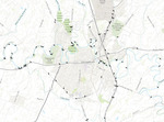
State of Kentucky
Temporal Coverage
Data collected from 2009 to 2024
Language
English
Funding Information
Kentucky Geological Survey
Related Content
Martin, S.L., and Morris, E.R., 2023, Fracture map of Hardin County, Kentucky: Kentucky Geological Survey Map and Chart, ser. 13, scale - 1:125,000. (In review as of 11/01/2023)
Recommended Citation
Martin, S.L., 2024. KGS Joint Data: Kentucky Geological Survey Research Data, Version 2. https://doi.org/10.13023/kgs.data.11.01.2023

Notes
File list (feature classes in ArcGIS geodatabase):
KGSJointData.gdb includes: KGSJointData_edited_1to1, point feature class KGSJointLocations, point feature class KGSJointMeasurement, table
The attributes for the KGS joint dataset include location information including county, quadrangle, latitude, longitude, and location confidence. The data also includes measurement attributes including type (of fracture), description (vertical or dipping), map symbol, GQ map unit, DVGQ map unit, lithology, orientation (quadrant), orientation (azimuth), dip, dip direction, orientation confidence, and comments.