

Research Data--KGS
Archived
This content is available here for research, reference, and/or recordkeeping.
Researcher ORCID Identifier
- Benjamin Tobin - https://orcid.org/0000-0002-0757-9946
- Benjamin Miller - https://orcid.org/0000-0003-4795-3442
- Matthew Niemiller - https://orcid.org/0000-0001-6353-8797
- Andrea Erhardt - https://orcid.org/0000-0002-5213-986X
Files
Download (1.1 MB)
Dataset Creation Date
07/01/2020
Release Date
Summer 7-20-2023
Publisher
University of Kentucky Libraries
Description
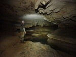
Dataset includes water level from four sites within Fern Cave in Jackson County Alabama. Additionally, it includes chemistry of water, sediments and cave-adapted isopods.
Digital Object Identifier (DOI)
https://doi.org/10.13023/kgs.data.07202023
Rights
© 2023 University of Kentucky
This dataset is distributed under the terms of the Creative Commons Attribution 4.0 International License (https://creativecommons.org/licenses/by/4.0/), which permits unrestricted use, distribution, and reproduction in any medium, provided that the dataset creators and source are credited and that changes (if any) are clearly indicated.
Supporting Information
Water level data was collected using Solinst Leveloggers and associated barometric loggers. Water chemistry was collected following standard methods and analysed at the Kentucky Geological Survey Water lab. Water, sediment, and isopod isotope data were analyzed at the Kentucky Stable Isotope Geochemistry Lab following standard procedures.
File Format
.csv, .txt
Version
1
Spatial Coverage
Jackson County, Alabama
Temporal Coverage
2020-2022
Language
English
Funding Information
Funding for this research was provided by the United States Fish and Wildlife Service through the Cooperative Ecosystems Study Unit program.
Recommended Citation
Tobin, B., Miller, B.V., Niemiller, M., Erhardt, A., 2023, Hydrology Data for Fern Cave, Alabama, Kentucky Geological Survey. doi.org/10.13023/kgs.data.07202023

Notes
These data were collected following standard collection and laboratory collection methods. Field site locations are described in and data is associated with: Miller, B.V., Tobin, B.W., and Hourigan, A.M., 2023, Mapping karst groundwater flow paths and delineating recharge areas for Fern Cave, Alabama through the use of dye tracing: U.S. Geological Survey data release, https://doi.org/10.5066/P9AE0LQR.