

Researcher ORCID Identifier
Steve Martin https://orcid.org/0009-0009-8533-2832
Files
Download Full Text (44.4 MB)
Abstract
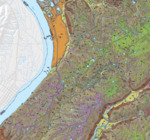
The Rising Sun 7.5-minute quadrangle is located in northern Kentucky in the Outer Bluegrass physiographic province (McFarlan, 1943). The area is underlain by Upper Ordovician limestone and shale, and is characterized by low- to medium-relief topography. The oldest rock unit in the quadrangle is the Point Pleasant Formation, which consists of interbedded limestone and shale, and is exposed at the base of the bedrock uplands area south of Lower East Bend Bottom. The shale-dominated Kope Formation overlying the Point Pleasant Formation is exposed in most stream channels and underlies the valleys and hillslopes in the quadrangle. The Kope Formation is overlain by the Fairview Formation, which consists of interbedded limestone and shale. The Fairview Formation underlies the majority of the upland areas in the quadrangle. The limestone of the Bellevue Tongue of the Grant Lake Limestone, and interbedded limestone and shale of the Bull Fork Formation, overlie the Fairview Formation. These formations underlie upland areas in the northeastern part of the quadrangle and some upland areas in the central part of the quadrangle. The majority of the land in this quadrangle is used for agricultural purposes and the extraction of natural resources. Land is used for livestock, and crops are farmed in upland areas, on river terraces, and on floodplains in stream valleys. Sand and gravel are excavated from outwash along the Ohio River north of Bellevue for aggregate and road metal. Small gravel pits, mostly abandoned, occur along the north edge of Upper East Bend Bottoms. Most of the development, such as major roadways, residences, and municipalities, occurs in the upland areas underlain by limestone. Residences can also be found on both the high-level fluvial terraces and alluvial terraces above the modern floodplain.
Publication Date
2018
Series
13
Report Number
16
Digital Object Identifier (DOI)
https://doi.org/10.13023/kgs13ct152018
Spatial Coverage
Boone County, Rising Sun Quadrangle
Funding Information
This map was generated using new field mapping along with compilation of unpublished and previously published data, and was funded in part by the U.S. Geological Survey’s National Cooperative Mapping Program under the STATEMAP program authorized by the National Geologic Mapping Act of 1992, Grant No. G17AC00255, and by the Kentucky Geological Survey.
Language
English
Repository Citation
Martin, S.L., Bottoms, A.E., Hammond III, M.L., 2018, Surficial geologic map of the Rising Sun 7.5-minute quadrangle, Kentucky. Kentucky Geological Survey, ser. 13, Contract Report 16.

Methodology
The surficial geology of the Rising Sun quadrangle was mapped using new field mapping at a 1:6,000-scale, and digitized at a 1:1,000-scale using LiDAR-derived basemaps and modern aerial imagery. LiDAR-derived basemaps of slope, contours, and relative elevation were used for mapping. Field data were recorded using the ESRI Collector app.