
-

Real-Time Dynamic Hazard Maps for Shallow Colluvial Landslides in Eastern Kentucky
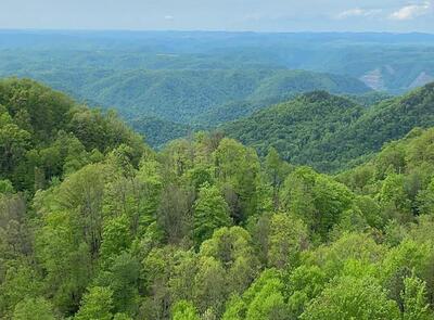
Landslide hazards pose a persistent threat to communities and infrastructure in Eastern Kentucky, where steep slopes, shallow colluvial soils, and variable hydrological conditions drive frequent slope failures. This work advances landslide hazard mapping (LHM) through the development of dynamic, spatiotemporal models for shallow colluvial landslides. Two studies refine the use of a limit equilibrium framework to enhance predictive capability. The first study establishes a novel LHM workflow that integrates Hydrus-1D simulations of soil moisture dynamics, driven by precipitation and evapotranspiration data, into slope stability analysis. Factor of Safety (FS) parameters are applied to statistics-based landslide susceptibility maps (LSM), producing accurate, ...Read More
-

Spatiotemporal Retrievals of Soil Moisture and Geomorphologic Data for Landslide Sites in Eastern Kentucky
These data are the soil texture, land information system-based soil moisture estimates from assimilation of NASA SMAP satellite-based observations and NOAH 3.6 Land Surface Model estimates, artificial neural network machine learning code, and in-situ soil moisture measurements.
-

Soil Moisture and Geomorphologic Data for Use in Dynamic and Forecastable Landslide Hazard Analyses in Eastern Kentucky
These data are the geomorphologic and land information system-based soil moisture estimates from assimilation of NASA SMAP satellite-based observations and NOAH 3.6 Land Surface Model estimates over known landslides in Eastern Kentucky. Additionally Long Short-Term Memory Recurrent Neural Network and logistic regression machine learning codes, as well as an Application programming interface code are included. Finally, in-situ data from Eastern Kentucky is included.
-

Multi-Temporal UAV Images and GeoDatabase Used to Estimate Temporal and Spatial Soil Moisture Content
We used small unmanned aerial vehicle (UAV) with optical digital camera to detect a land movement and to extract soil parameters. Using multi-temporal images in Garrard County, Kentucky, we detected land movement on three pairs of images that were captured one month apart. The multi-temporal images and the result of the movement analysis are available in folders. In addition, vertical displacement analysis is carried out using Differential Interferometry technique (DinSAR) to a pair of Synthetic Aperture Radar (SAR) images. Soil moisture data was estimated using linear regression machine learning model, and the python code and table used as training points ...Read More
-

GeoDatabase and Modeling Code Used for Landslide Hazard and Susceptibility Mapping in Eastern and Northern Kentucky
We created a landslide susceptibility map using spatial soil property features extracted from the NRCS WSS that include percent sand, percent silt, percent clay, saturated hydraulic conductivity, available water capacity, one third bar water content, plasticity index, and liquid limit, all of which were used as features in the logistic regression analysis. We also used satellite soil moisture data, and a high-resolution (1.5 m) LiDAR-derived digital elevation map (DEM) which include slope, aspect, curvature, elevation, roughness, and plan curvature. We show that using publicly available data, a multi-temporal landslide hazard map can be created that will produce a close-to-real time ...Read More
-

Landslide Soil Hydrology Data for Three Landslides in Kentucky
This data is from three landslides monitored in Kentucky between October 2015 and September 2020. The purpose was to capture and analyze subsurface hydrologic conditions within the landslides at different slope positions over time. The site descriptions, field methodology, data-acquisition techniques, and observations provide a general picture of soil moisture in hillslope soils. Data collected includes volumetric water content, soil water potential, bulk electrical conductivity, bulk dielectric permittivity, temperature. Water potential is the energy state of water in the soil, a determination of stress in the soil based on how water moves. Water potential can be described as the negative ...Read More
Printing is not supported at the primary Gallery Thumbnail page. Please first navigate to a specific Image before printing.
